• Hello, please take a minute to check out our awesome content, contributed by the wonderful members of our community. We hope you'll add your own thoughts and opinions by making a free account!

Misc Cold Season Complaining

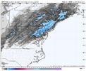
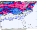
It's crazy that almost every single time we miss just south of snow storms due to the NW trend. Now we are going to lose out to the south?! Such a waste of crazy cold temps. Wouldn't have taken much liquid to have a decent little snow. Sorry if this has been asked & answered already, what is different with this storm that we aren't getting the usual NW trend? Instead models are progressing south each run. It's getting to the point that even if I was in those "jackpot" areas to the south, I would be nervous of losing it to the south as well the way each model has continued to trend.
I don’t know the why but for some reason when the models get hung up on one of these crappy solutions they stick like glue. I was deeply concerned a few days when everyone wanted suppression to account for the NW trend but I’ve seen it happen before, once the models shifted south they locked in.

Webber was on a day or so ago saying it was going to work back NW, maybe he’ll show up and give us a reason it will/can.
 
I don’t know the why but for some reason when the models get hung up on one of these crappy solutions they stick like glue. I was deeply concerned a few days when everyone wanted suppression to account for the NW trend but I’ve seen it happen before, once the models shifted south they locked in.

I mean the NWS/NOAA thinks otherwise they’re expecting an NW trend


Sent from my iPhone using Tapatalk
 
No matter what happens, I'm gonna enjoy the cold wave because in a couple of months it's gonna be hot, humid and miserable, bugs are gonna be everywhere and that annoying sun is gonna be in my face all the time lol.
NGL, I’d rather have seasonal temps if I can’t get winter precipitation. Guess that’s just me getting older, used to love to see the extreme cold regardless.
 
I hope the Euro is wrong about bring the precip north enough to give a 3-6 inch snow event for Coastal GA/SC/NC. That would be horrible by itself. Even the CMC still give Savannah a 2-4 inch event. Hopefully the 12Z GFS/Icon and other model guidance goes all in on ultra suppression to the point of putting even Houston and New Orleans out of the game for significant snow. Atleast I would feel better about missing out this system.
 
Last edited:
I’m just saying this, and it clearly may have some wishcasting in it. How many times have we even had the rug pulled out from under us with a north shift 48 hours in, hell even the day of. The northern fringe areas literally are a matter of 25-75 miles from a serious change in this event. Im 100% holding out hope for the January 2014 like solution. We were only looking at a dusting then and it was even more grim then this.
 
I’m just saying this, and it clearly may have some wishcasting in it. How many times have we even had the rug pulled out from under us with a north shift 48 hours in, hell even the day of. The northern fringe areas literally are a matter of 25-75 miles from a serious change in this event. Im 100% holding out hope for the January 2014 like solution. We were only looking at a dusting then and it was even more grim then this.
I am with you. I don't expect a radical change, but I do think there could still be a slight NW. trend that could put some of us that are on the cusp into a little better snowfall.
 
Last edited:
How much for me this time @JimmHypocracy I haven't looked in a while. Cause you know I'm always the winner east of the mountains!!! There's got to be a finger band or something that shoots up this side of the mountains that gives me 4-6" at least, right? ❄️☃️

NWS, missing something bad here?
TUESDAY
Partly sunny in the morning, then becoming mostly cloudy. Cold with highs in the mid 20s. Light and variable winds, becoming southwest around 5 mph in the afternoon.

TUESDAY NIGHT
Mostly cloudy in the evening, then becoming partly cloudy. Cold with lows around 10 above.

WEDNESDAY AND WEDNESDAY NIGHT
Mostly clear. Cold. Highs in the mid 20s. Lows around 10 above.

THURSDAY
Partly sunny. Highs in the lower 30s.

THURSDAY NIGHT AND FRIDAY
Partly cloudy. Lows around 20. Highs in the upper 30s.

FRIDAY NIGHT AND SATURDAY
Mostly clear. Lows around 20. Highs in the mid 40s.

$$
 
I’m just saying this, and it clearly may have some wishcasting in it. How many times have we even had the rug pulled out from under us with a north shift 48 hours in, hell even the day of. The northern fringe areas literally are a matter of 25-75 miles from a serious change in this event. Im 100% holding out hope for the January 2014 like solution. We were only looking at a dusting then and it was even more grim then this.
That’s what I’ve been thinking about since the collapse. How many times has an I20 paste job turned into cold rains and I40 gets nailed….it happens more times than not because of an amped up system that trends NW in the last 48 hours. However, when we need that trend, I don’t feel confident we can get it. It’s a complete waste of a perfect airmass for us, and it’s utterly disgusting.
 
I’m just saying this, and it clearly may have some wishcasting in it. How many times have we even had the rug pulled out from under us with a north shift 48 hours in, hell even the day of. The northern fringe areas literally are a matter of 25-75 miles from a serious change in this event. Im 100% holding out hope for the January 2014 like solution. We were only looking at a dusting then and it was even more grim then this.
A north trend is not happening with this "event". The flow is simply too suppressive/flat to support such a idea. Even the Euro(the amped out of all of the guidance) basically keeps the heaviest of the snow to areas near the Gulf and SE Coast.
 
A north trend is not happening with this "event". The flow is simply too suppressive/flat to support such a idea. Even the Euro(the amped out of all of the guidance) basically keeps heaviest of the snow to areas near the Gulf and SE Coast.

I’ve heard this before, every met and NWS office said the exact same thing January 2014. You’ve got the smartest people in the weather world who also think it easily can. I’ll take my chances all day long.
 
I am with you. I don't expect a radical change, but I do think there could still be a slight NW. trend that could put some of us on that are on the cusp into a little better snowfall.
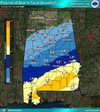
Same here. I would be lying if I didn't admit though my hope has drastically diminished. The whole time I have felt this is so similar to 2014. Even the maps on the models from then to this storm are similar. We were only suppose to get a dusting as well and not really be impacted. This was the call map in 2014 and the amounts and lines drawn are close comparison. I have wondered what made that storm different from this one. I most definitely still have a gut feeling this is going to give us at least an inch or two.
1737292929507.gif
 
I’ve heard this before, every met and NWS office said the exact same thing January 2014. You’ve got the smartest people in the weather world who also think it easily can. I’ll take my chances all day long.
Faco could very well be right, based on recent model input. But he's only saying such because he's salty. It's not based on anything he knows from meteorologic skill/knowledge.

Like you Parker, I'll wait another 24 hours, at least, before throwing in the towel.
 
Faco could very well be right, based on recent model input. But he's only saying such because he's salty. It's not based on anything he knows from meteorologic skill/knowledge.

Like you Parker, I'll wait another 24 hours, at least, before throwing in the towel.

No doubt about it. I’m just looking back at history and prior events and am a weenie. 😂
 
And to think the 93 Blizzard along with several other storms were locked in 5+ days out. In all my years of model watching 2008-2018 were good years. You could always count on certain trends ect. Not saying that the models are necessarily worse. It gets alot of trash talk but the GFS is not a bad model. After a few blockbuster runs it quickly shifted south and stayed there.
The Superstorm of 1993 came about from a very simple wave pattern (which is odd in itself) but an example of simple ingredients can make for the best dishes.
 
How much for me this time @JimmHypocracy I haven't looked in a while. Cause you know I'm always the winner east of the mountains!!! There's got to be a finger band or something that shoots up this side of the mountains that gives me 4-6" at least, right? ❄️☃️

NWS, missing something bad here?
TUESDAY
Partly sunny in the morning, then becoming mostly cloudy. Cold with highs in the mid 20s. Light and variable winds, becoming southwest around 5 mph in the afternoon.

TUESDAY NIGHT
Mostly cloudy in the evening, then becoming partly cloudy. Cold with lows around 10 above.

WEDNESDAY AND WEDNESDAY NIGHT
Mostly clear. Cold. Highs in the mid 20s. Lows around 10 above.

THURSDAY
Partly sunny. Highs in the lower 30s.

THURSDAY NIGHT AND FRIDAY
Partly cloudy. Lows around 20. Highs in the upper 30s.

FRIDAY NIGHT AND SATURDAY
Mostly clear. Lows around 20. Highs in the mid 40s.

$$
Finger band keeping me alive but this one ain’t it Frosty. Probably should have been. Standby for the next one.
 
To make matters worse, It’s pouring rain at my house this morning but in 2 days it will be dry and snowing in the mid 20’s somewhere at a beach IMG_1198.jpeg
 
People say if it doesn't snow enough in your backyard move. That may apply if you're mad about not getting double digits every year when your average is 5. But what about the ones where average snowfall is enough but are at like 3% of their average for the past 3 years? Those folks have a right to complain. And anyone who doesn't think so the ignore feature works great.
 
There's nothing worse than a forecast like this for a snow lover.

MARTIN LUTHER KING JR DAY
Sunny. Much colder with highs in the mid 20s. Northwest winds 5 to 10 mph with gusts up to 25 mph. Wind chill values as low as zero.

Mostly clear in the evening, then becoming partly cloudy. Cold with lows around 10 above. Northwest winds around 5 mph in the evening, becoming light and variable.

TUESDAY
Partly sunny in the morning, then becoming mostly cloudy. Cold with highs in the mid 20s. Light and variable winds, becoming southwest around 5 mph in the afternoon.

TUESDAY NIGHT
Mostly cloudy in the evening, then becoming partly cloudy. Cold with lows around 10 above.

WEDNESDAY AND WEDNESDAY NIGHT
Mostly clear. Cold. Highs in the mid 20s. Lows around 10 above.

THURSDAY
Partly sunny. Highs in the lower 30s.

THURSDAY NIGHT AND FRIDAY
Partly cloudy. Lows around 20. Highs in the upper 30s.

FRIDAY NIGHT AND SATURDAY
. LoMostly clear around 20. Highs in the mid 40s.

$$
 
Looks like everyone has did a swan dive off the cliff. That just leave us, the skeleton crew. We will have to wish cast the hell out of this thing. I am with y'all, how can we be so certain of the track if the LP hasn't even formed yet, and the models have been all over the place.
 
I am with you. I don't expect a radical change, but I do think there could still be a slight NW. trend that could put some of us on that are on the cusp into a little better snowfall.
It’s going to have to be radical for me to get into the game. Not gonna happen, just like 2014 wasn’t radical enough. Why I hated to hear all the suppression talk.
 
Back
Top