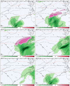
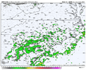
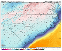
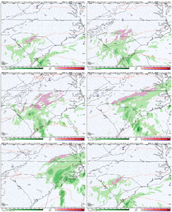
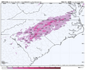
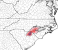
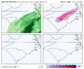
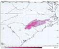
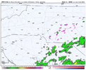
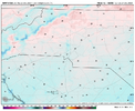
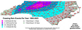
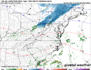
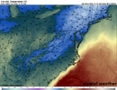
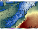
18z RGEM was bullish again, 18z nam had a small area, so far the gfs and euro don't have a lot going on
-
Hello, please take a minute to check out our awesome content, contributed by the wonderful members of our community. We hope you'll add your own thoughts and opinions by making a free account!
You are using an out of date browser. It may not display this or other websites correctly.
You should upgrade or use an alternative browser.
You should upgrade or use an alternative browser.
Wintry Christmas Eve NC Freezing Rain?
- Thread starter SD
- Start date
3k had a lot of precip developing with temps 33-35 and dews in the low 20s
Avalanche
Member
Well that would do it for us3k had a lot of precip developing with temps 33-35 and dews in the low 20s
gawxnative
Member
FFC does mention it in their Forecast Disco this PM for Eastern Counties.
This was clipped out of RAH's afternoon discussion:
***************************
.LONG TERM /MONDAY THROUGH SATURDAY/...
As of 259 PM Saturday...
As of Monday morning, high pressure is forecast to be sitting over
New York with a ridge extending southwest into the Carolinas. A weak
shortwave in the upper level flow should force a weak surface low to
develop off the Florida coast Monday evening. The low should reach
its closest point to central North Carolina Tuesday afternoon off
the coast of Wilmington and move northeast offshore after that.
There is a bit of uncertainty as to how far northwest the
precipitation will extend, and at this point, have kept a dry
forecast Monday night but introduced a slight chance of pops across
southeastern counties Tuesday. Cannot rule out the potential that
precipitation could start off very briefly as freezing rain, as
soundings show a thick layer of above freezing air above the
surface, but confidence is too low to include freezing rain in the
forecast at this time; the precipitation is primarily expected to
fall as rain.
**************************
They're at least mentioning it now.
SimeonNC
Member
I hope the precip can inch a little further NW 
This is the type of forecast that separates the men from the boys. This could very easily result in several hours of light freezing rain / drizzle on the northwest side that as we all know could lead to black ice on bridges and overpasses and resultant traffic catastrophe on Christmas Eve.This was clipped out of RAH's afternoon discussion:
***************************
.LONG TERM /MONDAY THROUGH SATURDAY/...
As of 259 PM Saturday...
As of Monday morning, high pressure is forecast to be sitting over
New York with a ridge extending southwest into the Carolinas. A weak
shortwave in the upper level flow should force a weak surface low to
develop off the Florida coast Monday evening. The low should reach
its closest point to central North Carolina Tuesday afternoon off
the coast of Wilmington and move northeast offshore after that.
There is a bit of uncertainty as to how far northwest the
precipitation will extend, and at this point, have kept a dry
forecast Monday night but introduced a slight chance of pops across
southeastern counties Tuesday. Cannot rule out the potential that
precipitation could start off very briefly as freezing rain, as
soundings show a thick layer of above freezing air above the
surface, but confidence is too low to include freezing rain in the
forecast at this time; the precipitation is primarily expected to
fall as rain.
**************************
They're at least mentioning it now.
SimeonNC
Member
The new 3k NAM has the precip more NW but keeps temps above freezing, though the dews are similar
Funny how a legit threat just pops up inside 5 days
SimeonNC
Member
The 00z RGEM is even colder in NC lol
SimeonNC
Member
The RGEM is colder but brings less precip NW.
BHS1975
Member
Didn't the RGEM nail the last minor event this month?The RGEM is colder but brings less precip NW.
The RGEM is usually garbage with ZR events. It always overestimates the coldDidn't the RGEM nail the last minor event this month?
Webberweather53
Meteorologist
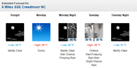
KRDU now mentions a slight chance of freezing rain in their forecast (around twenty percent) for Monday night. The warm air from the return flow returns Tuesday so any ice accrual would be short lived. At least some of us might break the winter precipitation drought.
Yep in these setups precip almost always earlier then progged and hi res models are catching up to that. Gonna catch some folks off guardVery likely this event is going to produce some travel hazards on Christmas Eve morning for early shoppers.
View attachment 156411
View attachment 156412
From past experiences, without a strong feed of cold/dry air we want lighter rates/amounts of precip. Otherwise, the freezing process will quickly cause the surface temps to rise above freezing. So in short, the above map posted by 1300m looks perfect to me.
I’m dreaming of a dark Christmas….
We're getting there. And the NAM just scored an impressive win over most other short-range guidance up in the northeast with this recent snow event there also. That fact, plus various other guidance hinting at this is giving me confidence we're at least going to see a period of some low-end impactful FZDZ along and west of I-95.We should be in the NAM's wheelhouse about now right?
The NAM in my opinion is probably one of if not the best short range models out there. It is one of the first this weather hobbyist looks at when storms get within 72 hours or so. This event might end up making some of the bridges and overpasses a little dicey in some areas.We're getting there. And the NAM just scored an impressive win over most other short-range guidance up in the northeast with this recent snow event there also. That fact, plus various other guidance hinting at this is giving me confidence we're at least going to see a period of some low-end impactful FZDZ along and west of I-95.
packfan98
Moderator
NBAcentel
Member
Webberweather53
Meteorologist
If QPF totals increase on some of the later model runs I would not be shocked if some of the local National Weather Services issued some advisories for this system. It would better to do that than for them to get caught with their pants down.
Avalanche
Member
Right now the locals aren’t mentioning anything other than some light rain towards the coast. I think they should first let the public know it might get wet before they mention ice.If QPF totals increase on some of the later model runs I would not be shocked if some of the local National Weather Services issued some advisories for this system. It would better to do that than for them to get caught with their pants down.
Webberweather53
Meteorologist
If QPF totals increase on some of the later model runs I would not be shocked if some of the local National Weather Services issued some advisories for this system. It would better to do that than for them to get caught with their pants down.
A freezing rain advisory is probably warranted already for counties near-west of Raleigh. Takes basically no ice at all to cause issues
RAH's afternoon short term discussion:
.SHORT TERM /MONDAY THROUGH TUESDAY NIGHT/...
As of 220 PM Sunday...
On Monday morning, high pressure will be centered over New York with
a ridge extending southwest through the Carolinas into Georgia. The
high will move offshore during the day as low pressure moves into
the Great Lakes. The most impactful weather during this time period
will be late Monday night into Tuesday morning. By 00Z Tuesday, a
weak (1024 mb) surface low will start spinning up along the
northeastern coast of Florida. This low will likely be closest to
the forecast area around 1019 mb off Wilmington early Tuesday
afternoon before moving off to the northeast. With the cold high
pressure extending south from New England into the Carolinas Monday,
there will be a good amount of cold air in place locally that should
result in evaporational cooling and could result in precipitation
Monday night initially beginning as something other than rain.
Considering how warm temperatures will be above the surface, snow
will not be a possible precipitation type with this storm. With how
shallow the below-freezing layer will be, precipitation types during
this time period will either be rain or freezing rain; sleet should
also not be a possibility. The GFS continues to be a wet outlier
compared to other models. The two biggest uncertainties with the
forecast will be the spatial extent of the freezing rain and how
much precipitation falls before any freezing rain changes over to
liquid rain. The most likely period for freezing precipitation will
be between midnight and 10am Tuesday. By the afternoon, the low will
be moving to the east and precipitation will be decreasing in
coverage, likely coming to an end by sunset. The primary change with
this forecast package was to expand the chance of precipitation
northwest, grazing portions of the Triad, and along the same lines,
expanding the area that has a chance of freezing rain. While pops
were increased, the only area with likely pops is southern Sampson
County, and the temperatures in that area should remain above
freezing, so all of that precipitation would fall as rain.
As for temperatures, Monday`s highs should be within a few degrees
of today`s values, in the mid 30s to the mid 40s. Values will drop
quickly Monday evening with clear skies before bottoming out around
midnight as cloud cover moves in from the south. temperatures will
then remain steady or slightly increase through the rest of the
night before following a typical diurnal curve Tuesday and Tuesday
night. Monday night`s lows will range from the mid 20s to the mid
30s, and Tuesday`s highs will range from the mid 40s in the east
(where skies will be cloudy all day) to the mid 50s in the west
(where skies should be sunny by the early afternoon). Tuesday
night`s lows will range from the mid 20s to the mid 30s, meaning
that road conditions could be hazardous as rainfall from earlier in
the day could freeze on roads that night.
&&
Low pressure will develop off the southeastern United States coast
Monday night into Tuesday, bringing a chance of freezing rain to much
of the forecast area. While all locations will have the threat for
freezing rain, the greatest potential for ice accumulation appears
to be along the US-1 corridor.
SimeonNC
Member
- Joined
- Jan 23, 2021
- Messages
- 4,590
- Reaction score
- 15,179
- Location
- Lebanon Township, Durham County NC
One thing I hadn’t thought about until tonight is after the last two days, the ground is gonna be really cold
SimeonNC
Member
Webberweather53
Meteorologist
Doesn't the HRRR have a warm bias? The 00z HRRR is legit colder than the 3k NAM, which is a first.
View attachment 156461
The HRRR has a mixing bias, which by virtue means it likes to mix out the shallow CAD too quickly and is usually too warm, particularly near the edge of the dome
Not having a closer look further at the HRRR, that's probably because it depicts clear skies in the sub-freezing areas.Doesn't the HRRR have a warm bias? The 00z HRRR is legit colder than the 3k NAM, which is a first.
View attachment 156461

