• Hello, please take a minute to check out our awesome content, contributed by the wonderful members of our community. We hope you'll add your own thoughts and opinions by making a free account!

Pattern August 2023 Thread

My neighborhood took it on the chin today. My neighbor lost a beautiful 100+ year old oak tree that turned my tulip poplar into a toothpick and snapped the power pole. Also ripped the power feed from the side of my house.

The next road over got it even worse, 20 trees snapped, a few more uprooted, a tree down on a house, etc.

We probably won't have power restored for at least a few days.

View attachment 136251

View attachment 136252View attachment 136250
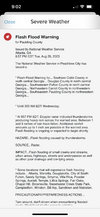
Looks like Durham got the worst of it. Crazy to see that much damage.from straight-line winds.
 
Wilmington is convinced we get crushed the next couple days but the hi res says it's mostly all centered back over SC towards Fayetteville. We had 50% yesterday 70% last night and we get zipped. Let's see how they with today's forecast

NEAR TERM /THROUGH TONIGHT/...
Confidence is moderate to high with the main story being the
much lower heat indices than we`ve seen recently (mostly less
than 100 degrees) but also an isolated severe storm/flood risk.

A cold front should progress into SE NC and NE SC early this AM
before stalling out as heating commences after daybreak.
Meanwhile the area will remain on the east side of an upper
trough which will keep deep moisture and periodic shortwaves in
place across the area. Should see an uptick in showers/storms
this afternoon as heating occurs and the sea breeze develops.
Given the fairly weak storm motions expected there will be at
least a low end risk for enough heavy rain to lead to some
localized minor flooding, especially central/eastern portions of
the area mainly east of Florence and Lumberton. Also can`t
completely rule out a few damaging wind gusts from wet
microbursts. High temps should be closer to normal, around 90
most inland spots.

Showers/storms should wind down a bit tonight due to weakening
instability, especially inland. However, continued deep
moisture, the nearby stalled front and possibility of upper
shortwave energy will mean a continuation of some rain
overnight. A few spots could pick up several inches of rain
through tonight. Low temperatures should fall back mainly into
the lower to mid 70s.

&&

.SHORT TERM /THURSDAY THROUGH FRIDAY NIGHT/...
The stalled frontal boundary to our west will maintain shower
and thunderstorm chances early Thursday. Diurnal heating and a
re-invigoration of the front`s eastward momentum is likely to
bring a secondary maximum of thunderstorm activity east of I-95
during the afternoon. Some drier air will begin to mix in aloft
which could provide a brief window for a marginal wind threat in
higher storm tops and increasing shear.
 
Still without power this morning.
So I have been in Durham the past few days and the storms yesterday have left half the city without power, there is even massive cell service interruption. Half our new traffic network is offline, and nothing can be done about that until power is restored. Who knows when everything will be back up, but they should have declared a state of emergency with half the traffic lights dark.
 
So I have been in Durham the past few days and the storms yesterday have left half the city without power, there is even massive cell service interruption. Half our new traffic network is offline, and nothing can be done about that until power is restored. Who knows when everything will be back up, but they should have declared a state of emergency with half the traffic lights dark.
Yeah, I’ve been relying on my cell phone more with power/internet out and it’s been really spotty with reception. Agreed on the traffic lights, it’s risky driving out there since people seem to not understand it’s supposed to be a four way stop when the stoplights are out, and instead it’s just a Mad Max free for all.
 
So I have been in Durham the past few days and the storms yesterday have left half the city without power, there is even massive cell service interruption. Half our new traffic network is offline, and nothing can be done about that until power is restored. Who knows when everything will be back up, but they should have declared a state of emergency with half the traffic lights dark.
Hate this is how you're getting introduced to Durham!
 
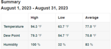
The humidity has been something else this summer. The last time I can remember this kind of humidity is in 1995 and that only lasted a couple of days I think. As bad as it has been around here though, it is nothing compared to I-95 and east in NC.
The Tonga volcanic eruption could apparently have something to do with this. It released an absolutely massive amount of water vapor that went up into the atmosphere when it erupted. All that water vapor is essentially acting as a greenhouse gas. They said the next 5 or so years could be even warmer than the usual warming trends we have seen in recent years.
 
Gonna be a lot of flooded underground tunnels.
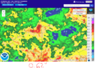
gfs_apcpn_swus_64.png
 
The Tonga volcanic eruption could apparently have something to do with this. It released an absolutely massive amount of water vapor that went up into the atmosphere when it erupted. All that water vapor is essentially acting as a greenhouse gas. They said the next 5 or so years could be even warmer than the usual warming trends we have seen in recent years.
I actually recently read a piece from NOAA about what effects the Tonga eruption will have on weather for the next couple years. It says that while increased water vapor in the atmosphere will not directly cause warming, it will amplify the greenhouse effects and that will lead to warmer periods… especially during summer months due to more daylight. I’m going to try and find again and share it. It was interesting that it did similarities on the timing in relation to the beginning of the El Niño that has started… apparently it’s similar to time between the eruption in the Philippines before the El Niño of 1992-93… a very stormy winter for the eastern half of the country including the March 1993 Superstorm.
 
Back
Top