The more interesting and uncertain part of the forecast
revolves around potential for snow to mix in with the rain
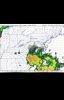
across parts of the Piedmont and northern and western Midlands
for a short period of time during the period of strongest
forcing around 12z. Model soundings and time heights show fairly
cold air aloft as the trough approaches but the lowest layers
remain just warm enough to support all rain across the forecast
area with wet bulb temperatures also remaining just high
enough to support rain. However, the big fly in the ointment
with this event is low-level dry air with dewpoints in the
teens across the Carolinas and if the strong upper forcing and
dynamical cooling combined with some evaporative cooling can
result in a near 0-degree isothermal layer somewhere in our
western and northern sections which if that does occur, there
could be a burst of heavy wet snow. The NAM/EC are the most
aggressive showing winter potential while the GFS has trended
farther inland with the precipitation shield but remains warmer
in the thermal profiles. Will continue the forecast of a
rain/snow mix for a few hours around 12z in the northern/western
sections but not carrying any accumulation at this time given
the uncertainty with this event, although would not be surprised
with the need to possibly go with an advisory on the midnight
shift if thermal profiles change.