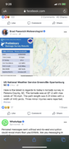
Wouldn't be surprised to see another tor warning or 2 this morning. Storms are bubbling nicely
-
Hello, please take a minute to check out our awesome content, contributed by the wonderful members of our community. We hope you'll add your own thoughts and opinions by making a free account!
You are using an out of date browser. It may not display this or other websites correctly.
You should upgrade or use an alternative browser.
You should upgrade or use an alternative browser.
Severe 3/21-3/24 Severe Weather
- Thread starter SD
- Start date
HSVweather
Member
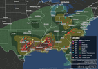
New Orleans tornado survey
Z
Zander98al
Guest
New Orleans tornado survey
10mph shy of ef4 wow.
Finally got our flooding raina this morning.
rburrel2
Member
Pickens county, sc tornado destroyed 6 homes(looks like mostly mobile homes) per the local news. The video footage looks like solid ef2 damage.
Jessy89
Member
Pickens county, sc tornado destroyed 6 homes(looks like mostly mobile homes) per the local news. The video footage looks like solid ef2 damage.
I agree ef2 about 5 miles from my home
Sent from my iPhone using Tapatalk
rburrel2
Member
It was 5 miles from me as well; to my north. Confirmed ef-2 with 115mph winds now.
Jessy89
Member
I’m not bragging but the group on Facebook. That I absolutely love and very active on because I want lives to be saved by severe weather. I believe the Tornado touched down In pickens county around 9pm it went unwarned. Well I posted this around 840pm. So my question is this if people like me and other weather hobbiest like myself can give people nearly 20 minute warning of a potential Tornado how did the National weather service miss it? Please yall if y’all are in GA NC Sc join this group and share. I really want people to get warning of severe weather quickly as possible to hopefully save lives. Very proud of our group last night

Sent from my iPhone using Tapatalk

Sent from my iPhone using Tapatalk
HSVweather
Member
Darklordsuperstorm
Member
Mason Dixon
Member
SWVAwxfan
Member
If only he had Dorothy strapped onto the bed of his truck.


