
Yep, Dolly being the next storm is wild. It’s virtually impossible based on history and I realize we still could get her within a few days from Invest 96L, but what if the rest of the season were to be so amazingly quiet that we end up not even getting to Dolly?

-
Hello, please take a minute to check out our awesome content, contributed by the wonderful members of our community. We hope you'll add your own thoughts and opinions by making a free account!
You are using an out of date browser. It may not display this or other websites correctly.
You should upgrade or use an alternative browser.
You should upgrade or use an alternative browser.
Tropical 2026 Tropics Thread 🌀
- Thread starter SD
- Start date
Keeping in mind that the UKMET was one of the earliest, to consistently predict Dolly with runs doing that going back as far as 7 days fwiw:
The 12Z UKMET has a low form in the subtropics well off the SE coast that later either his or is about to hit the SE US for the 3rd run in a row. Yesterday’s 12Z’s low was weak and it was about to hit NE FL at the end (Sept 2nd). Today’s 0Z had a TS about to come into the S portion of the FL E coast on Sept. 3rd.
Today’s 12Z UKMET has TCG at hour 108 that initially moves W but then strengthens into a TS that turns NW to hit Charleston on Sept. 3rd:
NEW TROPICAL CYCLONE FORECAST TO DEVELOP AFTER 108 HOURS
FORECAST POSITION AT T+108 : 29.8N 74.4W
LEAD CENTRAL MAXIMUM WIND
VERIFYING TIME TIME POSITION PRESSURE (MB) SPEED (KNOTS)
-------------- ---- -------- ------------- -------------
0000UTC 01.09.2026 108 29.8N 74.4W 1013 26
1200UTC 01.09.2026 120 29.8N 74.8W 1011 30
0000UTC 02.09.2026 132 29.5N 75.8W 1009 36
1200UTC 02.09.2026 144 30.3N 77.3W 1008 37
0000UTC 03.09.2026 156 31.4N 78.5W 1004 39
1200UTC 03.09.2026 168 33.1N 80.0W 1001 39
The 12Z UKMET has a low form in the subtropics well off the SE coast that later either his or is about to hit the SE US for the 3rd run in a row. Yesterday’s 12Z’s low was weak and it was about to hit NE FL at the end (Sept 2nd). Today’s 0Z had a TS about to come into the S portion of the FL E coast on Sept. 3rd.
Today’s 12Z UKMET has TCG at hour 108 that initially moves W but then strengthens into a TS that turns NW to hit Charleston on Sept. 3rd:
NEW TROPICAL CYCLONE FORECAST TO DEVELOP AFTER 108 HOURS
FORECAST POSITION AT T+108 : 29.8N 74.4W
LEAD CENTRAL MAXIMUM WIND
VERIFYING TIME TIME POSITION PRESSURE (MB) SPEED (KNOTS)
-------------- ---- -------- ------------- -------------
0000UTC 01.09.2026 108 29.8N 74.4W 1013 26
1200UTC 01.09.2026 120 29.8N 74.8W 1011 30
0000UTC 02.09.2026 132 29.5N 75.8W 1009 36
1200UTC 02.09.2026 144 30.3N 77.3W 1008 37
0000UTC 03.09.2026 156 31.4N 78.5W 1004 39
1200UTC 03.09.2026 168 33.1N 80.0W 1001 39
The 0Z UKMET has a low form in the subtropics well off the SE coast that later either hits or is about to hit the SE US for the 4th run in a row. Wed. 12Z’s low was weak and it was about to hit NE FL at the end (Sept 2nd). Yesterday’s 0Z had a TS about to come into the S portion of the FL E coast on Sept. 3rd. Yesterday’s 12Z UKMET had TCG at hour 108 that initially moved W but then strengthened into a TS that turned NW to hit Charleston on Sept. 3rd.
Today’s 0Z has TCG on Monday (8/31) for the 3rd run in a row with it moving WSW and then making TS status on Tue (9/1). It landfalls on WP Beach on Wed. (9/2) before moving W to the Gulf moving WNW out into the Gulf:
NEW TROPICAL CYCLONE FORECAST TO DEVELOP AFTER 96 HOURS
FORECAST POSITION AT T+ 96 : 28.9N 74.4W
LEAD CENTRAL MAXIMUM WIND
VERIFYING TIME TIME POSITION PRESSURE (MB) SPEED (KNOTS)
-------------- ---- -------- ------------- -------------
0000UTC 01.09.2026 96 28.9N 74.4W 1013 21
1200UTC 01.09.2026 108 28.2N 75.9W 1012 27
0000UTC 02.09.2026 120 27.0N 77.6W 1008 35
1200UTC 02.09.2026 132 26.5N 79.4W 1006 37
0000UTC 03.09.2026 144 26.9N 81.4W 1004 29
1200UTC 03.09.2026 156 27.6N 83.7W 1003 40
0000UTC 04.09.2026 168 28.6N 86.0W 1001 40
Today’s 0Z has TCG on Monday (8/31) for the 3rd run in a row with it moving WSW and then making TS status on Tue (9/1). It landfalls on WP Beach on Wed. (9/2) before moving W to the Gulf moving WNW out into the Gulf:
NEW TROPICAL CYCLONE FORECAST TO DEVELOP AFTER 96 HOURS
FORECAST POSITION AT T+ 96 : 28.9N 74.4W
LEAD CENTRAL MAXIMUM WIND
VERIFYING TIME TIME POSITION PRESSURE (MB) SPEED (KNOTS)
-------------- ---- -------- ------------- -------------
0000UTC 01.09.2026 96 28.9N 74.4W 1013 21
1200UTC 01.09.2026 108 28.2N 75.9W 1012 27
0000UTC 02.09.2026 120 27.0N 77.6W 1008 35
1200UTC 02.09.2026 132 26.5N 79.4W 1006 37
0000UTC 03.09.2026 144 26.9N 81.4W 1004 29
1200UTC 03.09.2026 156 27.6N 83.7W 1003 40
0000UTC 04.09.2026 168 28.6N 86.0W 1001 40

The gfs popped a hurricane under the ridge in the extended. The idea that the UK and now gfs have makes sense. Old fronts and mcvs parked in the SW atlantic or gulf with a late season subtropical ridge over the top can get it done
The gfs popped a hurricane under the ridge in the extended. The idea that the UK and now gfs have makes sense. Old fronts and mcvs parked in the SW atlantic or gulf with a late season subtropical ridge over the top can get it done
Shane, the 6Z GFS looks almost as if that TX H has origins from a combo of Dolly and a UK like subtropical energy/vorticity.
You are correct! 6z AI tried to toyed with the dolly remnant as well while the 6z Euro tried to spin up an old MCV along the Lousiana coast, interesting times ahead!The gfs popped a hurricane under the ridge in the extended. The idea that the UK and now gfs have makes sense. Old fronts and mcvs parked in the SW atlantic or gulf with a late season subtropical ridge over the top can get it done

0z ICON going for the recurve. LLC gonna have a fight on its hands soon with shear and dry air. We'll see

I know hurricane season hasn't reached its peak yet and there are still over three months to go but if things keep rolling along as they have so far, it may be possible to do something that hasn't been done in over 100 years: have a hurricane season with no hurricanes. The last time this
occurred was in 1914 with one tropical storm that year and no hurricanes. The only other hurricane season with no hurricanes was 1907 when only five tropical storms formed in the Atlantic during the year.
occurred was in 1914 with one tropical storm that year and no hurricanes. The only other hurricane season with no hurricanes was 1907 when only five tropical storms formed in the Atlantic during the year.
Last edited:

97L has that sneaky spin up in a hurry look. NHC isn't bullish, though.

 www.tropicaltidbits.com
IR Satellite Loop for Invest 97L | Tropical Tidbits
Invest 97L IR Satellite Loop
www.tropicaltidbits.com
Belle Lechat
Member
- Joined
- Aug 29, 2021
- Messages
- 1,657
- Reaction score
- 1,309


The Atlantic basin has a chance to have the latest first hurricane on record in the satellite era. If no North Atlantic tropical cyclone reaches hurricane strength before 12:00 UTC on September 11, which seems possible given the lack of model signals, 2026 will go the farthest into the season without a hurricane in the modern era.
This could be the first year since 1914 without a hurricane in the Atlantic basin. It's a longshot but the last year this happened was 112 years ago.
0Z UKMET has Edouard’s little sis like the 12Z run sort of had with its 1010 non-TC low, but is notably stronger with it as it has it as a TD:
NEW TROPICAL CYCLONE FORECAST TO DEVELOP AFTER 150 HOURS
FORECAST POSITION AT T+150 : 28.8N 95.9W
LEAD CENTRAL MAXIMUM WIND
VERIFYING TIME TIME POSITION PRESSURE (MB) SPEED (KNOTS)
-------------- ---- -------- ------------- -------------
1200UTC 08.09.2026 156 29.5N 96.9W 1003 29
0000UTC 09.09.2026 168 31.1N 99.1W 1007 21
NEW TROPICAL CYCLONE FORECAST TO DEVELOP AFTER 150 HOURS
FORECAST POSITION AT T+150 : 28.8N 95.9W
LEAD CENTRAL MAXIMUM WIND
VERIFYING TIME TIME POSITION PRESSURE (MB) SPEED (KNOTS)
-------------- ---- -------- ------------- -------------
1200UTC 08.09.2026 156 29.5N 96.9W 1003 29
0000UTC 09.09.2026 168 31.1N 99.1W 1007 21
Interesting. The genesis of this appears to be currently over S. Ga. atm. I thought perhaps it was picking up on the unsettled weather in the Bahamas and north of Cuba associated with the remnant of the Dolly remnant and an old frontal boundary, lol. But nope.0Z UKMET has Edouard’s little sis like the 12Z run sort of had with its 1010 non-TC low, but is notably stronger with it as it has it as a TD:
NEW TROPICAL CYCLONE FORECAST TO DEVELOP AFTER 150 HOURS
FORECAST POSITION AT T+150 : 28.8N 95.9W
LEAD CENTRAL MAXIMUM WIND
VERIFYING TIME TIME POSITION PRESSURE (MB) SPEED (KNOTS)
-------------- ---- -------- ------------- -------------
1200UTC 08.09.2026 156 29.5N 96.9W 1003 29
0000UTC 09.09.2026 168 31.1N 99.1W 1007 21
Although I think the latter is worth a peek from time to time.

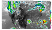
Nice Flare up off the back porch this afternoon

lexxnchloe
Member
lexxnchloe
Member
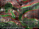
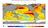
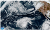
Southern Cal better hope the steering flow doesn't take a rare aim at them and the Baha over the next 30 days. Lot of juice to do the unthinkable.

Brent
Member
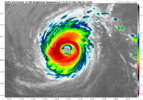
It's gonna be interesting to see how close Lowell gets to Hawaii. This has been a very dangerous setup for the state in the past. Their worst hurricanes on record have all unanimously come from the south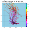
As a near coastal resident who was directly affected heavily by FIVE H/TS 2016-24, I’m very much enjoying the break from the stress of threats!
However, looking back at the 6 other El Niño seasons with <4.4 ACE through Sep 6th tells me to still be cautious for the rest of the season, especially late Sept through mid-Oct:
1) 1941: -TS TX/LA border mid Sep
-H TX late Sep
-TS Windwards/MH Honduras/Nicaragua/H Belize late Sep
-H NW Bahamas/MH S FL/H FL Pan early Oct
-TS SE Bahamas/FL Big Bend mid Oct
2) 1929:
-MH NW Bahamas and S FL tip/H FL Pan late Sep
3) 1914:
-TS FL/GA border mid Sep
4) 1905:
-TS Belize/LA late Sep
-TS W Haiti early Oct
-TS LA early Oct
5) 1904:
-H upper SC mid Sep
-TS Belize early Oct
-H C Cuba/S FL mid Oct
-TS FL Pan early Nov
6) 1876:
-H/Leewards/MH VI and PR/H Hisp/E Cuba/NC mid Sep
-TS Windwards late Sep/H Nicaragua early Oct
-H Caymans/MH W Cuba/H Keys and SW FL/TS Bermuda mid Oct
These six very quiet first half of season El Niño analogs are suggesting an avg of 3 TCs (range 1-5), including 1.5 H (range 0-3) and 0.8 MH (range 0-2) yet to come that would have significant to major land impacts. Hopefully though it will be most like 1914 or otherwise 1905 at the worst!
However, looking back at the 6 other El Niño seasons with <4.4 ACE through Sep 6th tells me to still be cautious for the rest of the season, especially late Sept through mid-Oct:
1) 1941: -TS TX/LA border mid Sep
-H TX late Sep
-TS Windwards/MH Honduras/Nicaragua/H Belize late Sep
-H NW Bahamas/MH S FL/H FL Pan early Oct
-TS SE Bahamas/FL Big Bend mid Oct
2) 1929:
-MH NW Bahamas and S FL tip/H FL Pan late Sep
3) 1914:
-TS FL/GA border mid Sep
4) 1905:
-TS Belize/LA late Sep
-TS W Haiti early Oct
-TS LA early Oct
5) 1904:
-H upper SC mid Sep
-TS Belize early Oct
-H C Cuba/S FL mid Oct
-TS FL Pan early Nov
6) 1876:
-H/Leewards/MH VI and PR/H Hisp/E Cuba/NC mid Sep
-TS Windwards late Sep/H Nicaragua early Oct
-H Caymans/MH W Cuba/H Keys and SW FL/TS Bermuda mid Oct
These six very quiet first half of season El Niño analogs are suggesting an avg of 3 TCs (range 1-5), including 1.5 H (range 0-3) and 0.8 MH (range 0-2) yet to come that would have significant to major land impacts. Hopefully though it will be most like 1914 or otherwise 1905 at the worst!
As a near coastal resident who was directly affected heavily by FIVE H/TS 2016-24, I’m very much enjoying the break from the stress of threats!
However, looking back at the 6 other El Niño seasons with <4.4 ACE through Sep 6th tells me to still be cautious for the rest of the season, especially late Sept through mid-Oct:
1) 1941: -TS TX/LA border mid Sep
-H TX late Sep
-TS Windwards/MH Honduras/Nicaragua/H Belize late Sep
-H NW Bahamas/MH S FL/H FL Pan early Oct
-TS SE Bahamas/FL Big Bend mid Oct
2) 1929:
-MH NW Bahamas and S FL tip/H FL Pan late Sep
3) 1914:
-TS FL/GA border mid Sep
4) 1905:
-TS Belize/LA late Sep
-TS W Haiti early Oct
-TS LA early Oct
5) 1904:
-H upper SC mid Sep
-TS Belize early Oct
-H C Cuba/S FL mid Oct
-TS FL Pan early Nov
6) 1876:
-H/Leewards/MH VI and PR/H Hisp/E Cuba/NC mid Sep
-TS Windwards late Sep/H Nicaragua early Oct
-H Caymans/MH W Cuba/H Keys and SW FL/TS Bermuda mid Oct
These six very quiet first half of season El Niño analogs are suggesting an avg of 3 TCs (range 1-5), including 1.5 H (range 0-3) and 0.8 MH (range 0-2) yet to come that would have significant to major land impacts. Hopefully though it will be most like 1914 or otherwise 1905 at the worst!
Y'all are probably fine either way. What's it been like 40-50 years since a hurricane made landfall in coastal GA?
Y'all are probably fine either way. What's it been like 40-50 years since a hurricane made landfall in coastal GA?
I meant to be cautious wherever anyone is located/a general idea.
Last GA land falling H: 1979 (David). However:
-despite no landfall, the center of still high end 2016 cat 2 H Matthew passed by only ~35 miles offshore and thus acted like a pre-land falling H causing a significant storm surge, 12-16” of rain, and H force winds leading to sig. damage/widespread multi day outages.
-2017’s Irma, which passed by well inland and only as a TS at its closest approach, still brought us a slightly larger surge than Matthew because the massive surge that it had caused when it was a cat 4 well to the S kept coming all of the way up here. I’m still amazed at the size of the surge! However, the winds and rain amounts were much lower than that from Matthew.
-Although the center of 2024 H Helene passed 100 miles to our W, we got H force winds along with the attending damage and widespread multi-day outages.
Last edited:
Also don’t forget that Micheal was still a category 3 when crossed into sw Georgia from the Florida panhandle in 2018.I meant to be cautious wherever anyone is located/a general idea.
Last GA land falling H: 1979 (David). However:
-despite no landfall, the center of still high end 2016 cat 2 H Matthew passed by only ~35 miles offshore and thus acted like a pre-land falling H causing a significant storm surge, 12-16” of rain, and H force winds leading to sig. damage/widespread multi day outages.
-2017’s Irma, which passed by well inland and only as a TS at its closest approach, still brought us a slightly larger surge than Matthew because the massive surge that it had caused when it was a cat 4 well to the S kept coming all of the way up here. I’m still amazed at the size of the surge! However, the winds and rain amounts were much lower than that from Matthew.
-Although the center of 2024 H Helene passed 100 miles to our W, we got H force winds along with the attending damage and widespread multi-day outages.
Shaggy
Member
GEFS is quite active in the long range and is not supported by the EPS so its kind of on its own.

NoSnowATL
Member
A year without a hurricane in the Atlantic would be wild especially with GW.
Brent
Member
A year without a hurricane in the Atlantic would be wild especially with GW.
Never been one since satellites
Even the totally dead seasons in the 80s had one or two
EPS is a wasteland if you look at wind shear. It will obliterate anything crossing the Atlantic. Homegrown looks like the best we can muster for the next 2 weeks, at least, unless something tries to get going in the fish zone.GEFS is quite active in the long range and is not supported by the EPS so its kind of on its own.
Shaggy
Member
Yeah it seems the gefs originates in the Caribbean nothing in the MDR.EPS is a wasteland if you look at wind shear. It will obliterate anything crossing the Atlantic. Homegrown looks like the best we can muster for the next 2 weeks, at least, unless something tries to get going in the fish zone.
lexxnchloe
Member
The UKMET has for the 2nd run in a row a TC in the Mediterranean Sea:
12Z UKMET:
NEW TROPICAL CYCLONE FORECAST TO DEVELOP AFTER 132 HOURS
FORECAST POSITION AT T+132 : 35.8N 21.0E
LEAD CENTRAL MAXIMUM WIND
VERIFYING TIME TIME POSITION PRESSURE (MB) SPEED (KNOTS)
-------------- ---- -------- ------------- -------------
0000UTC 14.09.2026 132 35.8N 21.0E 1008 31
1200UTC 14.09.2026 144 38.7N 24.0E 1007 27
0000UTC 15.09.2026 156 40.5N 24.6E 1007 27
1200UTC 15.09.2026 168 39.6N 22.6E 1008 25
12Z UKMET:
NEW TROPICAL CYCLONE FORECAST TO DEVELOP AFTER 132 HOURS
FORECAST POSITION AT T+132 : 35.8N 21.0E
LEAD CENTRAL MAXIMUM WIND
VERIFYING TIME TIME POSITION PRESSURE (MB) SPEED (KNOTS)
-------------- ---- -------- ------------- -------------
0000UTC 14.09.2026 132 35.8N 21.0E 1008 31
1200UTC 14.09.2026 144 38.7N 24.0E 1007 27
0000UTC 15.09.2026 156 40.5N 24.6E 1007 27
1200UTC 15.09.2026 168 39.6N 22.6E 1008 25
Brent
Member
Gotta love the fantasy 18z GFS probably one of the largest hurricanes ever in the Gulf haha. I'm sure it will be gone next run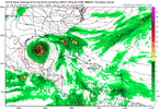

GeorgiaGirl
Member
Yeah I had a good laugh at that run.
0% chance of it occurring that way, but I do wonder if it’s CAG or nothing here, and if strong El Niños can shut down the CAG action too.
0% chance of it occurring that way, but I do wonder if it’s CAG or nothing here, and if strong El Niños can shut down the CAG action too.
Think this is the latest ever the Atlantic has made it without a Hurricane so far. Seems like the record date is this weekend perhaps. So we will be setting a new record and to no ones surprise, as a dud year for activity has been the call shot on everyone's outlook since last winter.
Shaggy
Member
It's still there on 06z run but it's always better to look towards ensembles at that range anywaysYeah I had a good laugh at that run.
0% chance of it occurring that way, but I do wonder if it’s CAG or nothing here, and if strong El Niños can shut down the CAG action too.
I'm still waiting to see one of the many CAG canes the GFS was cooking up throughout May and June. Homegrown storms as we approach October are certainly on the table, though.Yeah I had a good laugh at that run.
0% chance of it occurring that way, but I do wonder if it’s CAG or nothing here, and if strong El Niños can shut down the CAG action too.
lexxnchloe
Member
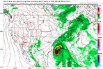
Not gone, lolGotta love the fantasy 18z GFS probably one of the largest hurricanes ever in the Gulf haha. I'm sure it will be gone next runView attachment 197944
lexxnchloe
Member
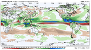
The rest of the season. 2027 has to be better if im alive to see it, lol