blueheronNC
Member
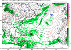
For 300 hours I gotta admit this is kind of a big signal for something. It may not be a direct US hit but the idea of a big storm between Bermuda and Mexico probably isn't a bad oneWeenie run for sure. This would be a big yikes
View attachment 173991
Yeah the signal is strong for something. Going back to what I said about consistency and consensus leading to confidence.........we are getting the consistency and consensus part locked in more each dayFor 300 hours I gotta admit this is kind of a big signal for something. It may not be a direct US hit but the idea of a big storm between Bermuda and Mexico probably isn't a bad one
Its still over Africa too that's the crazy part
I wonder if we won't see 96L the thing in the outlook ahead of it as sort of the sacrifice to create a better environment and threat if we continue to see the models all over it
Clearly something is coming. That's the biggest thing we can take from this because you don't see a signal like this that far out often
Euro is out to sea while the Euro AI is in Louisiana lol long way to go
Yeah the signal is strong for something. Going back to what I said about consistency and consensus leading to confidence.........we are getting the consistency and consensus part locked in more each day
One red flag for me is when something is being shown and it stays in the same time frame and never moves into the mid range. This system seems to like staying in that 300+ time frame
Where you going Shaggy I might need to follow lolThis is the run you've been waiting on @lexxnchloeView attachment 173984
Probably southport.......I don't plan on evacuating unless it's a legit 125+Where you going Shaggy I might need to follow lol
We are now seeing a lot of interesting things on the long range models as far as potential tropical systems to watch. Conditions over the Atlantic are slowly improving for tropical development as far as Saharan dust and wind shear are concerned and the African wave train is about to leave the station. Around two weeks from now many of the models have strong hurricane in the Atlantic basin, albeit, at different locations. So far what has developed has been weak in intensity but the weather models are indicating that is about to change. My father in law gave us his generator because he just went into a assisted living facility and if some of the long range model maps that have been posted here verify, it might come in handy very soon.
I’d only go if cat 3 or aboveProbably southport.......I don't plan on evacuating unless it's a legit 125+
The last category 3 hurricane to hit the North Carolina coast was Fran back in 1996 which we older folks who have lived here for most or all of our lives remember. Only one category 4 storm has officially been recorded which was Hazel back in 1954. It was the storm that my parents always talked about whenever hurricanes were mentioned. North Carolina has never seen a category 5 hurricane since weather records have been kept and I hope that trend continues.I’d only go if cat 3 or above
GFS is back to not developing 96L. When 96L doesnt develop then the next one is stronger and more westDespite not yet being declared an Invest, I think that a new thread for this AEW in W Africa would probably already be a good idea since it’s been dominating this thread for awhile and isn’t going to stop. I’m guessing it will make the next TWO based on this with it becoming an Invest very soon.
The 12Z UKMET is likely the 1st with a TD from this as it forms in only 114 hours (thus lemon-worthy). After sliding just N of the N Leewards, it ends the run approaching TS strength (33 knts/38 mph winds) 430 miles ENE of PR moving WNW at a pretty brisk 18 mph. It’s 168 is similar to 12Z Icon 180 posted above but is slightly ahead of it. Will have to wait for maps to try to get better idea of whether or not it’s implying it would likely recurve safely offshore the Conus.
NEW TROPICAL CYCLONE FORECAST TO DEVELOP AFTER 114 HOURS
FORECAST POSITION AT T+114 : 15.8N 46.0W
LEAD CENTRAL MAXIMUM WIND
VERIFYING TIME TIME POSITION PRESSURE (MB) SPEED (KNOTS)
-------------- ---- -------- ------------- -------------
1200UTC 13.08.2025 120 16.1N 48.2W 1009 28
0000UTC 14.08.2025 132 17.8N 51.6W 1009 27
1200UTC 14.08.2025 144 18.9N 54.9W 1009 29
0000UTC 15.08.2025 156 20.3N 57.7W 1009 30
1200UTC 15.08.2025 168 21.4N 60.9W 1007 33
The only way to possibly get a cat4 to hit NC is for it to be flying north. If it does what Diana did in 1984 it will weakenThe last category 3 hurricane to hit the North Carolina coast was Fran back in 1996 which we older folks who have lived here for most or all of our lives remember. Only one category 4 storm has officially been recorded which was Hazel back in 1954. It was the storm that my parents always talked about whenever hurricanes were mentioned. North Carolina has never seen a category 5 hurricane since weather records have been kept and I hope that trend continues.
Many people keep saying we are overdue for a major hurricane to impact the North Carolina coast. I hope this isn't the year that we cash in. There are a lot of people living along the coast now who have no clue about what a major hurricane can do as far as damage.
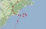
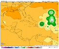
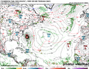
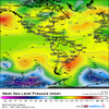
Stronger and further west than 0Z12Z Euro landfalls in E NC/Outer Banks at hour 324 (late on Aug 21st with it then in the 950s of mbs or likely near cat 3 status). All of this is very much just fwiw since it’s just an operational run out in fantasyland:
View attachment 174008
The last category 3 hurricane to hit the North Carolina coast was Fran back in 1996 which we older folks who have lived here for most or all of our lives remember. Only one category 4 storm has officially been recorded which was Hazel back in 1954. It was the storm that my parents always talked about whenever hurricanes were mentioned. North Carolina has never seen a category 5 hurricane since weather records have been kept and I hope that trend continues.
Many people keep saying we are overdue for a major hurricane to impact the North Carolina coast. I hope this isn't the year that we cash in. There are a lot of people living along the coast now who have no clue about what a major hurricane can do as far as damage.
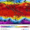
Seems that whatever the op does the ensemble mean does the oppositeLots of possibilities
View attachment 174014
I have you beat by ten years. I graduated in 1983. Personally, I'm glad there are so many younger members on this website with so much knowledge. They often teach an old dog like me new tricks which is impossible to do according to the old saying.Damn Im old. I graduated HS in 93. Thought Id be one of the younger ones on a weather forum.
That helps narrow it down
