lexxnchloe
Member
When was the last time a storm had a pressure gradient larger than the size of Texas?
Its the way the AI isWhen was the last time a storm had a pressure gradient larger than the size of Texas?
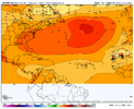
The western Gulf might be at risk in that pattern, with the trough recurring on the east coast.CFS continues to show the winter pattern has set in and it an east atlantic season.
Its possible. The only realistic chance for a US hit this season is a late season storm moving out of the Carib.The western Gulf might be at risk in that pattern, with the trough recurring on the east coast.
Its possible. The only realistic chance for a US hit thus one season is a late season storm moving out of the Carib.
I'm never a big fan of long range monthly forecast.Its possible. The only realistic chance for a US hit this season is a late season storm moving out of the Carib.
CFS showing the trof is in the EAST for awhileI'm gonna quote this for later
I mean really the 0z GFS had a doomsday hurricane 8 hours ago but sure everything is cancelled
Like are we serious?
I'm never a big fan of long range monthly forecast.

JB hasnt seen the CFSModels are kind of bucking the mjo composites towards the end of their run. Mjo would favor a lingering us threat but the models shoving the ridge west with a trough east really wouldn't
JB hasnt seen the CFS
12Z CFS likely recurve east of Bermuda
W African AEW:
1. The 12Z ICON is slightly stronger than the 0Z with the W African AEW. At 180, it has what already looks like nearly a TD at 19N, 46W. Although a TC near that position often recurves safely, this one is turning back to just N of due W after moving WNW earlier due to a stronger high to its north at this longitude.
2. The 12Z UKMET doesn’t have this. However, the 0Z had this, which may be from the same AEW:
NEW TROPICAL CYCLONE FORECAST TO DEVELOP AFTER 114 HOURS
FORECAST POSITION AT T+114 : 15.4N 18.6W
LEAD CENTRAL MAXIMUM WIND
VERIFYING TIME TIME POSITION PRESSURE (MB) SPEED (KNOTS)
-------------- ---- -------- ------------- -------------
0000UTC 12.08.2025 120 15.6N 21.0W 1009 28
1200UTC 12.08.2025 132 15.0N 24.0W 1010 27
0000UTC 13.08.2025 144 15.4N 26.0W 1010 23
1200UTC 13.08.2025 156 CEASED TRACKING

AI remains consistent and gets it to the coast. The reason why is because the AI doesnt develop that first cane that screws everything upThrough 222hrs the gefs seems more active and further SW. This is a 3 run trend. First time In a while with a system in the islands
View attachment 173972


Someone is going to wishcast it right into your backyard
That area is overdue too. It's been a while for Wilmington.This is the run you've been waiting on @lexxnchloeView attachment 173984
EURO/ AI. and GFS basically agree now that the GFS has dropped the first cane. Normally i would say with all 3 agreeing its very likely a major cane will be somewhere in the SW ATL but i am still wondering about all that dry air.This is the run you've been waiting on @lexxnchloeView attachment 173984
It's also 300 hours out so it's liable to end up at the Yucatan. It's clear the ensembles are leading the way. The GEFS at 12z was heavy loaded to a SE threat the 18z op followedEURO/ AI. and GFS basically agree now that the GFS has dropped the first cane. Normally i would say with all 3 agreeing its very likely a major cane will be somewhere in the SW ATL but i am still wondering about all that dry air.
