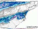
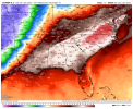
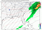
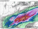
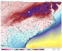
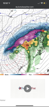
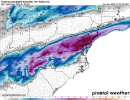
We have one more day of stress, fear, weenieism, and possible NW trends, this one is far from over
-
Hello, please take a minute to check out our awesome content, contributed by the wonderful members of our community. We hope you'll add your own thoughts and opinions by making a free account!
You are using an out of date browser. It may not display this or other websites correctly.
You should upgrade or use an alternative browser.
You should upgrade or use an alternative browser.
Misc 2021-22 Fall/Winter Whamby Thread
- Thread starter jackendrickwx
- Start date
Code for “we’re screwed”.I don't know if the computer models are ever going to make up their minds on this one. This may be one of those "nowcast" events.
Dewpoint Dan
Member
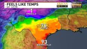
I wonder if this is the largest spread in temps in Texas history ?
NBAcentel
Member
Doesn’t show snow in my backyard, I toss
It's almost over, hopefullyI can’t take much more of this. This is getting ridiculous.
Its 69F at 10pm in January. ?
View attachment 100941
I don’t even want snow…I just want to not have to run my AC at night in January. That would be equal to a foot of snow in my book.
NBAcentel
Member
Thank goodness there’s no record strong -PNA showing up on ensembles anymoreI don’t even want snow…I just want to not have to run my AC at night in January. That would be equal to a foot of snow in my book.
NBAcentel
Member
Jeez I’m feining for the rap to run, these models are like crack right now, this is what happens when we are starved
Yeah, can't wait to see my light bill, Christmas lights and running the AC ?????I don’t even want snow…I just want to not have to run my AC at night in January. That would be equal to a foot of snow in my book.
Nothing more depressing than when NE weenies start getting excited from model trends. Doesn’t mean good for us
597DM
Member
Hello I here to provide assistance
Please doHello I here to provide assistance
NBAcentel
Member
RAP will kill our dreams and hope watch lol
Good, put us out of our misery so we can move onRAP will kill our dreams and hope watch lol
NBAcentel
Member
Move on to watching Friday morning become the same exact thing ??Good, put us out of our misery so we can move on
GeorgiaGirl
Member
Man, I've been gassed for most of today.
Nothing like having a few mimosas and seriously premelting over a game that has not occurred and one I won't be watching last night (and did again a moment ago, if it gets myself heated, I'm melting over something).
No more staying up to 1:30 AM for me (didn't mean to but it happened). I usually don't anyway.
LukeBarrette
im north of 90% of people on here so yeah
Meteorology Student
Member
2024 Supporter
2017-2023 Supporter
View attachment 100965
Weenie image of the year
For you… we’re crying in NC
Man, I've been gassed for most of today.
Nothing like having a few mimosas and seriously premelting over a game that has not occurred and one I won't be watching last night (and did again a moment ago, if it gets myself heated, I'm melting over something).
No more staying up to 1:30 AM for me (didn't mean to but it happened). I usually don't anyway.

Montanasnow30
Member
Well looks like I’ll be catching a flight  back to Billings Montana but I enjoyed coming back home to Alabama to visit family for New Years but anyway it’s time to go catch up with all the snow lovers back in Montana… oh and on another note I hope all you guys here in the Southeast can get some snow before winter is over because you guys deserve it
Dewpoint Dan
Member
I still think you actually live in AL and are "pretending" to live in Montana but who am I to judge ? ?Well looks like I’ll be catching a flightback to Billings Montana but I enjoyed coming back home to Alabama to visit family for New Years but anyway it’s time to go catch up with all the snow lovers back in Montana… oh and on another note I hope all you guys here in the Southeast can get some snow before winter is over because you guys deserve it
LukeBarrette
im north of 90% of people on here so yeah
Meteorology Student
Member
2024 Supporter
2017-2023 Supporter
Man I’ve been texting Wxfro too, I really wanted yesterday’s models to be right as a compromise. ?For you… we’re crying in NC
About to be 65/drizzle here on Monday while Richmond is getting pounded.
NBAcentel
Member
NBAcentel
Member
Someone tell me it’s gonna be okay
It's not like that winter at all, basically in any way.Trending towards another DC mauler. This is like 2009-2010 winter all over again.
597DM
Member
@Weenietag you might a couple people coming to join you. ?It's going to be okView attachment 100989
Windergawx
Member
Jan 1st 2022
11:55pm had to switch the ac on.
Would have opened the windows, but a cat might have jumped for colder climates
11:55pm had to switch the ac on.
Would have opened the windows, but a cat might have jumped for colder climates
All types of lightening, thunder and wind here right now. Amazing it might have a chance of snow here tomorrow evening and night. Wow
Wow lights trying to kick out. Dang.

