Bigedd09
Member
It's always something. Warm layer, dry layer, no forcing, something.... if there's a way to fail, we shall find it
Most true thing I’ve heard all day. It’s insanity
Sent from my iPhone using Tapatalk
It's always something. Warm layer, dry layer, no forcing, something.... if there's a way to fail, we shall find it
and will he stand in a fountain again if we see narry a single flake?Greg Fishel's post on Facebook about 30 minutes ago.
THIS TIME I CAN PROMISE YOU SNOW IN THE TRIANGLE, BUT…
It will snow tomorrow, and rarely can I make a statement like that in the piedmont of North Carolina with such high confidence! In contrast to the event a few days ago, a deep layer of the atmosphere will be cooling and we won’t have to worry about warm air aloft. But I have other concerns relating to impact.
First of all, the morning rush hour will be fine. A little light rain, if that. The precipitation intensity should pick up a bit late morning as the atmosphere cools enough to produce snow. But will it come down hard enough to extract heat from a warm ground and allow the snow to accumulate on the roads? I have my doubts but it’s worth watching. Accumulations are more likely on grassy surfaces and there I could see half an inch to at most an inch.
Then tomorrow night, black ice warnings are already flying, and that could happen but consider this. As soon as temps go below freezing tomorrow evening, the air will begin to dry out. This will cause increased evaporation rates. It’ll be a race! Will the standing water evaporate before it can freeze, or will it freeze before it can evaporate? That is the million dollar question! If the water does freeze I think it would be after the evening rush hour, so at this point I think the commute home will not be all that bad.
So those are my thoughts at the moment. Will update as needed but not just for the sake of cluttering the Facebook landscape! Talk soon


Between that and the NAM, it looks to another miss for usLol the 2z HRRR shafts Raleigh out of any precipitation.

Right or wrong gfs not backing down
Sent from my iPhone using Tapatalk
 www.facebook.com
If anything, the GFS has held consistent. But is it consistently wrong or right?
Right or wrong gfs not backing down
Sent from my iPhone using Tapatalk
That is wild. It keeps expanding as we get closer to go time
Sent from my iPhone using Tapatalk
 . It not only refuses to back off it keeps doubling down, someone smarter than me….. what are the differences at H5 that cause this downstream?
 And itn s crazy that there is such a difference in that model and others less than 24 hours out. There is even a difference of nothing at all or 2 inches on the short range models. I guess that's why all the local mets play it safe and just go with whatever one shows the least amount.This thing is either the new king …. Or a MASSIVE piece of Dog. It not only refuses to back off it keeps doubling down, someone smarter than me….. what are the differences at H5 that cause this downstream?
Sent from my iPhone using Tapatalk
And itn s crazy that there is such a difference in that model and others less than 24 hours out. There is even a difference of nothing at all or 2 inches on the short range models. I guess that's why all the local mets play it safe and just go with whatever one shows the least amount.
It pulled a cat out of its hat with last February’s storm, on an island for days that ended up being mostly right while other modeling was off. I will ride and die with this until I end up with just a dusting tomorrow.If anything, the GFS has held consistent. But is it consistently wrong or right?


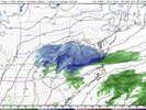
HRRR looks dead on…lock it in.
The newest radar looks even more robust than that so.....HRRR looks dead on…lock it in.
I’m not buying 0 QPF when every model was trending the other way 5 hours ago.HRRR looks dead on…lock it in.
Dead on??? Real time radar is way juicier than HRRRHRRR looks dead on…lock it in.
GFS looks good too. Too much gloom.4z HRRR looks like it’s going to be better for portions of NC. Higher QPF…
I’m with you, HRRR is one of my least favorite models for this reason. It almost always underestimates QPF. That’s why I like the NAM more at a range like this. NBM is also showing more QPF so I’m not buying it.I'm just gonna call it as I see it, the HRRR is out to frickin' lunch. Looking at the current radar presentation and the fact that it's frickin' foggy as all hell outside where I'm at right now, there's no way it ends up that dry.