CNCsnwfan1210
Member
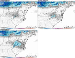
Is this good?
Sent from my iPhone using Tapatalk
Not bad I don’t think, coastal low might kick in here the next few frames
Sent from my iPhone using Tapatalk
Is this good?
Sent from my iPhone using Tapatalk
What is wrong with the NAM right now
It keeps leaving these unnatural stationary pockets of no precip
View attachment 178302
It’s been doing this for the past couple of years. I expect it to fill in by the 12z run tomorrow.What is wrong with the NAM right now
It keeps leaving these unnatural stationary pockets of no precip
View attachment 178302
Wasn't this always a moisture starved event?What is wrong with the NAM right now
It keeps leaving these unnatural stationary pockets of no precip
View attachment 178302
Couple of things. Since the “upgrade” some time back of the NAM it’s been light on qpf. The 3k NAM higher resolution is able to pick up on the Synoptics of this event better than the 12kWhat is wrong with the NAM right now
It keeps leaving these unnatural stationary pockets of no precip
View attachment 178302

Sure there could be some issues at onset within the model of boundary layer dry air, but not literal stationary pockets of zero precip. That doesn’t make sense. I would think it should be pretty closed to fully filled in like the 3k, and would imagine it’ll correctWasn't this always a moisture starved event?
Wow, that is a great looking storm for NC and VABeautiful!!
Sent from my iPhone using Tapatalk
Beautiful!!
Sent from my iPhone using Tapatalk
Now that's a nice look!Beautiful!!
Sent from my iPhone using Tapatalk
I've honestly seen the 12km NAM referred to as one of the worst models out there.What is wrong with the NAM right now
It keeps leaving these unnatural stationary pockets of no precip
View attachment 178302

Heck yeah. Bring it home!! Rooting for y’all
Now that would be gloriousLooks really nice!!
Sent from my iPhone using Tapatalk
12K NAM isn’t my favorite but I love the 3K. I have found it to be good at snowfall predictions during winter. It’s a model that should definitely not be ignoredI've honestly seen the 12km NAM referred to as one of the worst models out there.
3km NAM has some utility, especially with warm nosing / warm advection of course. It can be a bit light on precip when at range IMO
Agreed. We see time and time again the NAM starts honking the warm nose (when other models miss it) and is right more times than not. Seeing no sign of warm nosing on the NAM this time gives me hope.I've honestly seen the 12km NAM referred to as one of the worst models out there.
3km NAM has some utility, especially with warm nosing / warm advection of course. It can be a bit light on precip when at range IMO

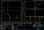
Certainly a rain or snow deal with the cold aloft. And in the event of heavier rates with borderline temps, this is a rates will Overcome dealAgreed. We see time and time again the NAM starts honking the warm nose (when other models miss it) and is right more times than not. Seeing no sign of warm nosing on the NAM this time gives me hope.
View attachment 178306
Starting look very close to that 1/9/2004 analog someone showed earlierLooks really nice!!
Sent from my iPhone using Tapatalk

Yeah, but these are the improvements with the wave that I've been looking for / hoping for all along. More amplitude, more vorticity, farther south. Hope it continues. Trend loop here on the hi-res / 3km NAM
View attachment 178311
From KRDU 1:30PM:
A COLD FRONT WILL MOVE ACROSS THE REGION ON MONDAY, WITH COLD AIR
CHASING THE DEPARTING PRECIPITATION THROUGH THE DAY. MORNING
TEMPERATURES WILL START NEAR FREEZING ALONG THE VA BORDER AND IN THE
MID TO UPPER 30S ELSEWHERE. RAIN WILL BE THE PRIMARY PRECIPITATION
TYPE, BUT TEMPERATURES WILL GRADUALLY FALL THROUGH THE AFTERNOON AS
COLDER AIR ARRIVES. THIS MAY ALLOW FOR A RAIN/SNOW MIX ACROSS
PORTIONS OF THE NORTHERN PIEDMONT—GENERALLY FROM ROCKY MOUNT TO
RALEIGH TO LEXINGTON. BEFORE PRECIPITATION TAPERS OFF EARLY MONDAY
EVENING, A BRIEF CHANGEOVER TO LIGHT SNOW IS POSSIBLE NEAR THE VA
BORDER. ANY ACCUMULATIONS WOULD BE MINOR AND MAINLY LIMITED TO
ELEVATED SURFACES GIVEN WARM GROUND TEMPERATURES.
—————
Does this seem realistic for RDU, little or no accum. due to cold chasing moisture? If there is any accum, what’s a reasonable upside accum limit there? Opinions?
IDK the scores obviously, however ...... I would take this as the winner currently until proven otherwise. Take the warmest and the driest and thats normally a solid bet jmoNAMs future replacement don't look as good, fyi. Still in testing mode though, no idea verification scores or how well it does with wintry precip
View attachment 178313
I am so saddened by the NAMs replacement…what are we thinkingNAMs future replacement don't look as good, fyi. Still in testing mode though, no idea verification scores or how well it does with wintry precip
View attachment 178313
By the way, that model (RRFSv1) is trash and isn’t replacing NAM. The operational version of RRFS (RRFSV2) will be MPAS-based, so see GSL-MPAS and MPAS-rnNAMs future replacement don't look as good, fyi. Still in testing mode though, no idea verification scores or how well it does with wintry precip
View attachment 178313
As noted that AFD was from earlier and things have changed since then and they also heavily utilize the NBM. As you can see that has also shown a nice uptick in accums, the last 2 frames are since their discussion at 1:30, if this trend continues, I'd expect to see a little different wording tomorrow. Maybe even in the overnight packageFrom KRDU 1:30PM:
A COLD FRONT WILL MOVE ACROSS THE REGION ON MONDAY, WITH COLD AIR
CHASING THE DEPARTING PRECIPITATION THROUGH THE DAY. MORNING
TEMPERATURES WILL START NEAR FREEZING ALONG THE VA BORDER AND IN THE
MID TO UPPER 30S ELSEWHERE. RAIN WILL BE THE PRIMARY PRECIPITATION
TYPE, BUT TEMPERATURES WILL GRADUALLY FALL THROUGH THE AFTERNOON AS
COLDER AIR ARRIVES. THIS MAY ALLOW FOR A RAIN/SNOW MIX ACROSS
PORTIONS OF THE NORTHERN PIEDMONT—GENERALLY FROM ROCKY MOUNT TO
RALEIGH TO LEXINGTON. BEFORE PRECIPITATION TAPERS OFF EARLY MONDAY
EVENING, A BRIEF CHANGEOVER TO LIGHT SNOW IS POSSIBLE NEAR THE VA
BORDER. ANY ACCUMULATIONS WOULD BE MINOR AND MAINLY LIMITED TO
ELEVATED SURFACES GIVEN WARM GROUND TEMPERATURES.
—————
Does this seem realistic for RDU, little or no accum. due to cold chasing moisture? If there is any accum, what’s a reasonable upside accum limit there? Opinions?

nonzero >4" lol. impressive odds of 1" for @RBR71 tho
