• Hello, please take a minute to check out our awesome content, contributed by the wonderful members of our community. We hope you'll add your own thoughts and opinions by making a free account!

12/2/2024 - Potential Clipper Action!

These soundings make my stomach hurt. Close enough to over perform close enough to complete heart breakView attachment 155279
i just think we'll need to be ready for the Great Virga Outbreak of 2024 to unfold. Somebody will finally get enough saturation to see one flake at 12:57am after the rest of us give up (not a forecast lol but i wouldn't rule it out)
 
On the HRRR, here is the infamous upstate / GSP mesolow that forms in these types of setups with upper wave / vort max approaching from the NW. Mesolow tracks across northern SC to Myrtle Beach. Helps with low level convergence and lift along and north of its track

xTzBYWu.gif
 
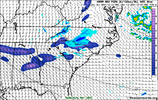
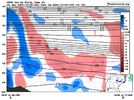
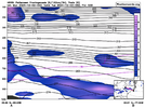
Building off of griteater's posts here, you can see the main forcing mechanism for generating light snow tomorrow night over NC is where you can get sufficient low-level (~800-850 hPa) sloped frontogenesis/convergence just underneath the DGZ & north of the mesolow, with the trailing mid-level vort max providing additional support.

hrrr_2024-12-02-00Z_030_39.333_270.067_29.167_289.267_Frontogenesis_850_Simulated_Reflectivity...png

hrrr_Simulated_Reflectivity_00_031_98726772_cross_weathernerds.png


hrrr_Frontogenesis_850_00_030_98726772_cross_weathernerds.png
 
Back
Top