rburrel2
Member
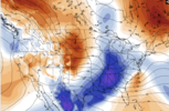
Ya'll, that Microsoft AI model,(which had been looking similar to the Euro AI... just went nuclear with a late phase... There aren't any precip maps for it that I've found, but it looks like a coastal nuke job.
You can't post this and not show somethingYa'll, that Microsoft AI model,(which had been looking similar to the Euro AI... just went nuclear with a late phase... There aren't any precip maps for it that I've found, but it looks like a coastal nuke job.
AgreeThere may be too many weather models now.
Looks bouncycorn Pangu-ish. We have new models to bring us to glory by god
I feel like the mix line on option one would be way more south due to the presence of CADView attachment 159971
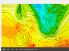
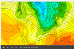
MY TAKEAWAY
Option 1 (Top Scenario):
- Storm Track: The low-pressure system takes a more northerly route, bringing warm Gulf air farther north ahead of the system.
- Impact: This leads to a predominant rain event across much of the Southeast, with a narrow band of mixed precipitation (sleet/freezing rain) to the north of the rain zone. Snowfall is confined to areas farther north, where the cold air remains entrenched.
- Cause: This setup typically results from a weaker ridge in the Midwest and a more zonal flow, which limits how far south the cold air can push. The warm air overruns the majority of the storm track, reducing the chances of significant snow in the southern regions.
Option 2 (Bottom Scenario):
- Storm Track: The low-pressure system tracks farther south, allowing cold air to dive deeper into the South and interact with Gulf moisture.
- Impact: Snowfall becomes the dominant precipitation type for a much larger area, especially in the Tennessee Valley, Mid-South, and into the Carolinas. A more widespread snow/mix zone appears, with less rain compared to Option 1. The transition zone shifts farther south, making this a colder and snowier outcome for many areas.
- Cause: This is driven by stronger Midwest ridging, which amplifies the jet stream and allows Arctic air to penetrate farther south. The storm track is forced to stay south, creating better conditions for snow.
Key Takeaways:
- Option 1 favors warmer conditions with limited snow, especially for southern regions.
- Option 2 is a more favorable setup for widespread snow and wintry weather, thanks to a colder, more suppressed storm track.
- The eventual outcome will depend on the strength of the Midwest ridge and how far south the cold air can push before the storm arrives.
plus Jimmymaps!Looks bouncycorn Pangu-ish. We have new models to bring us to glory by god
EURO AI is perfect OMGView attachment 159971
MY TAKEAWAY
Option 1 (Top Scenario):
- Storm Track: The low-pressure system takes a more northerly route, bringing warm Gulf air farther north ahead of the system.
- Impact: This leads to a predominant rain event across much of the Southeast, with a narrow band of mixed precipitation (sleet/freezing rain) to the north of the rain zone. Snowfall is confined to areas farther north, where the cold air remains entrenched.
- Cause: This setup typically results from a weaker ridge in the Midwest and a more zonal flow, which limits how far south the cold air can push. The warm air overruns the majority of the storm track, reducing the chances of significant snow in the southern regions.
Option 2 (Bottom Scenario):
- Storm Track: The low-pressure system tracks farther south, allowing cold air to dive deeper into the South and interact with Gulf moisture.
- Impact: Snowfall becomes the dominant precipitation type for a much larger area, especially in the Tennessee Valley, Mid-South, and into the Carolinas. A more widespread snow/mix zone appears, with less rain compared to Option 1. The transition zone shifts farther south, making this a colder and snowier outcome for many areas.
- Cause: This is driven by stronger Midwest ridging, which amplifies the jet stream and allows Arctic air to penetrate farther south. The storm track is forced to stay south, creating better conditions for snow.
Key Takeaways:
- Option 1 favors warmer conditions with limited snow, especially for southern regions.
- Option 2 is a more favorable setup for widespread snow and wintry weather, thanks to a colder, more suppressed storm track.
- The eventual outcome will depend on the strength of the Midwest ridge and how far south the cold air can push before the storm arrives.

I hope you continue to post more this is greatView attachment 159971
MY TAKEAWAY
Option 1 (Top Scenario):
- Storm Track: The low-pressure system takes a more northerly route, bringing warm Gulf air farther north ahead of the system.
- Impact: This leads to a predominant rain event across much of the Southeast, with a narrow band of mixed precipitation (sleet/freezing rain) to the north of the rain zone. Snowfall is confined to areas farther north, where the cold air remains entrenched.
- Cause: This setup typically results from a weaker ridge in the Midwest and a more zonal flow, which limits how far south the cold air can push. The warm air overruns the majority of the storm track, reducing the chances of significant snow in the southern regions.
Option 2 (Bottom Scenario):
- Storm Track: The low-pressure system tracks farther south, allowing cold air to dive deeper into the South and interact with Gulf moisture.
- Impact: Snowfall becomes the dominant precipitation type for a much larger area, especially in the Tennessee Valley, Mid-South, and into the Carolinas. A more widespread snow/mix zone appears, with less rain compared to Option 1. The transition zone shifts farther south, making this a colder and snowier outcome for many areas.
- Cause: This is driven by stronger Midwest ridging, which amplifies the jet stream and allows Arctic air to penetrate farther south. The storm track is forced to stay south, creating better conditions for snow.
Key Takeaways:
- Option 1 favors warmer conditions with limited snow, especially for southern regions.
- Option 2 is a more favorable setup for widespread snow and wintry weather, thanks to a colder, more suppressed storm track.
- The eventual outcome will depend on the strength of the Midwest ridge and how far south the cold air can push before the storm arrives.
I see your point about the mix line potentially being farther south due to CAD (Cold Air Damming). However, in Option 1, the warm Gulf air overrunning the region would likely erode the wedge faster, especially with a more northerly storm track. The strength and persistence of the CAD would depend on how entrenched the cold air is before the warm air surges in. If the wedge holds strong, you're absolutely right that the mix line could shift southward. It’s a tricky balance!I feel like the mix line on option one would be way more south due to the presence of CAD
I know what you guys are thinking. Probably the only way now to make this a memorable storm for us east of the apps folks is that late phase.You can't post this and not show something
Going by that, it looks like it phased in nearly all of the Baja wave and dug the central plains wave deep, while still remaining fairly cold. Hmmlongwave trough went neutral tilt close to the Mississippi on it. (Microsoft AI). Saturday 1am.
View attachment 159983
Can you do Gadsden?
Are you serious?Not that it matters.... But I feel confident that Microsoft AI model just dropped over a foot of snow in SC up through central and Eastern NC somewhere. Maybe in a wide swath. Let's hope it has some secret sauce here. The surface low steadily deepens from Pensacola, FL coastline to Savannah,GA coastline, to just off the coast of Wilmington, NC.
I think we're gonna see a storm, it's a question about if we're either going to see a snow event, a snow-to-mix/rain event or a a Ukie/Euro solution where we get precip but it's not more than a nuisance eventMan what a roller coaster. Looks like we're steady as she goes on temps for MBY but the phase interaction has trended weaker. That's kind of the issue we started with, storm or no storm, lol. Hate to see the EPS and GEFS back off with less phasing today. Hopefully that swings back overnight.
Long couple of days ahead.

We ride !!! Thing is still so many possibilities from cold rain to nothing lol
View attachment 159986View attachment 159987
Here is Gadsden and Huntsville for the rest of the bama folks. Onto 18z we go
The same as what?Just checked the next AI model (Fourcast)... it does that nearly the same thing(just slightly weaker)... wtf. These models were more progressive prior to this. lord have mercy.
I know what you guys are thinking. Probably the only way now to make this a memorable storm for us east of the apps folks is that late phase.
A lot of the snow maps being posted on various forums look beautiful for my area,, but as usual, I'm keeping my expectations low for the simple fact that WAA can destroy a good snow in Chattanooga. It happened last January. We were 33° with a mix before turning to all rain. Across the Tennessee river and points north got hammered with snow. We were 8 miles away from a 2" minimum snow where the rain/snow line cut off. Portions of north Hamilton County received 8" and even more as you go up the mountains around Dunlap. The thing about Chattanooga is that we might go 5-10 years with minimal snow, but when we do score, it's normally on the extreme high levels. Here's to hoping this could be one of those extremes!
Sent from my SM-S916U using Tapatalk
We will have a snowpack to our north, which should help with CAD. I feel like the I-85 corridor from upstate SC to the southern NC piedmont is looking at either a mainly snow event or a snow-to-ice/rain event as I said in another postI see your point about the mix line potentially being farther south due to CAD (Cold Air Damming). However, in Option 1, the warm Gulf air overrunning the region would likely erode the wedge faster, especially with a more northerly storm track. The strength and persistence of the CAD would depend on how entrenched the cold air is before the warm air surges in. If the wedge holds strong, you're absolutely right that the mix line could shift southward. It’s a tricky balance!
The problem with the CAD is as of now, it's all but non-existent. Snowpack to the north with a SE wind isn't of much help.We will have a snowpack to our north, which should help with CAD. I feel like the I-85 corridor from upstate SC to the southern NC piedmont is looking at either a mainly snow event or a snow-to-ice/rain event as I said in another post


Exactly it needs to be NE winds to funnel it inThe problem with the CAD is as of now, it's all but non-existent. Snowpack to the north with a SE wind isn't of much help.
