-
Hello, please take a minute to check out our awesome content, contributed by the wonderful members of our community. We hope you'll add your own thoughts and opinions by making a free account!
You are using an out of date browser. It may not display this or other websites correctly.
You should upgrade or use an alternative browser.
You should upgrade or use an alternative browser.
Wintry 1/9-12 Winter Potential Great Dane or Yorkie
- Thread starter SD
- Start date
Mahomeless
Member
This thread is knocking on 500 pages....still some snow hanging tough in the always shaded areas here in NE AL.
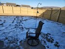
This is about how we've looked since Sunday here.Last bits of snow are finally melting away here in west Atlanta metroView attachment 163861
Brent
Member
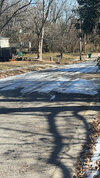
Yup the shady north side of my apartment complex is still a sheet of ice here too. We hit 56 yesterday
Drizzle Snizzle
Member
If it was February or March I guarantee you the ice would be gone by now. The lower sun angle helps keep the ice and snow around longer.Yup the north side of my apartment complex is still a sheet of ice here too. We hit 56 yesterday
Cad Wedge NC
Member
No, it's ground temps. That's the primary factor in keeping snowcover.If it was February or March I guarantee you the ice would be gone by now. The lower sun angle helps keep the ice and snow around longer.
Drizzle Snizzle
Member
Higher sun angle helps warm the ground moreNo, it's ground temps. That's the primary factor in keeping snowcover.
No I’ve seen plenty of February storms that the shady north side of my yard kept snow on the ground for a couple weeks. Happened after the February 2014 storm… I still had snow on the ground there the end of the monthIf it was February or March I guarantee you the ice would be gone by now. The lower sun angle helps keep the ice and snow around longer.
EastNcHeel
Member
I hope the discussion of sun angle vs. ground temps keeps up for a while. I want to see this thread get to 500 pages.
2hr delay for Grayson county Thursday. Hoping Surry County returns tomorrow
Still patches of ice and snow in the yard. Forgot how long things can stick around if ya get sleet and freezing rain on top of snow.
Wilkes will run on limited bus routes Thursday. 2hr delay Winston Salem
Brent
Member
Zactheplumber
Member
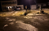
Still have a half inch plus of snow / now ice sheet on most of the driveway tonight. The adventure is real.Wilkes will run on limited bus routes Thursday. 2hr delay Winston Salem
smast16
Member
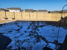
Still can't use the back deck, fully covered with 1" of snow still.
Wilkes County Schools will run on limited routes for Friday. Side Roads are grid locked in ice that face north and have banks providing shade. Some dirt roads also poor conditions.
Today will be a challenge, but seriously wondering if I can officially say last Friday's snow & ice stuck around for a week. Patches in yard still holding on.
500 pages we did it
Balakay
Member
Tis official. I still have snow and ice in the yard. Naturally fallen, not a snowman or shoveled offside walk. So this past storm left snow and ice on the ground in Atlanta for a whole week!
campamy
Member
The fact that there are still snow piles in the Walmart parking lot here from this event is bananas. I can't remember seeing something like that since living in Ohio.
ghost1
Member
Campamy… how many times have you been told that you look like Dylan Dryer the weather woman on NBCs Today Show?The fact that there are still snow piles in the Walmart parking lot here from this event is bananas. I can't remember seeing something like that since living in Ohio.
Brent
Member
The fact that there are still snow piles in the Walmart parking lot here from this event is bananas. I can't remember seeing something like that since living in Ohio.
Yeah I'm still seeing piles here too...14 days later
The only time I remember that here was after February 2021
campamy
Member
Campamy… how many times have you been told that you look like Dylan Dryer the weather woman on NBCs Today Show?
ghost1
Member
Question for all you guys and gals who know this stuff much better than I do (which is most of you)... I'm curious, how would you rank the performance of the models on this storm starting from 7 days out until the last flake fell at the Outer Banks? GFS/Euro/Canadian/ICON/UKMet


