• Hello, please take a minute to check out our awesome content, contributed by the wonderful members of our community. We hope you'll add your own thoughts and opinions by making a free account!

Wintry Winter 25-26 Winter Battle Zone

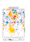
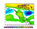
The image below is how it looked for Jan 2022 at this time, when instead of one of the coldest week 3-4 outlooks on record for the SE half of the US like was the case for Jan of 2025, it was suggesting that a mild SE half of the US was a much better possibility. This is when there was a similar very strong -PNA to what’s being forecasted for late Dec:
View attachment 179308

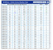
How did Jan 8-21, 2022 verify in Greensboro, NC? They ended up 4 BELOW normal and had two 1”+ snowfalls. So, one would have had no clue from NOAA even as late as Dec 24th of 2021 that a cold and snowy Jan of 2022 in much of the E US was incoming. The point is that sometimes the extended models don’t have a clue.
I guess the snow and cold skipped Atlanta because Atlanta had normal temps and only 1/2” of snow in January 2022.
 
I could see the Aleutian ridge finally getting dislodged eastward and/or poleward in mid January or so.

We just need another injection of westerly momentum to give things a kick. A fast-moving mjo could get the job done to shift the pacific jet equatorward and extend it.

We need an uptick in west pac convection to help us break this tropical +AAMa vs -EAMT stalemate that’s locked the Aleutian ridge in place, and we are almost certainly not getting help from the EAMT
 
I guess the snow and cold skipped Atlanta because Atlanta had normal temps and only 1/2” of snow in January 2022.

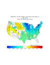
Yes, ATL was NN. That’s why I mentioned GSO. Like GSO, GSP also had 4 BN during 1/8-21 (dates for that weeks 3-4 outlook) along with 6.5” of snow. This is why I said that one would have had no clue from NOAA even as late as Dec 24th of 2021 that a cold and snowy Jan of 2022 in much of the E US (though not very cold like 2025) was incoming. Baltimore was similar, etc.

IMG_6272.png
 
Last edited:
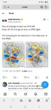
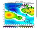
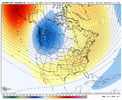
Today’s Euro Weeklies are similar to the prior ones through Jan 11th with mild for much of the country though the warmest is closer to the C US, well away from the E US.

However, today’s weeks 4-5 continue yesterday’s cooling trend. And week 6 is mainly NN in the E US.

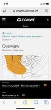
In summary, whereas the first 3 weeks (through 1/11) remain mild in much of the E US, the last 3 weeks (1/12-2/1) are mainly NN to a little BN in most of the E US as a +PNA tries to develop. So, there’s nothing remotely warm in the means in the SE for mid to late Jan. And this of course opens the door to even colder than NN as we get there, which is more in line with my thinking at this point.

+PNA trying to form for the week 1/19-25
IMG_6282.png
 
Last edited:
Today’s Euro Weeklies are similar to the prior ones through Jan 11th with mild for much of the country though the warmest is closer to the C US, well away from the E US.

However, today’s weeks 4-5 continue yesterday’s cooling trend. And week 6 is mainly NN in the E US.

In summary, whereas the first 3 weeks (through 1/11) remain mild in much of the E US, the last 3 weeks (1/12-2/1) are mainly NN to a little BN in most of the E US as a +PNA tries to develop. So, there’s nothing remotely warm in the means in the SE for mid to late Jan. And this of course opens the door to even colder than NN as we get there, which is more in line with my thinking at this point.

+PNA trying to form for the week 1/19-25
View attachment 179324
Sure that will get pushed back even further as time Rolls closer. Hate be that guy
 
The sooner we completely abandon La Nina, the better off we’re going to be late winter/after MLK Day.

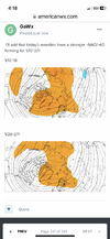
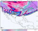
Some hints of the upper level footprint from La Nina just completely collapsing on the weeklies near the end of January into February
I know you know your stuff, but I’ll never believe it can snow in February again until I see it with my own two eyes. Therefore if we are punting most of Jan then it’s over in my eyes.
 
I know you know your stuff, but I’ll never believe it can snow in February again until I see it with my own two eyes. Therefore if we are punting most of Jan then it’s over in my eyes.
Couldn't have said it better myself Stevo! Been over a decade since a decent widespread Feb snow.
 
I know you know your stuff, but I’ll never believe it can snow in February again until I see it with my own two eyes. Therefore if we are punting most of Jan then it’s over in my eyes.

A lot of this is internally driven/random to a certain degree. We will regress back to the mean at some pt
 
Random I realize, but was looking over the winter of 96 for here in Northeast Tennessee and typed in February.

February of 1996 was absolutely insane.

14” of snow that month mainly from one storm early in the month, followed by a low of -15, followed by a record high of 79° later in the month.
 

Attachments

  • 3305E350-AF2F-4F0B-999A-74627ACB277F.jpeg
    3305E350-AF2F-4F0B-999A-74627ACB277F.jpeg
    721.2 KB · Views: 16
Random I realize, but was looking over the winter of 96 for here in Northeast Tennessee and typed in February.

February of 1996 was absolutely insane.

14” of snow that month mainly from one storm early in the month, followed by a low of -15, followed by a record high of 79° later in the month.

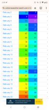
Lol it was crazy here too. Earliest 90 on record after -11Screenshot_20251220-022814.Chrome.png

I was still in Alabama then but I think that's the year we were so cold the lakes were icy and I remember running out of snow days at school lol. I can still recall them talking about us going on Saturday at one point(I believe some days were lost due to Hurricane Opal before the winter which was a disaster inland). I mean we were almost 200 miles inland and had 90 mph winds probably
 
Last edited:
Looking at strong -WPO Decembers since 1950 for a -ENSO (that’s in Dec and continues through JF per RONI):

I count 10 strong -WPO Decembers during -ENSO winters. Here’s how the subsequent WPO ended up for JF averaged out:

2013-14: -WPO

2010-11: -WPO

2005-6: +WPO

1995-6: -WPO

1983-4: neutral WPO

1964-5: neutral WPO

1962-3: -WPO

1961-2: -WPO

1956-7: -WPO

1955-6: -WPO


So, the tally for the JF avg is 7 -WPO, 2 neutral WPO, and 1 +WPO. So, these 10 strong -WPO Decembers during -ENSO decently favored -WPO for the average of JF fwiw. Both are favored to be -WPO but Jan is the most strongly favored for that.

Out of these 10, 7 Jans had BN temps in the SE. The ones that didn’t were 1965 (NN), 2006 (AN), and 1957 (AN). But Feb leaned AN, which isn’t surprising with -ENSO.

Note that all of those years were immediately followed by El Niño.
 
It would be nice if this year decided to go off the La Nina script at some point later on this winter, because people will not like the result in February if we don’t

Ever since October, we have deviated very little in general from it

October
IMG_7003.jpeg

IMG_7002.jpeg


November
IMG_7005.png

IMG_7004.gif


December
IMG_6619.jpeg

IMG_7001.gif

January. We will probably have more troughing than the weeklies show in January

IMG_7007.jpeg

IMG_7008.png

February last 30 years Nina composite 🚮 🤢

IMG_6997.jpeg
 
Back
Top