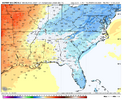
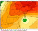
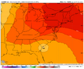
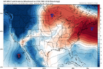
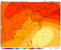
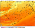
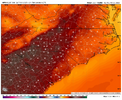
yepAIFS and GFS showing runs at 90F in mid Oct
-
Hello, please take a minute to check out our awesome content, contributed by the wonderful members of our community. We hope you'll add your own thoughts and opinions by making a free account!
You are using an out of date browser. It may not display this or other websites correctly.
You should upgrade or use an alternative browser.
You should upgrade or use an alternative browser.
Pattern Octoburn
- Thread starter SD
- Start date
Models look promising next weekend for eastern sections.
Probably will trend east.
Just about all of the major operationals now have this hybrid/cutoff low with at least most of them heavily influencing the wx for most of the area from E NC up through the MidAtlantic states. The GFS, the last major holdout, finally joined the nor’easter party starting with its 0Z run.
Interesting mid-level Fujiwhara on the 0Z Euro. That would get it into the coast.Just about all of the major operationals now have this hybrid/cutoff low with at least most of them heavily influencing the wx for most of the area from E NC up through the MidAtlantic states. The GFS, the last major holdout, finally joined the nor’easter party starting with its 0Z run.
One thing I've noticed time and again this season is that in the 5-10 day time frame, models want to show a big southeastward ridge or block in SE Canada. This would help steer a system just off the EC back west, and it has been doing that in the modeling. But as we move in, the block is less impressive and we end up with systems staying offshore or the alleged cutoff over the SE ending up not so strong and thus more progressive. That is something to watch here and as we head into winter.
Drizzle Snizzle
Member
My goodness look at Northern Missouri.oh the humanity. oh the roasting. View attachment 175371
Tsappfrog20
Member
NWS just upgraded The Enderlin, North Dakota #tornado from June 20, 2025 has been UPGRADED TO AN EF5.
Sent from my iPhone using Tapatalk
Sent from my iPhone using Tapatalk
Brent
Member
So apparently we broke the ef5 streak since 2013
On a tornado in North Dakota of all states in June
On a tornado in North Dakota of all states in June
NCSNOW
Member
NCSNOW
Member
The Euro is still jumping around quite a bit with the track of the cut-off hybrid. The 12Z has it much further SSW with it never getting close to the Mid-Atlantic states:
View attachment 175373
From that position, it weakens as it moves WSW and then dies as the center reaches far S SC. This track is an outlier:
View attachment 175374
It has the Icon in it's corner. 2 Highest Res Models on the Market, for what its worth
It has the Icon in it's corner. 2 Highest Res Models on the Market, for what its worth
Indeed, I see the 12Z Icon and Euro are very close to each other with where the low forms. But whereas the Icon then takes it up the E coast, this very odd looking Euro has it stall and then move WSW.
Interesting time frame selectedoh the humanity. oh the roasting. View attachment 175371
I know it’s gonna be hot after I’m just tired of ignoring the cold to post about the hotInteresting time frame selected
GeorgiaGirl
Member
Definitely can say that I'm holding on tight to the fact that the GFS's ensembles have consistently said the OP is crazy on the idea of upper 80s/90s verifying, but I know how this has worked previously in winter.
Entirely possible those end up trending towards more heat for a few days before that's all she wrote on warmer weather.
Entirely possible those end up trending towards more heat for a few days before that's all she wrote on warmer weather.
i'll be there! looking toasty for friday at the moment (still only upper 60s around there, but its mid october), but there looks to be an argument for a cooldown sometime in that next weekend vicinity, so perhaps saturday could be cooler.Announcement: Tis the sznView attachment 175384
outside the mtns some low 80-mid 80s depending on where you are. the raw Euro AI is still the most excited about baking into the upper 80s and low 90s for the deep south on the NE side of the ridge, but it has been ticking west with the center of that dome for a couple runs. may it continue all the way to california! doubt its enough to save us from a few 5-8F+ AN days but i'd be happy to take the chances of 85F+ off the table
out here talking phases already
Brent
Member
GFS finally has some cold air in here at hour 360 


Of course last year it got really cold and still got hot again.... I believe that was our latest 90 on record though
Of course last year it got really cold and still got hot again.... I believe that was our latest 90 on record though
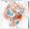
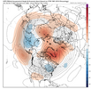
I think we want a warm October and a generally +NAO, right?Just a reminder that -NAOs still do indeed exist View attachment 175387View attachment 175388
It's impressive how much ridging we've seen through the summer and early fall up in Canada. Hope that continues through the cold season.
I feel like the last significant -nao October was maybe 2007? That winter was ok.I think we want a warm October and a generally +NAO, right?
It's impressive how much ridging we've seen through the summer and early fall up in Canada. Hope that continues through the cold season.
Im on team give me all the -nao you can give me and see if we can disrupt the pv.
I feel like the last significant -nao October was maybe 2007? That winter was ok.
Im on team give me all the -nao you can give me and see if we can disrupt the pv.
The full Oct 2007 actually averaged +0.45. Since then though, 2009, 2012-4, 2019, 2021, and 2023 all had a strong (<-1) NAO in Oct. Of these, only 2009 had a -NAO for the subsequent winter. Octs have had a -NAO leaning since 2009 while winters have leaned +NAO.
Interesting that 19,21,23 were all -nao. I must have been thinking of 09The full Oct 2007 actually averaged +0.45. Since then though, 2009, 2012-4, 2019, 2021, and 2023 all had a strong (<-1) NAO in Oct. Of these, only 2009 had a -NAO for the subsequent winter. Octs have had a -NAO leaning since 2009 while winters have leaned +NAO.
It's that time of year. You know me (no Halloween storm...). So bring on the +NAO and help keep us in a tranquil pattern until middle November. Then lets flip the pattern.I think we want a warm October and a generally +NAO, right?
It's impressive how much ridging we've seen through the summer and early fall up in Canada. Hope that continues through the cold season.
Interesting that 19,21,23 were all -nao. I must have been thinking of 09
And despite the -NAO leaning of Oct, check out the sharp change overall to a +NAO leaning in Nov since 2009! Something seems to change pretty drastically between Oct and Nov related to the NAO (at least since 2009). And then the winters have been mainly +NAO. Do you or does anyone else know what has driven this?
Yes, I'm with you!It's that time of year. You know me (no Halloween storm...). So bring on the +NAO and help keep us in a tranquil pattern until middle November. Then lets flip the pattern.
My guess is it is SST-driven. Hasn't the Atlantic been quiet warm for the last several years?And despite the -NAO leaning of Oct, check out the sharp change overall to a +NAO leaning in Nov since 2009! Something seems to change pretty drastically between Oct and Nov related to the NAO (at least since 2009). And then the winters have been mainly +NAO. Do you or does anyone else know what has driven this?
mosquitos have been at worst-i've-ever-seen, i-cant-go-outside, i-kill-at-least-5-in-my-house-per-day levels here in richmond
NCSNOW
Member
solar cycles. Flips ever 11 yearsAnd despite the -NAO leaning of Oct, check out the sharp change overall to a +NAO leaning in Nov since 2009! Something seems to change pretty drastically between Oct and Nov related to the NAO (at least since 2009). And then the winters have been mainly +NAO. Do you or does anyone else know what has driven this?
We're stuck in a pattern. A tendency for central US ridging with short bursts of ridging in NW Canada, sending shallow troughs along the northern tier. Fortunately, this pattern allows for HP to provide some relief via wedging for our area. Unfortunately, big shots of fall stay largely north and we remain largely dry. Not my favoritetale of two thursdays within the next 10 days on the latest GFS
View attachment 175396
View attachment 175395
I was hoping for some cooler weather for the start of deer season this year but it looks like the weather pattern has other ideas. I'd better wear the lightest weight hunting gear I can find and invest in some scentless insect repellent.tale of two thursdays within the next 10 days on the latest GFS
View attachment 175396
View attachment 175395
Will probably start a thread tomorrow for the thing off the coast if the models stay consistent through the day/night.
solar cycles. Flips ever 11 years
Since the 80s, there have been only 6 DJFs that averaged <-0.25 NAO. All 6 were within ~2 years of a Solar min with 1 or 2 near each min since the mid 80s. So, I’m looking for the next good chance at a -NAO winter overall to be ~late 2020s-2030 with 1-2 of them.
Shaggy
Member
Icon seems to have taken a step towards the euro with a SW driftWill probably start a thread tomorrow for the thing off the coast if the models stay consistent through the day/night.
Very wet eastern 1/3 and even tries to get some 40mph gust inland (we all know how that usually works out though)Icon seems to have taken a step towards the euro with a SW drift

