-
Hello, please take a minute to check out our awesome content, contributed by the wonderful members of our community. We hope you'll add your own thoughts and opinions by making a free account!
You are using an out of date browser. It may not display this or other websites correctly.
You should upgrade or use an alternative browser.
You should upgrade or use an alternative browser.
Tropical 2025 Tropical Thread
- Thread starter SD
- Start date
lexxnchloe
Member
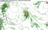
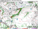
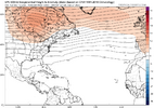
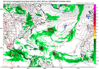
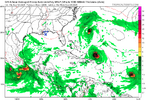
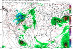
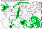
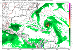
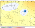
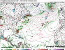
Euro has something as wellICON and CMC have something tracking toward the coast at 180-240hrs but looks like it starts recurving around the run's end
View attachment 174883
lexxnchloe
Member
lexxnchloe
Member
NoSnowATL
Member
Train of OTS hurricanes. Yay
lexxnchloe
Member
Good. No death and destruction this seasonTrain of OTS hurricanes. Yay
Like they’ve been showing almost every day for over a week and although they don’t get to above the active avg ACE like they showed 2 weeks ago, the Euro Weeklies still end the below avg ACE starting with the week that begins Sept 22nd. It rises to near the 20 year active avg then and that lasts for the 3 weeks going through Oct 12th. It still has the most active week of the next 4 to be 9/22-28 (with ~13.5 ACE) and the 2nd most active being 9/29-10/5. It’s projecting ~40 ACE 9/15-10/12. That would bring total ACE up to ~80. That would keep season to date ACE well below the active era’s avg of ~103 as of then.
Followup: Today’s EW for weeks 2-4 has significantly more ACE than that of the last 6 runs and is the most active for that 3 week period yet with AN/active each week. Whereas the run from 2 days ago had 40 ACE for 9/15-10/12, this new run has 8+16+13.5+10.5=48. It also shows increased risk to the SE US/Gulf 10/6-12.
Last edited:
Carolina Fever
Member
The hurricane season forecasts are getting as bad as the winter forecasts for the southeast.
For 60% orange in MDR
0Z UKMET: TS in middle of ocean again
NEW TROPICAL CYCLONE FORECAST TO DEVELOP AFTER 96 HOURS
FORECAST POSITION AT T+ 96 : 16.4N 45.5W
LEAD CENTRAL MAXIMUM WIND
VERIFYING TIME TIME POSITION PRESSURE (MB) SPEED (KNOTS)
-------------- ---- -------- ------------- -------------
1200UTC 17.09.2025 96 16.4N 45.5W 1005 41
0000UTC 18.09.2025 108 17.6N 47.7W 1005 45
1200UTC 18.09.2025 120 19.7N 49.9W 1006 44
0000UTC 19.09.2025 132 20.6N 51.6W 1006 40
1200UTC 19.09.2025 144 21.4N 53.0W 1005 36
0000UTC 20.09.2025 156 22.5N 53.5W 1004 46
1200UTC 20.09.2025 168 22.9N 55.4W 1002 45
I really think at this point in terms of the tropics, the biggest concern is anything developing and getting into the Gulf which now seeing its highest heat content on record.
Regarding the MDR AOI:
12Z:
-GFS/CMC/Icon all have this eventually as a H with GFS/CMC both recurving well E of Bermuda (Icon doesn’t go out far enough to tell)
-JMA through 72 has this as a TD at 48 and a TS at 72. This is stronger than the two prior 12Z runs that each had it as only a TD.
-Euro has a MH passing just SE of Bermuda
-UKMET again has this as a TS. This is a bit further W than recent runs but it’s still aiming a bit E of Bermuda as of 168:
NEW TROPICAL CYCLONE FORECAST TO DEVELOP AFTER 72 HOURS
FORECAST POSITION AT T+ 72 : 16.4N 47.4W
LEAD CENTRAL MAXIMUM WIND
VERIFYING TIME TIME POSITION PRESSURE (MB) SPEED (KNOTS)
-------------- ---- -------- ------------- -------------
1200UTC 17.09.2025 72 16.4N 47.4W 1006 40
0000UTC 18.09.2025 84 17.7N 48.8W 1006 42
1200UTC 18.09.2025 96 19.5N 52.1W 1006 44
0000UTC 19.09.2025 108 20.6N 54.3W 1006 40
1200UTC 19.09.2025 120 22.8N 55.1W 1006 44
0000UTC 20.09.2025 132 23.1N 57.0W 1005 43
1200UTC 20.09.2025 144 25.1N 57.7W 1003 46
0000UTC 21.09.2025 156 26.3N 58.6W 1001 49
1200UTC 21.09.2025 168 28.3N 59.3W 999 48
Last edited:
lexxnchloe
Member
Shaggy
Member
Brent
Member
Wake me when something is inside the Gulf under 200 hours 
lexxnchloe
Member
AUG 2027?Wake me when something is inside the Gulf under 200 hours
Regarding the MDR AOI:
12Z:
-GFS/CMC/Icon all have this eventually as a H with GFS/CMC both recurving well E of Bermuda (Icon doesn’t go out far enough to tell)
-JMA through 72 has this as a TD at 48 and a TS at 72. This is stronger than the two prior 12Z runs that each had it as only a TD.
-Euro has a MH passing just SE of Bermuda
-UKMET again has this as a TS. This is a bit further W than recent runs but it’s still aiming a bit E of Bermuda as of 168:
NEW TROPICAL CYCLONE FORECAST TO DEVELOP AFTER 72 HOURS
FORECAST POSITION AT T+ 72 : 16.4N 47.4W
LEAD CENTRAL MAXIMUM WIND
VERIFYING TIME TIME POSITION PRESSURE (MB) SPEED (KNOTS)
-------------- ---- -------- ------------- -------------
1200UTC 17.09.2025 72 16.4N 47.4W 1006 40
0000UTC 18.09.2025 84 17.7N 48.8W 1006 42
1200UTC 18.09.2025 96 19.5N 52.1W 1006 44
0000UTC 19.09.2025 108 20.6N 54.3W 1006 40
1200UTC 19.09.2025 120 22.8N 55.1W 1006 44
0000UTC 20.09.2025 132 23.1N 57.0W 1005 43
1200UTC 20.09.2025 144 25.1N 57.7W 1003 46
0000UTC 21.09.2025 156 26.3N 58.6W 1001 49
1200UTC 21.09.2025 168 28.3N 59.3W 999 48
For the MDR AOI, 0Z runs:
-are fairly similar for the Icon, GFS, and CMC
-This time the UKMET is even further W and threatens Bermuda:
0Z UK: NEW TROPICAL CYCLONE FORECAST TO DEVELOP AFTER 72 HOURS
FORECAST POSITION AT T+ 72 : 18.0N 48.8W
LEAD CENTRAL MAXIMUM WIND
VERIFYING TIME TIME POSITION PRESSURE (MB) SPEED (KNOTS)
-------------- ---- -------- ------------- -------------
0000UTC 18.09.2025 72 18.0N 48.8W 1008 38
1200UTC 18.09.2025 84 20.0N 51.3W 1007 42
0000UTC 19.09.2025 96 21.2N 53.2W 1007 38
1200UTC 19.09.2025 108 22.7N 55.1W 1008 30
0000UTC 20.09.2025 120 22.5N 57.2W 1008 32
1200UTC 20.09.2025 132 23.1N 58.3W 1009 31
0000UTC 21.09.2025 144 23.3N 59.8W 1008 33
1200UTC 21.09.2025 156 23.9N 61.0W 1008 35
0000UTC 22.09.2025 168 24.3N 63.1W 1007 31
lexxnchloe
Member
lexxnchloe
Member
Brent
Member
The red circle is an invest now
But yeah probably going out to sea
Technically there has been zero storms so far this month btw


But yeah probably going out to sea
Technically there has been zero storms so far this month btw
The red circle is an invest now
But yeah probably going out to sea
Technically there has been zero storms so far this month btw


Yep, the first time for no Sept TD+ by Sept 15th since 1992! That year’s first Sept TC was not til 9/17.
Regarding Invest 92:
12Z UKMET like prior run threatens Bermuda with this run aimed only a little E of there:
NEW TROPICAL CYCLONE FORECAST TO DEVELOP AFTER 54 HOURS
FORECAST POSITION AT T+ 54 : 17.5N 46.9W
LEAD CENTRAL MAXIMUM WIND
VERIFYING TIME TIME POSITION PRESSURE (MB) SPEED (KNOTS)
-------------- ---- -------- ------------- -------------
0000UTC 18.09.2025 60 18.3N 47.8W 1007 41
1200UTC 18.09.2025 72 20.5N 50.5W 1007 43
0000UTC 19.09.2025 84 21.3N 53.4W 1007 41
1200UTC 19.09.2025 96 22.5N 55.5W 1007 31
0000UTC 20.09.2025 108 23.3N 57.0W 1007 32
1200UTC 20.09.2025 120 25.2N 58.1W 1007 38
0000UTC 21.09.2025 132 26.6N 58.4W 1004 44
1200UTC 21.09.2025 144 27.7N 60.4W 1002 41
0000UTC 22.09.2025 156 29.0N 61.7W 999 49
1200UTC 22.09.2025 168 30.6N 62.4W 995 51
Tropical Weather Outlook
NWS National Hurricane Center Miami FL
Issued by the NWS Weather Prediction Center College Park MD
200 PM EDT Mon Sep 15 2025
For the North Atlantic...Caribbean Sea and the Gulf of America:
Central Tropical Atlantic (AL92):
A broad area of low pressure has formed roughly midway between the
Windward Islands and the coast of west Africa. This system has
become better organized since yesterday and is expected to move
through a favorable environment for further development. A
tropical depression or tropical storm is likely to form by the
middle to latter part of this week as the system moves
west-northwestward at 10 to 15 mph over the central tropical
Atlantic.
* Formation chance through 48 hours...medium...50 percent.
* Formation chance through 7 days...high...90 percent.
$$
Forecaster Blake/Putnam
That logo is pure Fire!
Regarding Invest 92L:
12Z JMA completed (fwiw): Although the 72 hour map had it recurving NW seemingly way out in safe recurve land, it then turned W through 144 getting it to 21N, 62W (similar to Icon). Then it does a recurve WNW and then NW ending at 25N, 70W.
12Z JMA completed (fwiw): Although the 72 hour map had it recurving NW seemingly way out in safe recurve land, it then turned W through 144 getting it to 21N, 62W (similar to Icon). Then it does a recurve WNW and then NW ending at 25N, 70W.
12Z UKMET: again has a followup MDR TC to Invest 92L (0Z actually had 2 followups):
NEW TROPICAL CYCLONE FORECAST TO DEVELOP AFTER 156 HOURS
FORECAST POSITION AT T+156 : 15.9N 37.2W
LEAD CENTRAL MAXIMUM WIND
VERIFYING TIME TIME POSITION PRESSURE (MB) SPEED (KNOTS)
-------------- ---- -------- ------------- -------------
0000UTC 22.09.2025 156 15.9N 37.2W 1012 31
1200UTC 22.09.2025 168 16.7N 39.4W 1011 32
lexxnchloe
Member
lexxnchloe
Member
NoSnowATL
Member
Lots of party cloudy skies
Now 60/90: is the long drought about to be broken? Keep in mind though that 91L also made it to 60/90 and surprisingly never developed:
Tropical Weather Outlook
NWS National Hurricane Center Miami FL
800 PM EDT Mon Sep 15 2025
For the North Atlantic...Caribbean Sea and the Gulf of America:
1. Central Tropical Atlantic (AL92):
A broad area of low pressure is located about midway between
the Windward Islands and the coast of west Africa. This system
is showing signs of organization, and is expected to move through a
favorable environment for further development. A tropical
depression or tropical storm is likely to form by the middle to
latter part of this week while the system moves west-northwestward
at 10 to 15 mph over the central tropical Atlantic.
* Formation chance through 48 hours...medium...60 percent.
* Formation chance through 7 days...high...90 percent.
Forecaster Pasch
lexxnchloe
Member
lexxnchloe
Member
For Invest 92L: getting very close now per 8AM TWO
Central Tropical Atlantic (AL92):
Showers and thunderstorms associated with a broad low pressure area
located about midway between the Windward Islands and the coast of
west Africa have become better organized since yesterday.
Environmental conditions are conducive for additional development,
and a tropical depression or storm is likely to form in the next day
or two as the system moves west-northwestward or northwestward at 10
to 15 mph over the central tropical Atlantic.
* Formation chance through 48 hours...high...90 percent.
* Formation chance through 7 days...high...90 percent.
Noles1812
Member
I think its safe to say this year they got it very wrong.
Speaking of Duck: Keep in mind that this wasn’t even given a 10% chance in any TWO to become just a subtropical depression. The TWOs cover both tropical and subtropical depression+ development potential.
Last edited:
This thread is as exciting as a PBS sewing show...and that's a good thing.
Last edited:
This thread is as exciting as PBS sewing show...and that's a good thing.
Yep. Just under one year ago, there was an absolute catastrophe affecting much of the SE US, especially W NC. Boredom in tracking is a tiny price to pay for safety from TCs.

