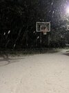
Just like the old days around 74 Skip. Waiting for the temp to crash. Good luck man!Interesting first two hours here in TLH.
Temp dropped to 30.5 as precip commenced as sleet, then a sn/ip mix, then briefly all snow.
It then went back to sleet and is now most zr with a bit of sleet mixed in.
Also, temps have risen a full degree to 31.6, I assume a product of WAA.
The RAP is undeterred, handing out 8 inches (Kuchera) while the HRRR thinks it sniffs out a sleet storm through midnight.
Anyway, ready for temps to crash a bit and a snow changeover to happen as SPC is predicting in its mesoscale.
-
Hello, please take a minute to check out our awesome content, contributed by the wonderful members of our community. We hope you'll add your own thoughts and opinions by making a free account!
You are using an out of date browser. It may not display this or other websites correctly.
You should upgrade or use an alternative browser.
You should upgrade or use an alternative browser.
Wintry January 21-23 2025
- Thread starter SD
- Start date
I know we all concentrate on our own backyards, but it's also good to look at this from some perspective. This is literally a once in a lifetime event for the Gulf Coast.This is a BIBLICAL Southern Winter Storm (using the SECS, etc. terminology). I thought there was no way the modeling could be right for what they were printing out for the Gulf Coast. It was unthinkable. It was impossible! I can’t believe Florida has likely DOUBLED their all time snowfall record, New Orleans has blown past theirs, and the entire Gulf Coast is getting pummeled by the same winter storm!! I wish I still lived in Tallahassee now!
I mean seriously--we had Blizzard Warnings in Lousiana today.
probably around 0.5” here but roads are destroyed. Cars stranded everywhere. There won’t be school tomorrow. South of 85 wins this one here
connorsclimate
Member
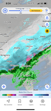
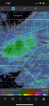
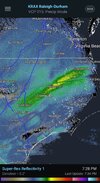
Is this for Raleigh too?Snowfall rates should steadily increase over the next few hours across the Carolinas as a mid-level warm front surges in from the south.
View attachment 166577
View attachment 166578
LovingGulfLows
Member
- Joined
- Jan 5, 2017
- Messages
- 1,371
- Reaction score
- 3,592
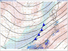
Sheesh dry air battle commences. Longer you can stay in the snow the better. Wonder how far it eats away. View attachment 166579
That 700mb dryline is no joke. For me it went from mod-heavy snow to nothing in like 5 minutes...like shutting off a faucet with no chance of turning it back on.
There is an mPING report 4 miles to my east says roads are starting to get covered and I'm now just seeing flakes. There seems to be a dry slot sliding in from the N over me. @freebird581bd that your report?
So I do have a question. If the FGEN at 850 and 700mb are parking over CLT why would we be drying up so quickly/fighting the dry slot so bad? I though that wherever it sets up is where there would likely be more precip/heavier rates. I could also be completely wrong lol
Roads are slushy around here and most every surface that isn’t black has a nice coating. Sitting at 27 currently but I’d swear there’s some freezing rain falling at the moment. Waiting for the next burst of snow.
NCSNOW
Member
Family on oak island getting ice mix, wilson an nash county all snow just started
Tokenfreak
Member
Sleeting now about 20 miles north of Goose Creek
WxBlue
Meteorologist
Like Raleigh or further east? Right now it seems like we're in the subsidence between bands.The mid-level cold front is pressing in from the west over the piedmont. Eventually subsidence drying will take over and shut the snow off, but you should see some good rates for a little while. It's areas further to the east where these rates are likely to be even greater later tonight as we squeeze more frontogenesis out of the initial mid-level warm front that comes in from the south then the subsequent mid-level cold front from the west.
NCSNOW
Member
Hwy 49 up out of charlotte to Badin lake, looks to be sweet spot, espeacilly east side
broken025
Member
Nice fluffy snow. Kids having a great time. Probably won’t get much but still a good time.
RAH just issued WWA for the remaining CWA that wasn't already under an advisory.
NoSnowATL
Member
About 3in here in LH Fla.About 2in here in Lynn Haven Fla.
Sctvman
Member
Freezing rain has changed to a sleet/snow mix. Sounds like mostly sleet
MotoWeatherman
Meteorologist
How often do you get 26 and pouring snow in Seaside FL? LOL. Nuts
JimBobs
Member
Definitely an overperfomer for CLT, at least here on the South side and presumable East as well. It's nice to not have sleet or rain or a warm nose or any of that crap for once. Not a lot of snow, but a nice snow.
Tarheel1
I TOLD YALL IT WASN’T GOING TO SNOW
Member
2024 Supporter
2017-2023 Supporter
2025 Supporter
Webberweather53
Meteorologist
Within the past 5 minutes it's really starting to open up here, solid -SN, accumulating rates, which I was not expecting till about 9 so that's a win. This band will likely slowly move to the NW at-least initially.
Stormsfury
Member
Avalanche
Member
Channel 11 out of Durham said about an hour left and the back edge would be east.What?! Lol the back edge is nowhere near Chapel Hill yet
AndyB
Member
Heavy sleet mixing with rain here in Summerville SC
BHS1975
Member
Where's the sweetspot?The mid level cold front is temporarily squeezing out better rates back over the I-85 corridor.
The further east you are in this setup, the higher those rates are going to be as we get more frontogen between this cold front and the mid level warm front moving in from the south.
View attachment 166586
Cary_Snow95
Member
Solid band setting up to the SW of Wake County
Heelyes
Member
It’s picked up here the last ten minutes
Ok and that was 55 mins ago, so you got 5 mins left, enjoy. Lol I think if you look at radar they may have been off just a tadChannel 11 out of Durham said about an hour left and the back edge would be east.
Cary_Snow95
Member
- Joined
- Jan 23, 2021
- Messages
- 3,740
- Reaction score
- 11,688
- Location
- Lebanon Township, Durham County NC
19/16!!
Coldest snow I think I’ve seen since 1988
Coldest snow I think I’ve seen since 1988
WolfpackHomer91
Member
Hold up now….. went outside after Dinner … we didn’t win , but we covered the spread !!! Dusting in Mooresville Linwood Rd /152

Sent from my iPhone using Tapatalk

Sent from my iPhone using Tapatalk
Crow
Member
How long before that front gets to Granville/Vance?The mid level cold front is temporarily squeezing out better rates back over the I-85 corridor.
The further east you are in this setup, the higher those rates are going to be as we get more frontogen between this cold front and the mid level warm front moving in from the south.
View attachment 166586
Flakes starting to beef a bit here. Roads are taking it on
WxBlue
Meteorologist
Probably over 0.5” on the roads at this point
Webberweather53
Meteorologist
Where's the sweetspot?
The sweet spot here is east of I-95 in places like Goldsboro, Greenville, etc where you’re getting better forcing initially with warm advection that also helps build up the mid-level temperature gradient in advance of the cold front that comes in from the west

