-
Hello, please take a minute to check out our awesome content, contributed by the wonderful members of our community. We hope you'll add your own thoughts and opinions by making a free account!
You are using an out of date browser. It may not display this or other websites correctly.
You should upgrade or use an alternative browser.
You should upgrade or use an alternative browser.
Wintry January 21-23 2025
- Thread starter SD
- Start date
beanskip
Member
You aren’t missing anything…same here. I can see Venus I think.Partly cloudy skies here in beautiful Morganton, NC!
chapelhillwx
Member
Cary_Snow95
Member
You sure it’s not Uranus?You aren’t missing anything…same here. I can see Venus I think.
mrscobb2u
Member
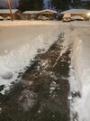
Roads are completely white in SE Greensboro towards Whitsett.
Nope. that site is down. there is a way to check the status of any given radar in RadarScope, but I don't remember how off the top of my head.Is something wrong with Radar Scope
JHS
Member
Coming down nicely here now and ground almost covered.
Now reporting a dusting. Powder Advisory Criteria has been met--Warning may be needed later..
Stormsfury
Member
Sleet monster going on here
Cary_Snow95
Member
Coming down decent now
They brined the roads in my part of Orange near I-40 in NE Chapel Hill. Interesting. They even had roads brined in the Triad when I was there earlier.22/15 Rh 76% s of carrboro. Light snow is increasing a bit. The deck and metal chairs are starting to whiten up. Not about to walk down to the road to see just yet. They didn’t brine the roads in Orange County. DOT stopped right at the Chatham line.
Tokenfreak
Member
I’m about 20 miles north of Goose Creek so I think I may be seeing it next. Be interesting to see if it’s sleet or snowSleet monster going on here
22 degrees and lots of small flakes, but it's coming down pretty good. Everything is white now.
- Joined
- Jan 23, 2021
- Messages
- 3,740
- Reaction score
- 11,688
- Location
- Lebanon Township, Durham County NC
3k worried me for yallSleet monster going on here
Drizzle Snizzle
Member
The last hour we had our heaviest snow of the day. I measured 2" at 7pm, an increase of 0.75" in the last hour.
Solid coating on the grass and driveway here. Starting to coat the street in front of my house. It’s been light but steady so far
Cary_Snow95
Member
Ground already turning white
Looks like i had one last layer to saturate flakes getting bigger and heavier
- Joined
- Jan 23, 2021
- Messages
- 3,740
- Reaction score
- 11,688
- Location
- Lebanon Township, Durham County NC
20/17. Coming down good. We might make those RAP predictions
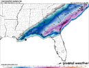
This is a BIBLICAL Southern Winter Storm (using the SECS, etc. terminology). I thought there was no way the modeling could be right for what they were printing out for the Gulf Coast. It was unthinkable. It was impossible! I can’t believe Florida has likely DOUBLED their all time snowfall record, New Orleans has blown past theirs, and the entire Gulf Coast is getting pummeled by the same winter storm!! I wish I still lived in Tallahassee now!
SimeonNC
Member
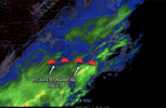
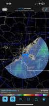
I don't wanna post the images and be a broken record but holy ---- the fgen is legit parking over CLT rn
Waiting is the hardest part. Spit a few flurries here and there but dry air is eating it up right now
Webberweather53
Meteorologist
WxBlue
Meteorologist
Don't think we're hitting 1.5" by 8 pm that the RAP is having. Slow start here.
GeorgiaGirl
Member
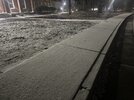
More from shortly after 5...
I do gotta say, while Jan 2014 was definitely fun, it was plain kickbutt cold then and it is now even if it's a few degrees warmer (edit: for me since I'm in a different location). I might try a jeb walk in an hour and a half, but I feel iffy on that.
I do gotta say, while Jan 2014 was definitely fun, it was plain kickbutt cold then and it is now even if it's a few degrees warmer (edit: for me since I'm in a different location). I might try a jeb walk in an hour and a half, but I feel iffy on that.
Just like everywhere along the NW side of this,Weird. My mother lives in Gramling/Inman area just north of 85. She hasn’t seen much of anything.
The gradient is exceptional!
Webberweather53
Meteorologist
Sheesh dry air battle commences. Longer you can stay in the shoe the better. Wonder how far it easts away. View attachment 166579
Wasn't expecting that much anyway back towards Charlotte. A coating plus or minus was about all I was thinking.
NCSNOW
Member
Fyi to my east. Over 2 hours in, still going as strong.
MichaelJ
Member
Flurries are done here, clouds breaking up rapidly. Cut off line must have been on a line from Charlotte to SE Guilford and then east from there
Same but it will try to continue to push East.. Raleigh should stay 1-2. Coastal regions win big!Wasn't expecting that much anyway back towards Charlotte. A coating plus or minus was about all I was thinking.
JQPublic
Member
DO ITI don't wanna post the images and be a broken record but holy ---- the fgen is legit parking over CLT rn
Pixie dust in Richmond
Tsappfrog20
Member
Coming down really good in Youngsville!!
Sent from my iPhone using Tapatalk
Sent from my iPhone using Tapatalk
beanskip
Member
Interesting first two hours here in TLH.
Temp dropped to 30.5 as precip commenced as sleet, then a sn/ip mix, then briefly all snow.
It then went back to sleet and is now most zr with a bit of sleet mixed in.
Also, temps have risen a full degree to 31.6, I assume a product of WAA.
The RAP is undeterred, handing out 8 inches (Kuchera) while the HRRR thinks it sniffs out a sleet storm through midnight.
Anyway, ready for temps to crash a bit and a snow changeover to happen as SPC is predicting in its mesoscale.
Webberweather53
Meteorologist
I don't wanna post the images and be a broken record but holy ---- the fgen is legit parking over CLT rn
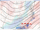
The mid-level cold front is pressing in from the west over the piedmont. Eventually subsidence drying will take over and shut the snow off, but you should see some good rates for a little while. It's areas further to the east where these rates are likely to be even greater later tonight as we squeeze more frontogenesis out of the initial mid-level warm front that comes in from the south then the subsequent mid-level cold front from the west.
Downeastnc
Member
Should be a interesting night might catch a break in our favor for once.What will be a nice band taking shape from Williamston back towards Goldsboro.
View attachment 166581

