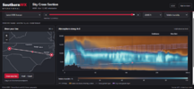
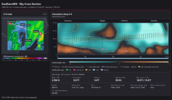
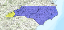
12z GFS OP really close to a nice cad storm middle next week, has more moisture than the Icon or ukmet. And boy howdy at the Cold front that swings down week of Thanksgivivng


Euro AI even worse

| Meteorological history | |
|---|---|
| Tornado outbreak | |
| Overall effects | |
 Path of the Raleigh tornado. | |
| Duration | November 28, 1988 |
| Tornadoes | 7 |
| Max. rating | F4 tornado |
| Duration | ~5 hours |
| Fatalities | 4 |
| Injuries | 154 |
| Damage | $285 million (non-normalized) |
| Areas affected | North Carolina and Virginia |

I wasn't here for it, but that one's got a legendary status here. Human toll exacerbated by hitting in the middle of the night.found it: 1988
From Wikipedia, the free encyclopedia
1988 Raleigh tornado outbreak
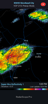
The 1988 Raleigh tornado outbreak was a destructive tornado outbreak in northeastern North Carolina and southeastern Virginia on November 28, 1988, between 1:00 AM and 5:45 AM. A tornado in the Raleigh area produced over $77 million (1988 USD) in damage, along with four fatalities (two in the city of Raleigh, and two in Nash County) and 154 injuries. The damage path from the storm was measured at 84 miles (135 km) long, and 0.5 miles (0.8 km) wide at times.
Meteorological history Tornado outbreak Overall effects
Path of the Raleigh tornado.Duration November 28, 1988 Tornadoes 7 Max. rating F4 tornado Duration ~5 hours Fatalities 4 Injuries 154 Damage $285 million (non-normalized) Areas affected North Carolina and Virginia
Synopsis
A surface-level pressure trough was located east of the Appalachian Mountains and extended from Maryland to Georgia. A warm front previously located in the coastal plains had moved into the Piedmont, separating air with temperatures and dew points in the 50s to the northwest from southeastern air with temperatures in the 70s and dew points in the 60s. A large upper level progressive amplitude trough stretched from the Great Lakes to the Mississippi Gulf Coast, and an also large amplitude ridge was situated over the western Atlantic with an axis extending from Bermuda to the Canadian Maritimes. A subtropical jetstream axis extended from the Gulf of Mexico to the Savannah River Basin. A polar jet stream was located over the Ohio River valley. Convective available potential energy was estimated at 1200 J/kg over the Raleigh area.[1]
All that weekend, the Storm Prediction Center was watching the eastern half of the United States for possibility for severe weather, according to WRAL-TV.
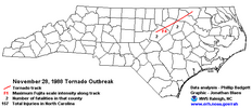
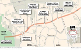

Yup...went through my neighborhood. IIRC the date. EF4 in North Raleigh and a couple of deaths from it. I have photos somewhere around the house. (Edit: I see the map, great visual!)" That pattern the week of Thanksgiving has the look of highs in the 70s and muggy lows in the 60s for a day or 2 so that will skew us A
again."
Someway somehow last week Nov it appears we will get a prettyy stellar cold front to swing down. I will be very suprised when it does, if we avoid a svre outbreak. Years ago/ 80s or 90s if my memory still works we had a tornado outbreak in November. If we are juiced up for a few days pre-front on sw wind / who knows

A girl at my elementary school died. She was in third grade, I think, the chimney fell into her bedroom. It went just north of my neighborhoodfound it: 1988
From Wikipedia, the free encyclopedia
1988 Raleigh tornado outbreak
The 1988 Raleigh tornado outbreak was a destructive tornado outbreak in northeastern North Carolina and southeastern Virginia on November 28, 1988, between 1:00 AM and 5:45 AM. A tornado in the Raleigh area produced over $77 million (1988 USD) in damage, along with four fatalities (two in the city of Raleigh, and two in Nash County) and 154 injuries. The damage path from the storm was measured at 84 miles (135 km) long, and 0.5 miles (0.8 km) wide at times.
Meteorological history Tornado outbreak Overall effects
Path of the Raleigh tornado.Duration November 28, 1988 Tornadoes 7 Max. rating F4 tornado Duration ~5 hours Fatalities 4 Injuries 154 Damage $285 million (non-normalized) Areas affected North Carolina and Virginia
Synopsis
A surface-level pressure trough was located east of the Appalachian Mountains and extended from Maryland to Georgia. A warm front previously located in the coastal plains had moved into the Piedmont, separating air with temperatures and dew points in the 50s to the northwest from southeastern air with temperatures in the 70s and dew points in the 60s. A large upper level progressive amplitude trough stretched from the Great Lakes to the Mississippi Gulf Coast, and an also large amplitude ridge was situated over the western Atlantic with an axis extending from Bermuda to the Canadian Maritimes. A subtropical jetstream axis extended from the Gulf of Mexico to the Savannah River Basin. A polar jet stream was located over the Ohio River valley. Convective available potential energy was estimated at 1200 J/kg over the Raleigh area.[1]
All that weekend, the Storm Prediction Center was watching the eastern half of the United States for possibility for severe weather, according to WRAL-TV.

I worked with her mother for 10 years. It was sad.A girl at my elementary school died. She was in third grade, I think, the chimney fell into her bedroom. It went just north of my neighborhood