• Hello, please take a minute to check out our awesome content, contributed by the wonderful members of our community. We hope you'll add your own thoughts and opinions by making a free account!

Wintry Winter 26-27

I keep reading about an early pv weakening in next few weeks. Is this just a sign of a more impressive cold front for fall or is it more too it? Judah Cohen on the bandwagon as of now
A PV stretch doesn't create an immediate effect. The *hope* would be a weaker PV going into the winter would be easier to disrupt later on. A weakened PV *can* lead to blocking which *could* set up in a favorable location which *might* lead to cold air in the East during the winter which *may* link up with moisture from the STJ *possibly* resulting in wintry weather.
 
A PV stretch doesn't create an immediate effect. The *hope* would be a weaker PV going into the winter would be easier to disrupt later on. A weakened PV *can* lead to blocking which *could* set up in a favorable location which *might* lead to cold air in the East during the winter which *may* link up with moisture from the STJ *possibly* resulting in wintry weather.
Also waiting on that major Typhoon recurve, to really shake up the pattern!
 
A PV stretch doesn't create an immediate effect. The *hope* would be a weaker PV going into the winter would be easier to disrupt later on. A weakened PV *can* lead to blocking which *could* set up in a favorable location which *might* lead to cold air in the East during the winter which *may* link up with moisture from the STJ *possibly* resulting in wintry weather.
Love this explanation. Thank you… knowledgeable yet funny at the same time
Because of all the non certain words haha
 
Getting the MJO stuck in phases 2/3 now, is not a good harbinger of a great winter for any of us! I feel like that’s locked in and may occasionally get into 7,8, and 1, but could see it riding the phase 2/3 most of the winter! These heatdomes keep forinh in the Central part of the country and are verifying stronger, and longer lived , than modeled! Deck is definitely stacked against us, even if that is only one part of the equation
 
18z gfs like previous runs gets closer an closer mid late next week to providing wnc mtns some early fun. Not there yet
Indices certainly look good for it. NAO looking to stay negative with the AO going negative and PNA going positive
 
30108950ab8a646af24f19168adafefe.png

d61f91dbd9217dc61f4c5d9c3f75e4dc.png

00z Euro/GFS still predicting at least a weakening of the SPV in early November.


Sent from my iPhone using Tapatalk
 
30108950ab8a646af24f19168adafefe.png

d61f91dbd9217dc61f4c5d9c3f75e4dc.png

00z Euro/GFS still predicting at least a weakening of the SPV in early November.


Sent from my iPhone using Tapatalk

79a3dac2c6eef610f01c41c34041ed18.jpg

If it were to happen, it’s nearly falling in line with its seasonal climate run of the SPV forecast, but as you can see…it recovers quickly later in November and then perhaps another weakening by late December if correct.


Sent from my iPhone using Tapatalk
 
79a3dac2c6eef610f01c41c34041ed18.jpg

If it were to happen, it’s nearly falling in line with its seasonal climate run of the SPV forecast, but as you can see…it recovers quickly later in November and then perhaps another weakening by late December if correct.


Sent from my iPhone using Tapatalk

bbb3bfbf3848d63fa1ea1f8a704dcc4c.jpg

There’s the max weakening around Nov 5 and then the vortex strengthening afterwards from yesterdays SPV forecast.


Sent from my iPhone using Tapatalk
 
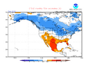
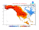
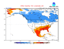
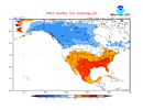
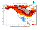
Here’s the latest 10 day CFSv2 mean for Feb ‘27 (Nino): 80% of CONUS BN; much AN E Canada:
IMG_3026.png

No other mid Oct 10 day mean for Feb back to 2012 has had anything even closely resembling this extreme couplet, and a cold dominant Feb US/much warmer than normal E Can have been on EVERY 10 day mean since they started going out that far in mid August!

Check out how much Feb of ‘27 differs from all other Feb forecasts back to the start of the CFSv2:

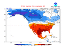
2026: 1% of CONUS BN; BN E Can:
IMG_3028.png

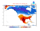
2025: 0% of CONUS BN; BN E Can
IMG_3029.png

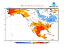
2024 (Nino): 0% of CONUS BN; AN E Can
IMG_3030.png

2023: 33% of CONUS BN; BN E Can
IMG_3031.png

2022: 6% of CONUS BN; BN E Can
IMG_3032.gif

2021: 20% of CONUS BN; BN E Can
IMG_3033.gif

2020: 1% of CONUS BN; BN E Can
IMG_3034.gif

2019 (Nino): 5% of CONUS BN; BN E Can
IMG_3035.gif

2018: 20% of CONUS BN; BN E Can
IMG_3036.gif

Continued in my next post due to limitation of 10 attachments/post…..
 
Continued from my prior post…..

2017: 3% of CONUS BN; BN E Can
IMG_3037.gif

2016 (Nino): 4% of CONUS BN; AN E Can
IMG_3038.gif

2015 (Nino): 0% of CONUS BN; BN E Can
IMG_3039.gif

2014: 4% of CONUS BN; BN E Can
IMG_3040.gif

2013: 1% of CONUS BN; BN E Can
IMG_3041.gif

2012: 15% of CONUS BN; BN E Can
IMG_3042.gif

———————————
Feb: % BN Conus; E Can anom

‘27 (Nino): 80% BN US; much AN E Can

’26: 1% BN US; BN E Can

’25: 0% BN US; BN E Can

’24 (Nino): 0% BN US; AN E Can

’23: 33% BN US; BN E Can

’22: 6% BN US; BN E Can

’21: 20% BN US; BN E Can

’20: 1% BN US; BN E Can

’19 (Nino) 5% BN US; BN E Can

’18: 20% BN US; BN E Can

’17: 3% BN US; BN E Can

’16 (Nino): 4% BN US; AN E Can

’15 (Nino): 0% BN US; BN E Can

’14: 4% BN US; BN E Can

’13: 1% BN US; BN E Can

’12: 15% BN US; BN E Can

—————————————


Analysis of above:

-Feb of ‘27 80% BN US vs only 33% (‘23) for next closest! Avg of only 7.5% BN US for 2012-26 and a mere 2% BN for the four El Niño cases!

-The other 4 Nino Febs had no more than 5% BN US! The two strongest Nino Febs had US BN of 0% (‘24) and 4% (‘16)! So, there’s virtually no resemblance to ‘27.

-BN in the SE US virtually nonexistent on any of 2012-2026 with most of them mild. But in stark contrast, 2027 has a very cold SE!

-Feb of ‘27 has by far the warmest E Can. Only 2 others had any degree of AN (much less intense than ‘27) and they were the 2 strongest El Niños (‘24 and ‘16).

——————

In closing, Feb of ‘27 has been very persistently (for 2 months!) showing on the CFSv2 a highly unique (among all Febs on record) extreme couplet of a cold dominant CONUS and extreme blocking/very warm E Canada. The CFSv2 has been trying to tell us something it never has and though I’m not at all saying to trust it, I am suggesting that it not be dismissed.

 
Last edited:
Continued from my prior post…..

2017: 3% of CONUS BN; BN E Can
View attachment 199048

2016 (Nino): 4% of CONUS BN; AN E Can
View attachment 199049

2015 (Nino): 0% of CONUS BN; BN E Can
View attachment 199050

2014: 4% of CONUS BN; BN E Can
View attachment 199051

2013: 1% of CONUS BN; BN E Can
View attachment 199052

2012: 15% of CONUS BN; BN E Can
View attachment 199053

———————————
Feb: % BN Conus; E Can anom

‘27 (Nino): 80% BN US; much AN E Can

’26: 1% BN US; BN E Can

’25: 0% BN US; BN E Can

’24 (Nino): 0% BN US; AN E Can

’23: 33% BN US; BN E Can

’22: 6% BN US; BN E Can

’21: 20% BN US; BN E Can

’20: 1% BN US; BN E Can

’19 (Nino) 5% BN US; BN E Can

’18: 20% BN US; BN E Can

’17: 3% BN US; BN E Can

’16 (Nino): 4% BN US; AN E Can

’15 (Nino): 0% BN US; BN E Can

’14: 4% BN US; BN E Can

’13: 1% BN US; BN E Can

’12: 15% BN US; BN E Can

—————————————


Analysis of above:

-Feb of ‘27 80% BN US vs only 33% (‘23) for next closest! Avg of only 7.5% BN US for 2012-26 and a mere 2% BN for the four El Niño cases!

-The other 4 Nino Febs had no more than 5% BN US! The two strongest Nino Febs had US BN of 0% (‘24) and 4% (‘16)! So, there’s virtually no resemblance to ‘27.

-BN in the SE US virtually nonexistent on any of 2012-2026 with most of them mild. But in stark contrast, 2027 has a very cold SE!

-Feb of ‘27 has by far the warmest E Can. Only 2 others had any degree of AN (much less intense than ‘27) and they were the 2 strongest El Niños (‘24 and ‘16).

——————

In closing, Feb of ‘27 has been very persistently (for 2 months!) showing on the CFSv2 a highly unique (among all Febs on record) extreme couplet of a cold dominant CONUS and extreme blocking/very warm E Canada. The CFSv2 has been trying to tell us something it never has and though I’m not at all saying to trust it, I am suggesting that it not be dismissed.
Donald Trump Reaction GIF
 
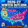
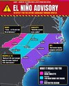
I don’t need Judah, JB, Max Velocity, or Brads winter outlook, here is the winter outlook from the GOAT!!
Rain_Cold
View attachment 199054
The Carolinas look great in this graphic. The borders are perfect. Definitely the correct shape.
 
Feels good going into winter knowing I got 11” last year. Anything I get this winter is just gravy.
Okay, but Raleigh is so salty about the snow hole that the entirety of Wake County was prescribed blood pressure medication...

We need this super El Niño to reel one in. I do not enjoy doing Synoptic meteorology labs about last January's snowstorm and being constantly reminded of the failure.
 
The odds we go 90+ staright days without temps ever getting below freezing throughout the entire column for atleast a couple of 24-48 hour spells are almost zilch. The mystery is , do one of those almost guranteed quick spells time up with what is supose to be a barrage of moisture plumes coming from our SW / all thanks to the STJ firehose.

Odds are high some area on here scores atleast one pretty good hit. Even if we spend 99% of the rest of winter in cold rain, cloudy mid 40's days etc,

Caveat though, is if there is a way to screw it up/ we will find it.
 
Wait are you saying this is from Rain_Cold?

SnowBirdBob’s logo is on it
No
I’m saying Rain_Colds favorite Met is SnowbirdBob! His forecasts are on fleek
My only source for winter weather forecasts, oh, and the DGEX
 
I don’t need Judah, JB, Max Velocity, or Brads winter outlook, here is the winter outlook from the GOAT!!
Rain_Cold
View attachment 199054
I see South Carolinian forces have invaded around Charlotte and are pushing northwards past Hickory and towards Wilkesboro. North Carolinian forces will need to stop their advance before they isolate the mountains from Raleigh and all hope at saving the western half of the state is lost. With winter setting in, time is running short....
 
I see South Carolinian forces have invaded around Charlotte and are pushing northwards past Hickory and towards Wilkesboro. North Carolinian forces will need to stop their advance before they isolate the mountains from Raleigh and all hope at saving the western half of the state is lost. With winter setting in, time is running short....
Should have been expecting this, but we've got time. Definitely need to counter that advance to reclaim CLT at least. They can have Gastonia though. 😏
 
Yuck, I wore shorts and a tank top on Christmas that year
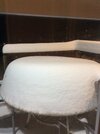
A month later I got the biggest snowfall I’ve had living here despite a warm winter overall. 12 inches fell in about 6 hours. It was insanely heavy rates with big fat flakes that I’ve only ever seen one other time in flagstaff Arizona. Needless to say it all melted in 4-5 days.IMG_1250.jpeg
 
I don’t need Judah, JB, Max Velocity, or Brads winter outlook, here is the winter outlook from the GOAT!!
Rain_Cold
View attachment 199054
Literally 4 hours later! Complete 180!
BOB is starting to lose street cred with me!
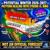
And I grew up on the mean streets of Gastonia!😂IMG_6809.jpeg
 
Back
Top