BufordWX
Member
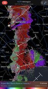
Solid couplet. SPC doesn’t even have a general T-storm risk anymore and this forms lol.
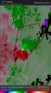



Flash flood warning now in effect. Multiple roads through McDowell county are impassable.Confirmed landslide in McDowell county on highway 226A. Just heard of another one in McDowell county but can’t confirm just yet. Right at 6 inches of rain now and still more to go.


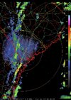

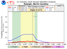
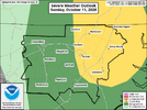
THEY killed it for us. Not looking good for eastern countiesHad some rain here this morning but it stopped a couple of hours ago. Wonder if we will still have the chance for severe weather tomorrow.


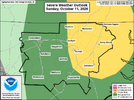
WFUS52 KRAH 111257
TORRAH
NCC007-123-153-167-111330-
/O.NEW.KRAH.TO.W.0009.261011T1257Z-261011T1330Z/
BULLETIN - EAS ACTIVATION REQUESTED
Tornado Warning
National Weather Service Raleigh NC
857 AM EDT Sun Oct 11 2026
The National Weather Service in Raleigh has issued a
* Tornado Warning for...
Northern Anson County in central North Carolina...
Southwestern Montgomery County in central North Carolina...
Northwestern Richmond County in central North Carolina...
Southeastern Stanly County in central North Carolina...
* Until 930 AM EDT.
* At 857 AM EDT, a severe thunderstorm capable of producing a tornado
was located 8 miles northeast of Marshville, or 13 miles northwest
of Wadesboro, moving northeast at 40 mph.
HAZARD...Tornado.
SOURCE...Radar indicated rotation.
IMPACT...Flying debris will be dangerous to those caught without
shelter. Mobile homes will be damaged or destroyed.
Damage to roofs, windows, and vehicles will occur. Tree
damage is likely.
* This dangerous storm will be near...
Ansonville around 900 AM EDT.
Other locations impacted by this tornadic thunderstorm include
Uwharrie Haven, Norwood, Peachland, Polkton, and Lake Tillery.
PRECAUTIONARY/PREPAREDNESS ACTIONS...
TAKE COVER NOW! Move to a basement or an interior room on the lowest
floor of a sturdy building. Avoid windows. If you are outdoors, in a
mobile home, or in a vehicle, move to the closest substantial shelter
and protect yourself from flying debris.
&&
LAT...LON 3497 8030 3519 8028 3532 8007 3513 7990
3495 8029 3497 8031
TIME...MOT...LOC 1257Z 235DEG 36KT 3508 8028
TORNADO...RADAR INDICATED
MAX HAIL SIZE...0.00 IN
$$
AS
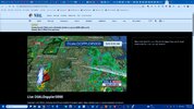

Doesn't matter, the sun is out now.
@SuperNET its comin for you!WFUS52 KRAH 111326
TORRAH
NCC007-111400-
/O.NEW.KRAH.TO.W.0010.261011T1326Z-261011T1400Z/
BULLETIN - EAS ACTIVATION REQUESTED
Tornado Warning
National Weather Service Raleigh NC
926 AM EDT Sun Oct 11 2026
The National Weather Service in Raleigh has issued a
* Tornado Warning for...
Central Anson County in central North Carolina...
* Until 1000 AM EDT.
* At 926 AM EDT, a severe thunderstorm capable of producing a tornado
was located over Wadesboro, moving northeast at 35 mph.
HAZARD...Tornado.
SOURCE...Radar indicated rotation.
IMPACT...Flying debris will be dangerous to those caught without
shelter. Mobile homes will be damaged or destroyed.
Damage to roofs, windows, and vehicles will occur. Tree
damage is likely.
* This dangerous storm will be near...
Wadesboro around 930 AM EDT.
Other locations impacted by this tornadic thunderstorm include
Lilesville, Blewett Falls Lake, and Polkton.
PRECAUTIONARY/PREPAREDNESS ACTIONS...
TAKE COVER NOW! Move to a basement or an interior room on the lowest
floor of a sturdy building. Avoid windows. If you are outdoors, in a
mobile home, or in a vehicle, move to the closest substantial shelter
and protect yourself from flying debris.
To report severe weather contact your nearest law enforcement agency.
They will send your report to the National Weather Service office in
Raleigh.
&&
LAT...LON 3510 8004 3508 8000 3512 7995 3512 7993
3510 7991 3507 7991 3504 7988 3503 7988
3501 7990 3498 7987 3495 7987 3493 7986
3483 8015 3499 8022
TIME...MOT...LOC 1326Z 239DEG 32KT 3494 8010
TORNADO...RADAR INDICATED
MAX HAIL SIZE...<.75 IN
$$
AS


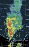
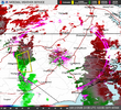
Don't try to encourage it to get bigger.a 63 mile wide severe thunderstorm warning. You don’t see that everyday in North Carolina. That’s something you see in the Dakotas or Canada View attachment 198778

Great... We're next. Prepare to lose power and possibly my NEW home!Tornado warnings for Moore and Chatham County. No reports of tornadoes on the ground but rotation has been detected on radar.


BULLETIN - IMMEDIATE BROADCAST REQUESTED
Severe Thunderstorm Warning
National Weather Service Raleigh NC
1106 AM EDT Sun Oct 11 2026
The National Weather Service in Raleigh has issued a
* Severe Thunderstorm Warning for...
Southern Orange County in central North Carolina...
Northern Harnett County in central North Carolina...
Lee County in central North Carolina...
Western Wake County in central North Carolina...
Chatham County in central North Carolina...
Southern Durham County in central North Carolina...
* Until 1145 AM EDT.
* At 1106 AM EDT, severe thunderstorms were located along a line
extending from 8 miles south of Mebane to near Sanford, moving east
at 45 mph.
HAZARD...60 mph wind gusts.
SOURCE...Radar indicated.
IMPACT...Expect damage to roofs, siding, and trees.
* Locations impacted include...
Raleigh, North Carolina State Fairgrounds, Durham, Cary, Chapel
Hill, Sanford, Pittsboro, Garner, Carrboro, Fuquay-Varina, and
Angier.
This includes the following highways...
Interstate 85 between Mile Markers 175 and 181.
Interstate 40 between Mile Markers 263 and 298.
Interstate 440 between Mile Markers 1 and 7.
Interstate 540 between Mile Markers 0 and 10.
US 1 between Mile Markers 69 and 101.
the Durham Freeway between Mile Markers 2 and 15.
PRECAUTIONARY/PREPAREDNESS ACTIONS...
Straight line winds can blow down trees, power lines, and damage
mobile homes and other buildings. Seek shelter in a sturdy structure
until the storm has passed. Stay away from windows as flying debris
generated by damaging winds can be deadly.
A Tornado Watch remains in effect until 500 PM EDT for central North
Carolina.
&&
LAT...LON 3606 7867 3559 7862 3552 7871 3549 7866
3547 7864 3537 7928 3547 7936 3550 7934
3552 7936 3584 7938 3585 7924 3591 7926
3599 7926
TIME...MOT...LOC 1506Z 264DEG 37KT 3596 7928 3544 7925
HAIL THREAT...RADAR INDICATED
MAX HAIL SIZE...<.75 IN
WIND THREAT...RADAR INDICATED
MAX WIND GUST...60 MPH

Line really beefed up and got crowded. Better chance of this getting more discreet later today around 95


Old house has under it, but new house doesnt!View attachment 198791
4 warnings lined up down this way


Huh? Mo Tomorrow isn't even a real county, so is KwyjiboTornado touchdown was reported in Mo tomorrow County.