• Hello, please take a minute to check out our awesome content, contributed by the wonderful members of our community. We hope you'll add your own thoughts and opinions by making a free account!

Pattern NC Only Thread

Nice break today - I got a little wet walking around today - but enjoyed not feeling a sheen on my body walking to the car.

.85 total in 12 hours

Modeling still sucked with rain and coverage yesterday - the front was weak and disorganized as it pasted through. GSP had a high of 71-72 today- it was 65 at 00:53 this morning and has trended down all day. I'm not complaining - I'll take it - but still fundamental problems with forecasting.
 
Last edited:
57 when i woke up around 5:30, still 57. Picked up 0.10" earlier.

Salisbury, NC is over 5" in the last 72 hours. Mount Mitchell sits at 46.8F. A few north/west of the Triad spots are around 54F, taking the title of coldest east of the mountains.
 
61 temps have fallen off a degree since the wind went to due north. Tomorrow afternoon is going to be a treat for this time of year with dews mixing into the 30s which should set the stage for Saturday to be the coldest morning. Really not entirely sure this big low off the coast will let us max out the cooling but widespread low 50s with some 40s tonight, probably widespread upper 40s to around 50 Saturday morning, Sunday is up in the air as some models want to pull some higher dews and clouds back in. If we can get clear an relatively calm on Sunday I could see a couple upper 30s
 
I'll probably have to convince the wife not to put up the Christmas tree.

My wife is the exact opposite. She doesn't care if we have a Christmas tree or not. I've put our tree up the past five years, at least, with some help from one of my granddaughters a couple of times. She also wants it down before New Year's Day.
 
61 temps have fallen off a degree since the wind went to due north. Tomorrow afternoon is going to be a treat for this time of year with dews mixing into the 30s which should set the stage for Saturday to be the coldest morning. Really not entirely sure this big low off the coast will let us max out the cooling but widespread low 50s with some 40s tonight, probably widespread upper 40s to around 50 Saturday morning, Sunday is up in the air as some models want to pull some higher dews and clouds back in. If we can get clear an relatively calm on Sunday I could see a couple upper 30s
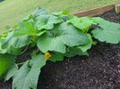
I'm sure Greensboro will have it's first frost, heck they might even pick up a little accumulation
 
Back
Top