What AI has to say about this over central NC and more specifically the Triangle.....
The Verdict for Piedmont NC
Your chances of seeing
at least one major winter weather event are higher than normal because of the raw storminess driven by El Niño. However, your chances of a prolonged, consistently snowy winter are
stifled by the -PDO. Expect a highly volatile winter where you will likely be tracking agonizingly close boundaries between 38°F bone-chilling rain and a major winter mess.
For The Triangle (Raleigh-Durham-Chapel Hill), the setup of a Super El Niño clashing with a negative Pacific Decadal Oscillation (-PDO) creates a
textbook "boom-or-bust" winter for snow chances.
Historically, this specific clash means
your chances for a single, major, high-impact snow or ice storm are significantly higher than normal, but your chances of seeing frequent, consistent snow flurries or cold winter days are actually
lower than normal.
The Clashing Physics Over the Triangle
The 30-year average winter snowfall for the Triangle is
7.9 inches. However, a Super El Niño combined with a -PDO creates two highly conflicting trends that usually pull that average apart into extremes:
1. Why the "Boom" Potential is High (Super El Niño)
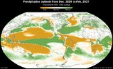
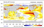
A Super El Niño aggressively fires up the Southern subtropical jet stream. This guarantees that the Southeast will be locked into a
wetter-than-normal weather pattern with an influx of coastal low-pressure systems. For the Triangle, this means the raw "fuel" for a winter storm—copious moisture tracking up from the Gulf of Mexico or along the coast—will be readily available all winter. When a brief blast of cold air manages to slip down, it can easily trigger a massive "home run" snow or ice storm.
2. Why the "Bust" Potential is High (-PDO)
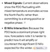
A negative PDO is the snow lover’s worst enemy in North Carolina. It tends to favor a strong
Southeast Ridge—a warm high-pressure system sitting right off the Atlantic coast. This ridge acts like a leaf blower, pushing warm, subtropical air straight up into central North Carolina. Since 2019, a persistent -PDO has been the main driver behind the region's recent snow droughts, turning potential snowstorms into
chilly, raw, 38°F rainstorms.
The Analog Blueprint: How Past Winters Played Out
Meteorologists track past "analog years" that shared this similar climate profile to see how it resolves in central North Carolina:
- The 1982–1983 Winter (The Boom): This was a massive Super El Niño. The Triangle was slammed by intense moisture, and because cold air occasionally aligned perfectly, it resulted in a highly snowy, active winter.
- The 2015–2016 Winter (The Icy Bust): Another historically strong Super El Niño. The Triangle experienced incredible moisture, ranking as one of the top 10 wettest winters on record for the state. However, the warm -PDO signal dominated the overall temperature pattern. While the season was mostly mild and rainy, it did produce a high-impact, crippling ice and sleet storm rather than clean, powdery snow.
What to Expect This Winter
Instead of a normal winter, expect a
highly volatile, gray, and wet season. You will likely spend the winter watching local meteorologists track the "rain-snow line" down to a matter of a few miles across Wake, Durham, and Orange counties. If the El Niño moisture wins out during a transient cold snap, the Triangle will see a major winter event. If the -PDO ridge holds its ground, expect historic amounts of cold rain.