Avalanche
Member
Nice work and hopefully this pans out. We need thisUpdated forecast tending warmerView attachment 197508

Nice work and hopefully this pans out. We need thisUpdated forecast tending warmerView attachment 197508

Updated forecast tending warmer
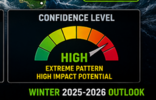


Updated forecast tending warmerView attachment 197508

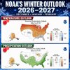
Did Shetley make this map?? The dry makes it to Jonesville somehow! Giddy up! View attachment 197529


Giddy up! View attachment 197529

At least it would be warm rain.Giddy up! View attachment 197529

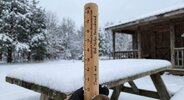
I have something similar but I don’t measure snow with it.
"The El Nino measure has leveled off, and keep in mind that a very visible downturn or crash is predicted around October 1."--Where are you seeing this?I get the distinct impression that many of you want to be done with the summer and are ready for a turn toward a more exciting fall and winter weather pattern nationally....
And I understand that sentiment, because the same features that have been visible in the JJA semester very likely will last through perhaps the first 3/4 of September. The heat has been intense in the same areas, and before the season is done I am fairly certain that another prominent burst of cTw+mTw values will overtake most of the lower 48 states. Thunderstorms are providing some excitement along the northern tier (that streak of frequent severe weather in the Midwest is plainly obvious), but the boundary associated with the repetitive convection will likely get close to the Canadian border in the 11-15 day period, and perhaps again in Week 4. Since the Labor Day holiday weekend is now in our forecast range, I have to stress that the famed "Corn Belt tornado machine" is probably going to get another heavy workout. Draw a line from Iowa to Ohio and block 200 miles either side for the "danger zone" when making your travel plans either side of September 5-6-7.
What will finally take down the Sonoran heat ridge will be one of two features. That productive moisture axis off of Mexico, currently increasing hurricane chances to Baja California and Hawaii, should turn its energy toward either the Isthmus of Tehuantepec or the Sea of Cortez in mid or late September. Another possibility is that the polar westerlies may split in a "typical El Nino" fashion, where energy and cold pockets blast through the Desert Regions into the Edwards Plateau. Judging by current satellite trends, which feature an arc of deep tropical moisture from the equatorial Pacific Ocean into Mexico and then Florida, I favor the former risk. And if that is the configuration for fall and winter, all of you who have been chomping at the bit for colder SON to DJF period (like the analogs and CFS series keep saying) could be very happy. The El Nino measure has leveled off, and keep in mind that a very visible downturn or crash is predicted around October 1. It is too early to post any exact predictions, but should a typhoon get ingested into that Gulf of Alaska Low/Vortex, then the 1965-66 and 1976-77 comparison tests should get a lookover. Since the waters in the Atlantic Basin are not mirroring the +ENSO values, and because blocking has been so recurrent with cold frontal passages from the north central states through the Great Lakes into the Northeast, seasonal amplification trends would favor a +PNA/-NAO outline as we head into the low sun period. We will get an end to the oppressive heat in Texas and the severe weather cycle in Illinois. But keep your eyes open to the possibility of a very stormy fall and winter that eventually would tap into colder air.
Prepared by Meteorologist LARRY COSGROVE on
Sunday, August 23, 2026 at 3:55 A.M. CT
"The El Nino measure has leveled off, and keep in mind that a very visible downturn or crash is predicted around October 1."--Where are you seeing this?
You need to ask LC"The El Nino measure has leveled off, and keep in mind that a very visible downturn or crash is predicted around October 1."--Where are you seeing this?
I suppose he is talking about this"The El Nino measure has leveled off, and keep in mind that a very visible downturn or crash is predicted around October 1."--Where are you seeing this?
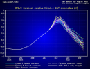

Yep and just look at chart above. Anything above 2.0 is considered a strong el nino. By mid Jan after it has been declining in strength, its still at 2.0+.Lmao this Nino going off the chart
Talking hearing now has been early JanuaryThe model consensus has this peaking ~Nov 15th.
Talking hearing now has been early January
Seen several even going early March. , but average I been seeing late December to early January, nothing we can do about it anyways. Stand by and see . Say we will see some extreme weatherI’ve seen no model peaking this Nino as late as early Jan.
Seen several even going early March. , but average I been seeing late December to early January
Try get it linkedPlease show the forum actual model consensus evidence supporting your last 2 posts saying avg peak late Dec/early Jan and several as late as early March. TIA
I think you’re right about how blocking sets up this year and the impact it will. Fortunately it seems like the last several years we’ve gone back into a cycle that good blocking and negative NAO has been setting up more often during the winter.Yep and just look at chart above. Anything above 2.0 is considered a strong el nino. By mid Jan after it has been declining in strength, its still at 2.0+.
This will produce a lot of extreme wx. From droughts to flooding globally . Probably crank out quite a few more severe events than the conus is accustomed to late fall into winter.
Most likely this all time highest el nino will produce several blockbuster winter storms for whoever can thread the needle and get the atmosphere just cold enough to cooperate. Gonna be tough down this way outside of elevation. How the blocking does or doesn't materilize will hold the key to frozen for many of us in the southeast.
Most unlikely scenerio is, we in the SE will see is a major artic outbreak. Best call you have made. Now anything is possible. But strong el ninos really screw with the way the tablle gets set for delivering true polar air. Biggest help to us in the SE is keeping the atlantic sst above normal heading into winter. This will increase the potential for a negative AO /NAO. If the pv gets locked in and tightened up around the NP, gonna be hard to get dislodged this year.
Its LC, gotta take it with a grain of salt.


Don’t forget cutting persimmon seeds.Seriously, the CFS v2? You will get better chances looking at the woolly worm

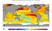
Can the Atlantic stay AN? Check out the NW Pac. Might be a wildcard/ monkey wrench this winter
View attachment 197566


