
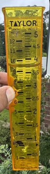
I have 2.36 inches in the rain gauge at my hacienda near Lake Wheeler. Hopefully, more will come overnight into tomorrow morning and less will fall on Saturday. I'm looking at a piece of property I might be interested in Saturday morning.



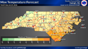
It was quite muggy as well before the storms came inWow. Wilmington's high was 17 degrees higher than RDU today. (91 compared to 74)

I hardly ever look at it except in winter to see when it's going to give us the big snowstorm then subsequently warm up the mid levels.So bad for the nam to be this wrong? Unbelievable fail for that model.

Looks like it'll be a record low max at rdu I believe cooler than Christmas dayWow. Wilmington's high was 17 degrees higher than RDU today. (91 compared to 74)


What was your total yesterday?NWS Will most likely be issuing a new flood watch with the afternoon package as we have a shot to get one more good lick tonight. Currently soaking shower rains in the wedge regime. Been in the 60's and that should continue today. Gonna be tough mowing the old folks lawns this weekend and mine.
I'm sitting a shade above the 8 inch mark for July. If the wave coming in tonight can ramp up, it should get the creeks and rivers running real good and hopefully make it down into Badin Lake , get it filled back up.
My gauge was overflowing@ 5 inches +. My best guess is we got around 6 -7 so far for the event. HP through Gboro down to us racked up no doubt. We are over 8 inches for the month of JulyWhat was your total yesterday?
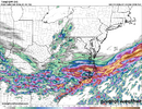
Radar blew up when random showers moved east of us offshore..75 so far with a tricky forecast according to their disco. This part caught my attention
This is a complicated forecast with high bust potential, but leaves
me feeling a little uneasy. Be careful today and this weekend.
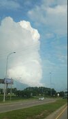
Yeah some cool cloud structures this morning for sureRadar blew up when random showers moved east of us offshore.





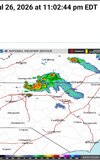

Need the MCS to be 6 hrs sooner....Wilmington talking up the potential for tomorrow night already. Someone should see some decent storms
Why does Axl look like SD in 25 years!??Not my photo, but from RAH concert! View attachment 197011View attachment 197012


Yeah ots definitely weakening as it gets to me but central and coastal plains looks solidNeed the MCS to be 6 hrs sooner....

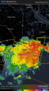


Can Rain Cold go too?I own a house up in Boone. Going up again this weekend. Here's the 7-day grid forecast:
Today
Partly sunny, then gradually becoming sunny, with a high near 74. Northwest wind 14 to 16 mph, with gusts as high as 29 mph.
Tonight
Mostly clear, with a low around 55. Northwest wind 11 to 13 mph, with gusts as high as 25 mph.
Thursday
Sunny, with a high near 73. Northwest wind 7 to 13 mph, with gusts as high as 22 mph.
Thursday Night
Clear, with a low around 55. Northwest wind 7 to 9 mph, with gusts as high as 20 mph.
Friday
Sunny, with a high near 77. Northwest wind around 5 mph becoming calm in the morning.
Friday Night
Partly cloudy, with a low around 60.
Saturday
A chance of showers and thunderstorms after 2pm. Mostly cloudy, with a high near 74. Chance of precipitation is 50%.
Saturday Night
A chance of showers and thunderstorms before 8pm, then showers likely and possibly a thunderstorm between 8pm and 2am, then showers likely after 2am. Mostly cloudy, with a low around 61. Chance of precipitation is 70%.
Sunday
Showers likely, then showers and possibly a thunderstorm after 8am. High near 69. Chance of precipitation is 80%.
Sunday Night
Showers and possibly a thunderstorm before 2am, then a chance of showers. Low around 61. Chance of precipitation is 80%.
Monday
Showers and possibly a thunderstorm. High near 71. Chance of precipitation is 80%.
Monday Night
Showers and possibly a thunderstorm. Low around 62. Chance of precipitation is 80%.
Tuesday
Showers likely and possibly a thunderstorm. Partly sunny, with a high near 74. Chance of precipitation is 70%.
Even my house here at Falls Lake is not bad (compared to the last month).
Today
Sunny, with a high near 86. Northwest wind 5 to 7 mph.
Tonight
Mostly clear, with a low around 66. Northwest wind 3 to 5 mph.
Thursday
Sunny, with a high near 85. Northwest wind 3 to 5 mph.
Thursday Night
Clear, with a low around 67. Calm wind.
Friday
Sunny, with a high near 88. Calm wind.
Friday Night
Partly cloudy, with a low around 70.
Saturday
Partly sunny, with a high near 86.
Saturday Night
Mostly cloudy, with a low around 70.
Sunday
A chance of showers and thunderstorms after 2pm. Partly sunny, with a high near 85. Chance of precipitation is 40%.
Sunday Night
A chance of showers and thunderstorms before 8pm, then showers likely and possibly a thunderstorm between 8pm and 2am, then a chance of showers after 2am. Mostly cloudy, with a low around 71. Chance of precipitation is 60%.
Monday
Showers likely and possibly a thunderstorm. Mostly cloudy, with a high near 83. Chance of precipitation is 70%.
Monday Night
Showers likely and possibly a thunderstorm. Mostly cloudy, with a low around 71. Chance of precipitation is 60%.
Tuesday
A chance of showers and thunderstorms. Partly sunny, with a high near 85. Chance of precipitation is 40%.
I can live with 80s. But of course, I love the 70s in Boone.
You're a lot closer to the mountains now. Very easy day trips. Many years back I use to gold pan on the Wilson Creek. That's not too far from you.Can Rain Cold go too?
