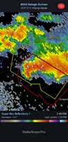
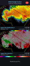
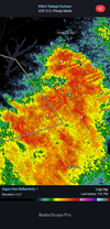
AFD is a good read. Hope to cash in late tonight through wed pm over this way, as it looks like the front is gonna be to my south. Cooler air will be nice, but need the rain first and foremost.
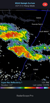
Training and backbuilding
convection, with an increasing risk of
excessive rain and
flash flooding, will then become favored along
the
outflow-reinforced frontal zone over
srn VA and nrn
NC late
tonight-early Wed, before settling
swd across most of all cntl
NC
later Wed-Wed night.
A categorical upgrade from Slight risk to
Moderate for excessive rain may become necessary (Level 2 to 3) as
uncertainties from mesoscale and convective influences to the
placement and evolution of the boundary become clearer; and a Flash
Flood Watch may be needed by later this afternoon or overnight.
While a few strong to severe downbursts will also be possible, the
flash flood risk will have become relatively greater by Wed.
KEY MESSAGE 3... A cold
front will move across
NC on Thursday and
then stall across the Carolinas into the weekend producing a period
of
unsettled weather with cooler than average temperatures.
There is
significant uncertainty in the placement of the front which will
greatly determine forecast details including the potential for
significant rainfall.
A mid and upper-level
trough will persist across the Great Lakes and
Northeast through the Thursday through Monday period. A cold
front
will move south across
NC on Thursday and
likely stall across along
the Carolina coast and extend westward somewhere in the Carolinas on
Friday through Monday. The
front will mark the leading edge of a
cooler and more
stable airmass and the frontal zone will be the
focus for showers and thunderstorms through much of the period.
While the operational
GFS and EC move the
front into
NC on Thursday
night and then waver it near the
NC/SC border or even across eastern
NC on Friday through the weekend the various GEFS and ENS
ensemble
members provide a wide range of solutions including pushing the
front further south through SC into GA while others lift the
front
across
NC into VA.
Climatology would suggest a significant southward
push would be unusual and a northward retreat would be more common.
In addition sub-synoptic factors including the development of
convection near the
front could impact the evolution and placement
of the
front.
Notably cooler and drier air will setup behind the
front with much
lower precipitation chances. Near the frontal zone and especially
south of the
front expect much more cloudiness,
muggy conditions and
unsettled weather with multiple rounds of showers and storms. On
Friday
PW values will potentially range from near 1.1 inches across
southern VA to 2.4 inches across southeastern
NC. Similarly surface
dewpoints may range from near 60 in northwestern
NC to the mid 70s
across southeastern
NC. WPC
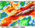
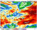
QPF guidance for Thursday through Monday
highlights a dramatic range in precipitation with
rainfall totals of
a half inch or so in Triad, 1.5 to 2.0 inches in the Triangle and 2
to 4 inches in the Sandhills. A slight shift in the frontal
placement could dramatically alter the precipitation amounts.
At this point, the most
likely scenario is for the
front to move
across
NC on Thursday with showers and storms fairly widespread
across the area. While rain chances continue across central
NC on
Friday, the focus for showers and storms shifts to southern and
eastern areas. Precipitation coverage and intensity decreases late
in the weekend and on Monday. Expect a
fair amount of cloudiness
through the period with improvement late in the period. High
temperatures will range below
normal through the period, most
significantly on Thursday with morning lows near average through the
period.







 )
)