
Brent
Member
man 10 degrees is cold asf
Especially if it's windy. You'll be rethinking your decision to move here haha
I always tell people there's usually a moment every winter it happens

man 10 degrees is cold asf



Yeah but next winter will be different. This is the winter we've all been waiting for our entire lives.Weatherman Plus says this coming winter will be one to remember. I’ve heard that every winter since 1985.
I hope for 70s all winter. That what I’m waiting for.Yeah but next winter will be different. This is the winter we've all been waiting for our entire lives.

You moved to the right stateI hope for 70s all winter. That what I’m waiting for.

Take it to the bank. You will remember it. But its gonna be for the most undesired reasonsWeatherman Plus says this coming winter will be one to remember. I’ve heard that every winter since 1985.
I keep reading about the el nino for this winter. If it doesn't get "too" strong, we could see better chances of ice storms this winter. But if it gets to historic/super ranges, the whole country could get flooded with warmth. Did a Google search and found the winter of 1877-78 having these highlights:
The winter of 1877–1878 in North Carolina was remarkably warm, largely recognized as an exceptionally mild season brought on by a historic 'Super' El Niño event. Across the eastern United States, temperatures were well above normal, yielding a near 'winter-less' season with minimal snow and causing agricultural disruptions due to muddy and impassable roads. [1, 2, 3, 4, 5]
The unusual weather conditions produced several specific anomalies:
Other super el ninos From Webbers site:
- Above-Average Temperatures: Seasonal averages were staggering, with some early historical climate datasets marking December through February as the warmest on record at the time. [1, 2]
- Lack of Snow: There was almost no measurable snowfall across the state, making travel difficult as the usual frozen ground turned into a muddy mess for horse-drawn wagons. [1, 2]
- Early Blooms: The unseasonable warmth tricked nature, with newspaper and diary accounts from the era reporting spring flowers blooming in the middle of winter and trees blossoming exceptionally early. [1, 2]
- Historical Documentation: Official weather service record-keeping in Charlotte began in 1878, cementing the memory of this uniquely mild year right as institutional meteorology was taking off.
1982-83 had one small event (2-3") at/around RDU, and a couple of dustings.
1997-98 again had one small event (1-3") at/around RDU and one other dusting.
1915-16 again had one small event (1-3") at/around RDU and numerous dustings.
ERIC WEBB'S NORTH CAROLINA WINTER STORM ARCHIVE
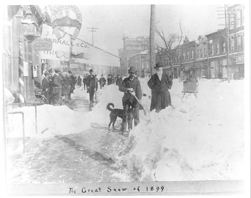
Fayetteville St. in Raleigh during the Great Blizzard of 1899 Obtained at : https://www.timetoast.com/timelines/historical-blizzards--2www.webberweather.com
1. Asheville temp. records go back to 1876 and thus include 1877-8. Whereas Dec was mild/AN at 43.6, Jan was actually snowy and cold/BN (35.2) and Feb was NN (39.8). So, DJF averaged 39.5, which is actually NN.
In Jan, they had well above normal snow with 4” on the 4th and 4.5” on the 31st! They had a low of 7F on the 7th. So, I wonder why this source per your post said:
The winter of 1877–1878 in North Carolina was remarkably warm, largely recognized as an exceptionally mild season brought on by a historic 'Super' El Niño event.
This doesn’t at all jibe with this Asheville data and I haven’t found any data for any other locale in NC going that far back.
Data from here:
—————
2. Regarding other super-El Nino winters in the SE:
-1888-9: Feb 1889 had a SE major snowstorm and was cold allowing for DJF to avg BN
-1957-8: cold winter overall with cold in Jan and especially Feb. and was snowy overall, esp in Feb, which included deep SE
-1965-6: cold winter overall thanks to quite cold in Jan and overall snowy in part of SE thanks to Jan/Feb
-1972-3: historic ZR Jan N GA and vicinity; historic snowstorm Feb AL to NC, including deep SE; overall NN temps with BN Feb
-1982-3: very snowy much of SE, including historic snow much of area in spring! ATL had biggest snowstorm as well as snowiest winter since 1939-40! It hasn’t been matched since! Overall NN temps.
-1991-2: ATL and nearby had a major snowstorm in Jan. Otherwise it was a mild winter.
-1997-8: NN temps overall with cold Dec, mild Jan, and NN Feb
-2015-6: AN temps overall due to warmest on record Dec as JF were actually BN to NN
—————
In summary,
-a super-Nino doesn’t point to an expected warm SE winter as only 2 of the 9 averaged mild in DJF. Only one, 1991-2, averaged mild throughout DJF.
-Super El Niño winters tend to average mild in the N tier of the US, not the SE.
-Dec will be favored to be AN as 6 of these 9 had a mild Dec, including the warmest on record
-Jan/Feb averaged out will be favored to be BN with most of the 9 BN overall, with some quite cold months in some cases
-AN wintry precip prospects are better than avg. All it takes is one major snow in the SE in many cases.
-AN rainfall prospect is the best news of all due to the drought!
@CaryWx[/USE
[/QUOTE]

Tennessee Storm says don't even bother.Weatherman Plus says this coming winter will be one to remember. I’ve heard that every winter since 1985.

The snowiest strong El Niño year on record for Greensboro, NC, is the winter of 1965–1966, which recorded an impressive total of 26 inches of snow during the three-month winter period at Piedmont Triad International Airport. [1, 2]
Strong El Niño patterns generally provide a more active storm track for the southern and eastern United States, typically resulting in higher-than-average winter precipitation and snowfall for the Piedmont Triad. A breakdown of notable strong El Niño winters in Greensboro includes: [1, 2]
Late dec 2010 nov dec was. But this is fall 09 into jan feb 2010 season. 09-10 winter was el nino winter. Your thinking 2010-2011 winter.2010, 2013-14 were LaNina?
Lol I never watch the news. I have sat in Van's office and talked to him, definitely a great guy but rarely ever watch news.Late dec 2010 nov dec was. But this is fall 09 into jan feb 2010 season. 09-10 winter was el nino winter. Your thinking 2010-2011 winter.
Lol dont be arguing with van denton and charles ewing, emily.
It was from wghp post. Didnt show credit

The good news imo is that this winter is less straight forward than the last 2. If this were a weak or mod nino the hype for this winter being cold and snowy would be monumental. I believe the nino itself is central or east with a lean to east based. I still wonder if we can break it down as we get later in the winter and if that has an impact with later arriving post MLK winter. I think somethings may interfere but there may be some tendency for this winter to try to -NAO more than usual.@ GAWX ,SD, Web/ anyone. Where she gonna set up shop? Lock its gonna be strong. Strong verse super record breaking, does it really make any difference.
All about location an orientation. Am I way off here?

2009-2010 was probably the best winter of my life overall. 2013-2014 is competitive but was heavily slanted towards the latter part of the winter whereas 2009-2010 had 1”+ snowfall in four months (December - March) at GSO which has to be pretty rare? The only downside was watching DC get pummeled with multiple historic snowstorms while we just got some front end slop.The snowiest strong El Niño year on record for Greensboro, NC, is the winter of 1965–1966, which recorded an impressive total of 26 inches of snow during the three-month winter period at Piedmont Triad International Airport. [1, 2]
Strong El Niño patterns generally provide a more active storm track for the southern and eastern United States, typically resulting in higher-than-average winter precipitation and snowfall for the Piedmont Triad. A breakdown of notable strong El Niño winters in Greensboro includes: [1, 2]

Absolutely means everything..east or west based could be a banter or a wet dud. To be continued!Personally, i think it depends on whether it is east-based or not.
Get that SPV weak and we good!Absolutely means everything..east or west based could be a banter or a wet dud. To be continued!
@ GAWX ,SD, Web/ anyone. Where she gonna set up shop? Lock its gonna be strong. Strong verse super record breaking, does it really make any difference.
All about location an orientation. Am I way off here?
I can see that for the NE, cause the west based gets them way more precip, but central to east they get more skunked with the qpf. You always see el nino outlook maps stripe the southern states with AN precip from coast to coast and Big BN bulge in MW , especially upper mid west.Based on analysis I just did tonight, the most Modoki (W based) El Niño events since 1950 were (starting from strongest):
1. 2004-5
2. 2014-5
3. 1968-9
4. 1977-8
Thus, it appears to me that regarding wintry precip in El Niño seasons, the SE (based on ATL and RDU) seems to do somewhat better with C based (3.4 with clearly the warmest anomalies) than W based (Modoki). If I’m not mistaken, the NE tends to do better with the opposite, W based/Modoki over C based. Interesting!

I read we're going to have a super El Nino and record breaking snowfall this winter.

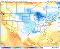

Welp ChatGPT and James Spann says it's likely to snow IMBY, so I'm going to roll the dice and bet for the best.
In all seriousness, as a newbie- how far in advance can you reliably predict AO/NAO/PNA pattern likelihoods?
How do you like the Euro seasonal height pattern for January? Looks like a strong STJ, maybe flooding the US with warmth. But....Sure what can possibly go wrong

Gotta be North of I 40, South of I-10, or East of I-95. Everybody else; forget about it.Swerve, it only snows along the gulf coast, the rest of us get whiffs
And Northwest GeorgiaThe only people complaining should be Raleigh people.
I think @Mitch West still has a right to complainAnd Northwest Georgia
Nah they got 2 in or at least close to their averageI think @Mitch West still has a right to complain


 what we will get??