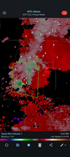
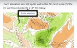
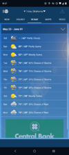
Looks like there have been a few sprinkles at home. Why the 80-100% rain forecasts I have no idea.



We really hate being successful around here. Remove this dead wedge and it's bombs away yesterday afternoon and todayWedge winning, shocker
Yeah my .28 is probably 2.8 without the wudgeWe really hate being successful around here. Remove this dead wedge and it's bombs away yesterday afternoon and today
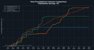
Finally scored some good rains here. 2.45 in inches so far today with 2 day total of 3.64...and i dont think im done yet with more building to my south. The runoff/rates have been impressive. I got about an inch yesterday in about 10 minutes..it was pretty wild to see it go from dry and dusty to having water everywhere in 5 minutes.3.34 the last 24 hours and getting mucho dark again just to my west. Hopefully all of you will get your share as well.


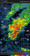
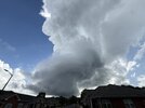 Easily the best supercell storm structure I have ever seen today over Woodstock, Georgia as a small shower ingested some shear
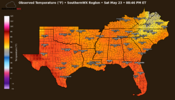

Maybe I‘m forgetting, but I don’t recall seeing even a drop of rain here since at least May 13th that is until earlier this evening. I finally got a few drops (a T) then and radar suggests I could get some more later. But prospects aren’t great for much more this evening. Regardless, things are looking up for the next couple of days and much of the week to come with an overall wet pattern.

Exactly. I'm still at .28 since the pattern change to cool and wet. And no offense to @FallsLake for sharing the map, but if i had a dollar for every time the CFS ended the drought in the long range, we'd all be rich lolThe CAD wedge has been stubborn over the North Carolina Piedmont and is the reason rainfall totals have been paltry compared to areas to the south and east of us. It looks like it will be stuck in place for one more day and KRDU will have its third day in a row with a record setting minimum high temperature with little to show for it in the rain gauge. During the past twenty-four hours, no measurable precipitation has been recorded at my residence near lake Wheeler in Raleigh.
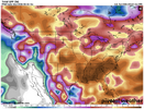
Hey I agree...just the CFS messenger. I have the attitude of I'll believe it when I see it.Exactly. I'm still at .28 since the pattern change to cool and wet. And no offense to @FallsLake for sharing the map, but if i had a dollar for every time the CFS ended the drought in the long range, we'd all be rich lol


And then we could be looking at another CAD for next weekend. Many of us have stated "The one thing we do good with is CAD".GSP is now thinking the CAD hangs on into tomorrow and if does rainfall totals will have to be cut again up in NC.
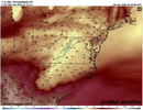
You may very well lose it over there and maybe the Raliegh area will too, but it's stronger than ever from the upstate of SC up into the NC foothills and western piedmont and is not going anywhere fast.Its brighter today than yesterday. Maybe we finally lose this curse


Feels steamy and natty too.ESE wind now it might finally be over