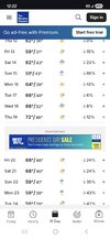
• Hello, please take a minute to check out our awesome content, contributed by the wonderful members of our community. We hope you'll add your own thoughts and opinions by making a free account!

Pattern Fab Feb

Allan Huffman, this morning.

4e8e917a3fb933eddbe6c589ad809400.jpg


Sent from my iPhone using Tapatalk
 
After a fantastic period the last 3.5 weeks, the “Big 3” remain the mainly lousy 3 overall for week 2 although the AO is rising mainly only to neutral after just a very short +:

PNA: week 2 yucky if you like it cold (CAD areas’ best hope is for a nice CAD to break up the warmth mid to late next week)
IMG_8144.png

NAO: rising
IMG_8145.png

AO: rising
IMG_8146.png
 
Jan. 11 last day above 60 & Jan. 23 last day above 50. Been a nice run of cold temps the last month overall.
Throw in 3 ice/sleet/snow events and I'd give it an A! I'd be happy with a nice long warm up and I know my wife and fellow teachers don't wanna miss anymore school. Glad I'm retired and don't have to worry about make-up days anymore!
 
Euro still isn't quite sure who it wants to be this weekend as far as SE QPF, but the overall footprint has taken a big move northward
ecmwf-deterministic-se-precip_48hr_inch-1770789600-1771264800-1771264800-20.gif

AIFS headed up too. Still sorta in believe it when I see it mode for QPF over 1.5" around here

ecmwf-aifs-all-se-total_precip_inch-1770789600-1771286400-1771286400-20.gif
1770811018311.png

Starting to consolidate on the EPS imby, losing many of the 2"+ members but also losing many of the <0.5" ones.
1770810900248.png


Pretty simple looking forecast today. Slow re-mild and then cool-chilly/rainy Sunday (the former part depending on your location, considering the image below), followed by a nice mild-up to kick off next week.

1770811114720.png
 
Yea Allan and Jonathan both agree with y’all that winter is on its last leg


Sent from my iPhone using Tapatalk

We finally reeled one in this year so as much as I want to mumble and complain, I really can’t. An Ice event and a solid 4-5 inch snow and pretty dang cold all winter. Hopefully we can keep it going next winter.
 
I am about ready to punt Fab Feb. The D7ish system has a remote chance to pull a miracle, especially N and W, but aside from that it looks over. March is too early to say, but if the late February pattern carries over into early March, we’ll be running out of time quickly and having to depend on a late season miracle like 1915, 1973, 1974, 1981, 1983, 1989, etc….

It’s interesting in recent years a portion of the NC Piedmont actually got accumulating snowfall in early April two years in a row.

1770823655688.png


1770823673811.png

I think this was the last warning criteria April snowfall that happened in NC outside the mountains in April. Also, late March / early April snowfalls seemed to happen a lot in the 1970s and 1980s. And I mean even the 1993 Superstorm was pretty late in mid-March.

1770823812269.png
 
Last edited:
I am about ready to punt Fab Feb. The D7ish system has a remote chance to pull a miracle, especially N and W, but aside from that it looks over. March is too early to say, but if the late February pattern carries over into early March, we’ll be running out of time quickly and having to depend on a late season miracle like 1915, 1973, 1974, 1981, 1983, 1989, etc….

It’s interesting in recent years a portion of the NC Piedmont actually got accumulating snowfall in early April two years in a row.

View attachment 194055


View attachment 194056

I think this was the last warning criteria April snowfall that happened in NC outside the mountains in April. Also, late March / early April snowfalls seemed to happen a lot in the 1970s and 1980s. And I mean even the 1993 Superstorm was pretty late in mid-March.

View attachment 194057

The EWs continue to suggest that next week is a false spring with it cooling to NN for the week ending Mar 1st (mix of AN, NN, and BN) along with pretty solid cold lingering in the NE US. So, if that were to verify, I’d think a tap of that NE cold leading to a CAD based ZR threat wouldn’t be shocking by any means for part of NC. Even though not likely, it’s impossible for anyone to possibly know for sure.
 
With the type of air mass sitting to the north, I still feel like we're solidly in the game. Maybe not for the next 10 days, but could be after that.

You can really lean into the idea that we won't see any additional cold air intrusions to the SE through the first half of March. That hasn't been the case with the pattern all winter, but maybe it starts now. It usually does, so we can go with that.

But it won't take a Herculean effort to get it into the pattern. With an active storm track and with such a temp contrast, I'd actually look for a big dog to send winter out with a bang. It could be in the East, too. I don't really think any of that is unreasonable to play out.
Yeah I don't remember many recent February months with that kind of cold lingering around. Models might be right on the 10 day forecast but all bets are off after that. Also, if the thread title is changed so it follows the January one, it won't be long before the pattern goes back lol.
 
Back
Top