Bigedd09
Member
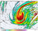
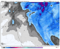
nam coming in way north through 15 hours compared to 6z run
it looks like it goes from atlanta to macon to savannah.Good morning, all.
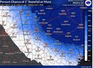
I wake up a bit aggravated for N. Georgia this AM. The overnight models have ticked east with the precip here rather than an expansion westward as hoped for. At this point, while I'd love to see a reversal of this overnight trend to bring Atlanta better into the game, now I'm hoping we don't lose this any further east. The hoped-for west-central Tennessee to Macon track of the 500MB now appears completely off the table.
Hopefully, trends come back westward today now that the main players are well within the ROAB network.


Actually looks like it ticked a little west, noise at this point.nam coming in way north through 15 hours compared to 6z run
This upper low is projected to be a top tier lowest heights record challenger though. 20:1 ratios being thrown around thru the forecast offices even in Charleston stillSimilar events with high ratio snows in Raleigh produced 12:1 and 15:1. Not sure last time Raleigh had a 20:1 ratio snow but I know we just generally accept that it’s happening for this event.
Both Jan and event were cold upper lows too.
View attachment 191735
HRRR has the meso low deformation band right over MBY, as opposed to the model consensus that the feature is further east. It puts down 6" here in an incredibly narrow path. Talk about a nail-biter!6z HRRR has some decent snow into Atlanta proper, 2" type deal - 0z had almost nothing.

Picture pleaseThey’re showing the in-house model on wyff and it’s absolutely murdering the upstate. Looks way more intense than the hrrr

Heck yeah. Enjoy and be safe brother.NWS calling for 3-7 tonight and 3-7 tomorrow for us just outside of Gatlinburg. Still some snow on the ground from Sunday. Beautiful up here. Look forward to the OBS thread. Happy for Mitch and all the Carolina folks. View attachment 191704
Surprising on the NAM -- I'm only out to 24 hours, but the ULL looks to be slightly stronger and with slightly better tilt.Looks like the NAM and HRRR have trended further offshore and weaker with the coastal low so far on the 12z runs after steady improvements yesterday across most models.
That sweet, very narrow band over Walton, Barrow, Jackson and Banks counties is going to make a small number of people very happythis seems like a positive
View attachment 191720
Same here buddy. You can bet I screenshot this when I first saw it this morning.Don’t see something like this very often around here. Looking forward to this weekend.View attachment 191706
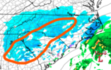
Those bands that it’s setting up just to east and southeast of CLT early tomorrow morning look intense. Perhaps some thundersnow with those?

It's occluding. Just sat there for 6 hours while deepening about 7 mbAnd now the coastal low is looking better. I may have been hasty in my previous comment.

