WxBlue
Meteorologist
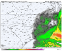
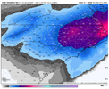
look at that bottom graphic. Lighting up across the upstateGood or bad for the upstate?
Sent from my iPhone using Tapatalk
At that frame, -SN extends as far inland as basically Hillsborough still.Final (still going in ENC) View attachment 191620


Isn't this 3 hours before the end?
Thanks for catching that! I didn't realize the radar panels were not loaded for hr 48 yet in my excitement! I replaced it with the hr 48 panel (which still has snow to Hillsborough).Isn't this 3 hours before the end?
That’ll do it. Mid level warm front trending north. Wonder how far this goes View attachment 191628View attachment 191629View attachment 191630
That’ll do it. Mid level warm front trending north. Wonder how far this goes View attachment 191628View attachment 191629View attachment 191630
The further north it goes the more widespread and intense the initial precipitation is gonna beIt may not be done trending north and west
Sent from my iPhone using Tapatalk
Yeah, concerning for SE NC and NE SC who are dealing with a lot of P-type issues that aren’t expected. Warm nose always wins? Hopefully not for their sake, although one man’s trash is another man’s treasure.That’ll do it. Mid level warm front trending north. Wonder how far this goes View attachment 191628View attachment 191629View attachment 191630

Dry bias since the updatestill think the NAMs are to dry here, especially for the western areas
Yeah, as great as this run is for the Triangle, it’s a disaster for Charlotte. Seems unlikely.still think the NAMs are to dry here, especially for the western areas
That’s a strange one… something seems off here View attachment 191634View attachment 191635
Have a feeling this is about to fill in to match consensus View attachment 191640View attachment 191641
But it’s strange how most other modeling makes it work with both except for the NAMs. Something to keep a eye on I guessYea not a fan of how we’ve started to go back to the Dominant Coastal weaker ULL look Fro….. we can’t score from that back our way
Sent from my iPhone using Tapatalk

