-
Hello, please take a minute to check out our awesome content, contributed by the wonderful members of our community. We hope you'll add your own thoughts and opinions by making a free account!
You are using an out of date browser. It may not display this or other websites correctly.
You should upgrade or use an alternative browser.
You should upgrade or use an alternative browser.
Wintry Machine Learning Mauler 1/30-2/1
- Thread starter SD
- Start date
How would you rank them in reliability
John1122
Member
I've been looking into what makes up the NBM, I was surprised that it uses old data, the 18z was using the 0z Euro ens individual members for instance. It also uses a ton of bad models at range, like the NAM nest cams, the RAP, and the HRRR for 42 hr 6hr snowfall for instance. It doesn't use the OP Euro at all that I could find.Super confused by this as well. I would expect the National Blend of Models to more or less reflect the models I see, but it often doesn’t seem to. Also, what is the difference between the NBM and the Parallel NBM?
All modeling shows me with 3 to 5 inches as of 18z. The NBM shows me with 1/2 inch. It's a very odd tool and the NWS here seems to rely on it exclusively to make their forecast.
“Nowcasting” a ULL dropping down from the north is the king of all nowcasting hallucinations. You swear it’s going west, then you swear it’s going south, only to find out it was a wobble. Lol!IMHO - “Nowcast” seems to be overused quite a bit with systems, but with this storm…we can expect that things change frequently up to and throughout the event. These are fairly dramatic jumps for specific locations run to run regardless of models.
rburrel2
Member
3km nam carries the meso low to the coast dumping snow along the way… it’s happened before.
I kind of have a hunch the models are slowly seeing this process. Instead of a typical north trend, we will see the models continue with a west trend, pulling the low closer to the coast. This should bring the heavier precip further west, similar to Jan 2000. Of course, this only happens if the better west trend of the upper low and more negative tilt continues.Damn thats actually eerily similar to the instant occlusion of Jan 2000, just further south
Last edited:
Outdated info, @bouncycorn can shed light on this and has numerous times actually. My understanding it does include all globals, CAMS and if I'm not mistaken NWS models or data that is not readily available to the public. But the reason it gets so much attention is NWS offices mention it often in their AFD and rely heavily on in for their forecastI've been looking into what makes up the NBM, I was surprised that it uses old data, the 18z was using the 0z Euro ens individual members for instance. It also uses a ton of bad models at range, like the NAM nest cams, the RAP, and the HRRR for 42 hr 6hr snowfall for instance. It doesn't use the OP Euro at all that I could find.
All modeling shows me with 3 to 5 inches as of 18z. The NBM shows me with 1/2 inch. It's a very odd tool and the NWS here seems to rely on it exclusively to make their forecast.
At 12z runs tomorrow…3km will carry more weight with me. Then probably NAM. I havent used the FV much.How would you rank them in reliability
iGRXY
Member
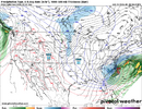
Another big increase on the ICON
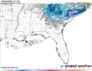
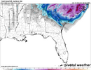
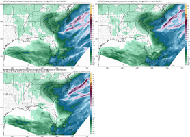
What is this? Genuinely have no clue what model this is.HRW-WRF-NSSL is basically the opposite of the NAM 3km with very patchy and light anemic precip returns, but instead the snow totals are much higher
View attachment 191524
View attachment 191525
Stormsfury
Member
The FV3 in summer can overblown convection, once in awhile it does well.At 12z runs tomorrow…3km will carry more weight with me. Then probably NAM. I havent used the FV much.
RGEM still looks pretty good to me. I tend to trust it a bit more at current range vs NAMs. Not saying it has the final answer, just a thought
Thrasher Fan
Member
The ICON ICON'd. lol
iGRXY
Member
Absolutely smoked
Mpirone12
Member
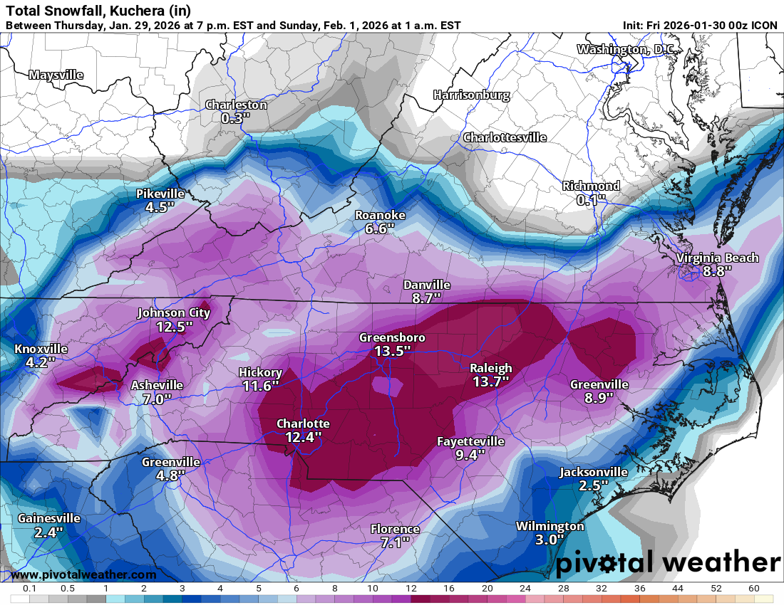
Absolutely smoked
At this point I don’t even know what to believe. This is crazy man

Sent from my iPhone using Tapatalk
John1122
Member
You can look at the NBM Dashboard. It lists no OP Euro that I see, and 0z Euro ens members, and 6z GEFS ens members for 18z.Outdated info, @bouncycorn can shed light on this and has numerous times actually. My understanding it does include all globals, CAMS and if I'm not mistaken NWS models or data that is not readily available to the public. But the reason it gets so much attention is NWS offices mention it often in their AFD and rely heavily on in for their forecast
Model Date Cycle Projection Valid Date
ECMWFE P1 20260129 0 60 2026013112
GEFS P27 20260129 6 54 2026013112
GEFS P26 20260129 6 54 2026013112
GEFS P25 20260129 6 54 2026013112
GEFS P24 20260129 6 54 2026013112
GEFS P23 20260129 6 54 2026013112
GEFS P22 20260129 6 54 2026013112
GEFS P21 20260129 6 54 2026013112
GEFS P20 20260129 6 54 2026013112
GEFS P2 20260129 6 54 2026013112
GEFS P28 20260129 6 54 2026013112
GEFS P19 20260129 6 54 2026013112
GEFS P17 20260129 6 54 2026013112
GEFS P16 20260129 6 54 2026013112
GEFS P15 20260129 6 54 2026013112
GEFS P14 20260129 6 54 2026013112
GEFS P13 20260129 6 54 2026013112
GEFS P12 20260129 6 54 2026013112
GEFS P11 20260129 6 54 2026013112
GEFS P10 20260129 6 54 2026013112
GEFS P1 20260129 6 54 2026013112
GEFS P18 20260129 6 54 2026013112
GEFS P29 20260129 6 54 2026013112
GEFS P3 20260129 6 54 2026013112
GEFS P30 20260129 6 54 2026013112
SREF ARW P6 20260129 3 57 2026013112
SREF ARW P4 20260129 3 57 2026013112
SREF ARW P3 20260129 3 57 2026013112
SREF ARW P2 20260129 3 57 2026013112
SREF ARW P1 20260129 3 57 2026013112
SREF ARW N6 20260129 3 57 2026013112
SREF ARW N4 20260129 3 57 2026013112
SREF ARW N3 20260129 3 57 2026013112
SREF ARW N2 20260129 3 57 2026013112
SREF ARW N1 20260129 3 57 2026013112
RAPX 20260129 15 45 2026013112
NAMH 20260129 12 48 2026013112
HRRRX 20260129 12 48 2026013112
HIRESW FV3 20260129 12 48 2026013112
GFS 20260129 6 54 2026013112
GEFS P9 20260129 6 54 2026013112
GEFS P8 20260129 6 54 2026013112
GEFS P7 20260129 6 54 2026013112
GEFS P6 20260129 6 54 2026013112
GEFS P5 20260129 6 54 2026013112
GEFS P4 20260129 6 54 2026013112
ECMWFE P9 20260129 0 60 2026013112
WRF ARW 20260129 12 48 2026013112
ECMWFE P8 20260129 0 60 2026013112
ECMWFE P6 20260129 0 60 2026013112
ECMWFE P28 20260129 0 60 2026013112
ECMWFE P27 20260129 0 60 2026013112
ECMWFE P26 20260129 0 60 2026013112
ECMWFE P25 20260129 0 60 2026013112
ECMWFE P24 20260129 0 60 2026013112
ECMWFE P23 20260129 0 60 2026013112
ECMWFE P22 20260129 0 60 2026013112
ECMWFE P21 20260129 0 60 2026013112
ECMWFE P20 20260129 0 60 2026013112
ECMWFE P29 20260129 0 60 2026013112
ECMWFE P2 20260129 0 60 2026013112
ECMWFE P18 20260129 0 60 2026013112
ECMWFE P17 20260129 0 60 2026013112
ECMWFE P16 20260129 0 60 2026013112
ECMWFE P15 20260129 0 60 2026013112
ECMWFE P14 20260129 0 60 2026013112
ECMWFE P13 20260129 0 60 2026013112
ECMWFE P12 20260129 0 60 2026013112
ECMWFE P11 20260129 0 60 2026013112
ECMWFE P10 20260129 0 60 2026013112
ECMWFE P19 20260129 0 60 2026013112
ECMWFE P3 20260129 0 60 2026013112
ECMWFE P30 20260129 0 60 2026013112
ECMWFE P31 20260129 0 60 2026013112
ECMWFE P50 20260129 0 60 2026013112
ECMWFE P5 20260129 0 60 2026013112
ECMWFE P49 20260129 0 60 2026013112
ECMWFE P48 20260129 0 60 2026013112
ECMWFE P47 20260129 0 60 2026013112
ECMWFE P46 20260129 0 60 2026013112
ECMWFE P45 20260129 0 60 2026013112
ECMWFE P44 20260129 0 60 2026013112
ECMWFE P43 20260129 0 60 2026013112
ECMWFE P42 20260129 0 60 2026013112
ECMWFE P41 20260129 0 60 2026013112
ECMWFE P40 20260129 0 60 2026013112
ECMWFE P4 20260129 0 60 2026013112
ECMWFE P39 20260129 0 60 2026013112
ECMWFE P38 20260129 0 60 2026013112
ECMWFE P37 20260129 0 60 2026013112
ECMWFE P36 20260129 0 60 2026013112
ECMWFE P35 20260129 0 60 2026013112
ECMWFE P34 20260129 0 60 2026013112
ECMWFE P33 20260129 0 60 2026013112
ECMWFE P32 20260129 0 60 2026013112
ECMWFE P7 20260129 0 60 2026013112
WRF MEM2 20260129 12 48 2026013112
Best ICON run by far.
Absolutely smoked
JWaterman
Member

Absolutely smoked
Have I mentioned how much I love the ICON? Definitely didn’t say it was trash a few days ago. Nah for sure wasn’t me
Sent from my iPhone using Tapatalk
Stormsfury
Member
Bigedd09
Member
RGEM much better as well. I’d take surface precip rgem at this range over the NAM any day of the week just imo
Sent from my iPhone using Tapatalk
Sent from my iPhone using Tapatalk
iGRXY
Member
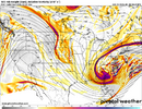
Icon is very similar to the GFS/EURO at H5. You’re slowly seeing the short range models go that way little by little each run. It won’t be long until we are likely getting to the consensus the globals are showing
wow
Member
RGEM going neg... Watch those rates explode
GSP @ 9:52pm
WHAT...Heavy snow possible. Total snow accumulations between 4 and 7 inches east of I-26. Total accumulations between 2 and 4 inches across the remainder of the area. Wind gusts of 25 to 35 mph.
WHAT...Heavy snow possible. Total snow accumulations between 4 and 7 inches east of I-26. Total accumulations between 2 and 4 inches across the remainder of the area. Wind gusts of 25 to 35 mph.
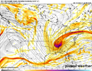
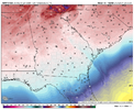
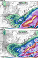
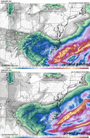
That’s just a thing of beauty right there. We just don’t see that look very often in the south.The RGEM might be trying to pull a rapid occlusion East of Charleston this time.
View attachment 191534
A 978 off Lookout?The RGEM might be trying to pull a rapid occlusion East of Charleston this time.
View attachment 191534
View attachment 191535
Mpirone12
Member
I will say despite the short range models discrepancies. The globals are starting to dial it in.
Sent from my iPhone using Tapatalk
Sent from my iPhone using Tapatalk
So far majority of Models pulled west some and had more expansive view even though NAM outputs of qpf are off...
If you look at the Relative Moisture for HRW WRF and NSSL you can see basically the outline of the snow output thru it
If you look at the Relative Moisture for HRW WRF and NSSL you can see basically the outline of the snow output thru it
Stormsfury
Member
On hr 48, it actually popped a new low east of Charleston after having one further north off ILM. Cyclonically looped.A 978 off Lookout?
John1122
Member
It was also severely outdated last storm. It kept showing 6-8 inches of snow over me long after all models that are actually useful showed the warm nose/ice meant no shot of that. It took 3 to 4 cycles for the NBM to actually catch up. Using that old data really holds it back. Wild that the 18z today was using the 0z Euro ens.Outdated info, @bouncycorn can shed light on this and has numerous times actually. My understanding it does include all globals, CAMS and if I'm not mistaken NWS models or data that is not readily available to the public. But the reason it gets so much attention is NWS offices mention it often in their AFD and rely heavily on in for their forecast
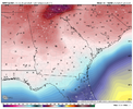
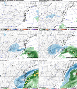
Maybe the only model with any direction right now. Doesn’t mean it’s right, but almighty give me SOMETHING to go off ofRGEM continues to improve..love to see thatView attachment 191539

