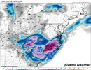
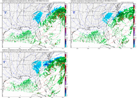
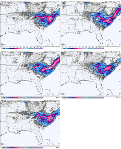
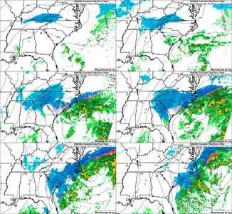
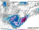
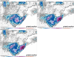
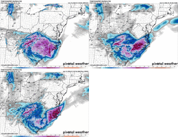
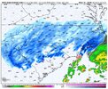
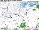
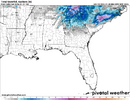
one reason the nam 3k totals are so low using kuchera is the fact that the nam is 5-7° warmer than consensus lol. literally has the piedmont west of charlotte at like 28-30 the entire time the heavy snow is falling. was also the warmest model last week so take that into consideration.
-
Hello, please take a minute to check out our awesome content, contributed by the wonderful members of our community. We hope you'll add your own thoughts and opinions by making a free account!
You are using an out of date browser. It may not display this or other websites correctly.
You should upgrade or use an alternative browser.
You should upgrade or use an alternative browser.
Wintry Machine Learning Mauler 1/30-2/1
- Thread starter SD
- Start date
It's trying. Again gradient with this one is going to be wild3k about to go wild in eastern NC
LovingGulfLows
Member
- Joined
- Jan 5, 2017
- Messages
- 1,499
- Reaction score
- 4,100
3KM NAM reflects these super impresssive precip shields then output the most unimpressive QPF totals. It's really weird.
BrickTamland
Member
NAM and 3K both cranking in NC.
SnowDeac
Member
This is gonna be the kiss of death. Short range models not looking near as promising so far!0z NBM…CLT couldn’t screw this up if they wanted. They getting a foot+ easy…
View attachment 191470
iGRXY
Member
We aren’t in their range yetThis is gonna be the kiss of death. Short range models not looking near as promising so far!
Well that makes a lot of sense. I wonder what makes it so run so much warmer than other models.one reason the nam 3k totals are so low using kuchera is the fact that the nam is 5-7° warmer than consensus lol. literally has the piedmont west of charlotte at like 28-30 the entire time the heavy snow is falling. was also the warmest model last week so take that into consideration.
3k has pulled the coastal low back a good 200 miles SW since it's 12z run.It's trying. Again gradient with this one is going to be wild
Did we get any total maps from the 3k NAM? Curious since you said it was smoking the upstate.We aren’t in their range yet
Can you drop some maps Brick?NAM and 3K both cranking in NC.
HailCore
Member
I was just remarking at that. As many have pointed out, the temps are somewhat reducing the kuchera ratios, but with the reflectivity and relatively moist air/small dry layer to overcome, those totals would probably be 1.5 to 2 times what is shown there if that expansive precip shield actually formed.3KM NAM reflects these super impresssive precip shields then output the most unimpressive QPF totals. It's really weird.
- Joined
- Jan 23, 2021
- Messages
- 4,596
- Reaction score
- 15,184
- Location
- Lebanon Township, Durham County NC
FV3 is an easy foot here
If you watched the FFC briefing today, this is looking more like option #3 on the ULL track. Hello?!Nice. Another 50-100 miles further west with this same look and all of N. Georgia will be a winter wonderland. Not too shabby as is, btw.View attachment 191500
BrickTamland
Member
wow
Member
every model is basically just alternating sides of the Carolinas to utterly paste
All I am going to say is some of our best snows have come at the last minute when no one thought it was happening lol. Just two days ago the locals were like, not happening.... today..... different tune. LOL. It is reassuring to see the data trending toward giving us at least an inch. I'm thinking 1-3" is a good roundabout idea for ATL. We'll see how it shakes out though! What a fun few weeks of tracking(even if I have been mute). Either way, the prolonged cold this weekend is going to be a doozy!
BrickTamland
Member
NWG_WX14
Member
A few more trends like this and the coastal is going to really go boom over ENC
It scares me that the 18z op euro was so bad so far the hrrr, 12k, 3k, and fv3 were A+Just slight changes
View attachment 191512
I don’t see how the eastern coastal plain of NC doesn’t get smoked here
Sctvman
Member
12z Euro is about 30-40 miles west with the SLP off of HAT at 12z Sunday compared to 0z 3k NAM, Euro is also 4mb deeper at 972. Compared to the 0z 12k NAM, the Euro was about 60-80 miles west, same pressure though of 972mb, again 12z Sunday. With blowing and drifting, travel in Eastern NC is looking particularly challenging Sunday morning.
I know there is a Raleigh bias here but I believe it is going under discussed that we are within 60 hours in and a growing consensus of models give those along and east of 17 a top 5 all time event
Yeah, I saw it. I still want it to be a bit further west. The NAM 500MB ULL track was closer to the AIGFS track from multiple runs, but still east of its positions. So, it has room to do better.If you watched the FFC briefing today, this is looking more like option #3 on the ULL track. Hello?!
Stormsfury
Member
Damn thats actually eerily similar to the instant occlusion of Jan 2000, just further south3k..sexy View attachment 191510
One more tick west and that pink blob lollipop, that was on obx, that now resides in wake county, will be over here.Dont pay attention to the numbers but the SW trend. SC and GA getting more in it.
View attachment 191506
@kyllo, send the Nam couisins to the transfer portal. Name FV3 starting QB
How much further west could that moisture from the coastal actually get. Could it actually get as far west as the Triangle?A few more trends like this and the coastal is going to really go boom over ENC
Somebody has got to get the dry slot.Just slight changes
View attachment 191512
IMHO - “Nowcast” seems to be overused quite a bit with systems, but with this storm…we can expect that things change frequently up to and throughout the event. These are fairly dramatic jumps for specific locations run to run regardless of models.
I’m just a guy but NAM looked like an early nod toward the EURO at the surface
Super confused by this as well. I would expect the National Blend of Models to more or less reflect the models I see, but it often doesn’t seem to. Also, what is the difference between the NBM and the Parallel NBM?What models and/or data are in the NBM that causes it to consistently show the snow further north like this. It hasn't wavered
View attachment 191501
mudaddict
Member
Must be the lightest snow ever back in middle tn... shows snow there for 18hrs and only 1 inch..ill be happy with any amount though0Z 3K NAM KucheraView attachment 191513
HailCore
Member

