• Hello, please take a minute to check out our awesome content, contributed by the wonderful members of our community. We hope you'll add your own thoughts and opinions by making a free account!

Pattern NC Only Thread

RDU westward, especially Clt down into upstate SC, ULL gonna do work. East of RDU we need the coastal, I'm northern fringe and again gonna be a corridor of disappointment somewhere around I-95 to US 1.
How do you think huntersville looks? Maybe too far north?
 
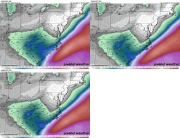
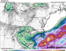
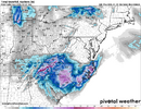
For central and northeastern NC, it may come down to what we get from the initial band of precip that comes through on Friday night. The NAM, RAP, and HRRR all show this band coming through before it breaks up and re-generates southwest of us. Of course, the 3k NAM says no to this as well.
 
Yeah, not gonna lie, I am a bit nervous. I feel pretty good about a warning criteria snowfall, but it might be more in the 2-4" range and not the memorable totals I was hoping for. For you, it's even more uncertain, although you also have some extreme boom potential as we've seen in some modeling.
 
For central and northeastern NC, it may come down to what we get from the initial band of precip that comes through on Friday night. The NAM, RAP, and HRRR all show this band coming through before it breaks up and re-generates southwest of us. Of course, the 3k NAM says no to this as well.
Once all the 12z globals are in we'll have an idea about the precip totals and 'dry slotting' set up consistency I suppose. Then might be having to wish for overperformers? Keep forgetting though we still have a good 24-36hrs or so of modeling to go after that.
 
Once all the 12z globals are in we'll have an idea about the precip totals and 'dry slotting' set up consistency I suppose. Then might be having to wish for overperformers? Keep forgetting though we still have a good 24-36hrs or so of modeling to go after that.
I'm not sure we'll know for sure where the dry slotting will fully set up until the storm is nearly over. Going to be a real wild card. Of course, modeling can give us an idea but that stuff seems unpredictable.
 
I'm not sure we'll know for sure where the dry slotting will fully set up until the storm is nearly over. Going to be a real wild card. Of course, modeling can give us an idea but that stuff seems unpredictable.
I hear you but I look at diversity vs alignment. Trend seems to be a dry slot or low totals space somewhere on the field. Not to mention the total precip numbers are oddly trending down in many areas. Not everywhere though.
 
I hear you but I look at diversity vs alignment. Trend seems to be a dry slot or low totals space somewhere on the field. Not to mention the total precip numbers are oddly trending down in many areas. Not everywhere though.
I'm definitely worried for our backyards with regards to it. Seems if it sets up, it'll either be over us or close enough to us to cause a lot of concern.

Maybe I should stick with my original weekend plans of driving down to Charlotte, LOL. I'm just not sure how getting back on Sunday would be, and I was supposed to go down Saturday morning which wouldn't go well. And my friend was flying into Charlotte mid-day on Saturday, which seems unlikely to happen.
 
I'm not sure I could continue posting if that happened. December 2000-esque fail after seeing those 8-12" / 12-18" maps from RAH WFO.

The UKMET has been pretty clueless with this system having huge swings, etc. so I am not too worried about it, but I don't like it at all.
 
Then we have the GEFS.....saying it's a std precip field hit like a coastal low should perform. :p
 
Back
Top