-
Hello, please take a minute to check out our awesome content, contributed by the wonderful members of our community. We hope you'll add your own thoughts and opinions by making a free account!
You are using an out of date browser. It may not display this or other websites correctly.
You should upgrade or use an alternative browser.
You should upgrade or use an alternative browser.
Wintry Machine Learning Mauler 1/30-2/1
- Thread starter SD
- Start date
packfan98
Moderator
whatalife
Moderator
Bigedd09
Member
Brad P said ratios look like they’ll be 17:1
Sent from my iPhone using Tapatalk
Ive seen printed ratio on the 06GFS as high as 26:1 on the Bufkit out of khky (Hickory)Brad P said ratios look like they’ll be 17:1
Sent from my iPhone using Tapatalk
iGRXY
Member
Most model guidance has along and west of Highway 25 in the upstate getting at least 0.4” of liquid. Using Brad’s 17:1 ratio that’s almost 7”. I still think we will uptick the QPF like the AIGFS shows and you can see the higher resolution of the euro picking up on my leeside enhancement so totals are starting to tick up to 0.5”. I also tend to think imby we could be closer to 20:1 ratios. Somewhere between 6-10”+ feels reasonable right now
packfan98
Moderator
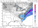
Starting to get in range of the NWS Winter Graphics. This map is the forecast through Saturday morning at 7am. Should be much more after that.

Can you drop a link to the graphics page I can’t find it, thanks!Starting to get in range of the NWS Winter Graphics. This map is the forecast through Saturday morning at 7am. Should be much more after that.

ForsythSnow
Moderator
Seeing both the RGEM and NAM with huge precip shields makes me wonder if the globals are underdoing the extent of the moisture. Have to watch to see if they both hold their ground and if others follow suit especially the SR models as we get closer.
I think Brad was averaging things out for his area. Looking at soundings, I think 25:1 is certainly possible for areas under and just to the north of that ULL.Ive seen printed ratio on the 06GFS as high as 26:1 on the Bufkit out of khky (Hickory)
packfan98
Moderator
HERE YOU GO for your NWS OutletCan you drop a link to the graphics page I can’t find it, thanks!
wow
Member
Looks like we have a fairly broad agreement with models with regard to the track of the ULL at this time. If this holds, then it comes down to the last minute adjustments... Strength of the ULL and how quickly it can go neg and cut off. That will determine if this one goes full blast, esp for central and eastern parts of NC and points NE.
Shaggy
Member
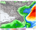
Again this is what people want to see. The low track is fine leave it alone but let the models play catchup on qpf.Nice increase View attachment 190488
rburrel2
Member
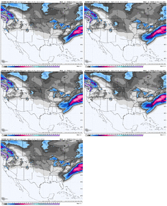
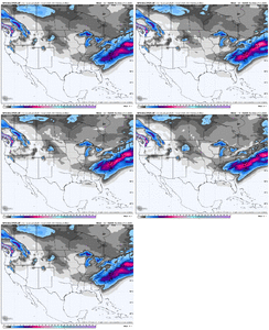
Here is where Clemson, SC stands on the 06z models:
| Model | Runtime | lead to start 7am Saturday | Kuchera snow | 10:1 Snow | Total liquid | Start time | end time | notes |
| Euro | 06z | 78hr | 4.6 | 2.8 | 0.28 | 5am Sat | 8pm Saturday | |
| Euro AI | 06z | 78hr | N/A | 3.8 | 0.4 | 1am Sat | 8pm Saturday | |
| GFS | 06z | 78hr | 5.2 | 4.5 | 0.47 | 8am Sat | 6pm Saturday | |
| GFS AI | 06z | 78hr | N/A | N/A | 0.47 | 7pm Friday | 9pm Saturday | |
| Rgem | 06z | 78hr | 3.2 | 2.8 | 0.28 | 4pm Friday | N/A | not finished, only through 1pm saturday |
| NAM | 06z | 78hr | 6.1 | 4.4 | 0.44 | 3am Saturday | N/A | not finished, only through 1pm saturday |
| ICON | 06z | 78hr | N/A | 1.4 | 0.19 | 8am Saturday | 3pm Saturday |
@griteater may be time to fire up the forecast contest thread
rburrel2
Member
NWS must be thinking 3:1 ratios are happening??? lolStarting to get in range of the NWS Winter Graphics. This map is the forecast through Saturday morning at 7am. Should be much more after that.

I'm sorry, but this is pathetic. It's just a wishcast for less snow essentially. no guidance supports this. Is it their job to mislead the public?
Edit: just saw it's only through 7am Saturday, so nevermind. Haha
That’s just thru 7am sat just getting startedNWS must be thinking 3:1 ratios are happening??? lol
I'm sorry, but this is pathetic. It's just a wishcast for less snow essentially. no guidance supports this.
Monitoring the evidence at hand and don’t want to jump the gun, but noted@griteater may be time to fire up the forecast contest thread
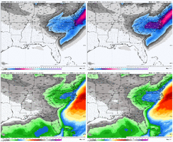
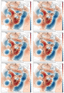
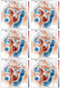
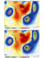
It looks to me like the key piece that is keeping the storm a bit south is the short term trend of the 50/50 Low near Newfound edging southwest (here on the EPS and GEFS)
View attachment 190489
View attachment 190491
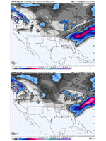
And some differences still at day 3 between GEFS/EPS...but we can see why the GEFS is more north. Be nice if they split the difference from here on in...
Cary_Snow95
Member
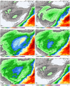
Seems orientation is changing a bit. The good thing is NC seems to be the pivot point.And can see the GEFS ticking north the past few runs...and you can argue the EPS is too
View attachment 190496View attachment 190497
Seems orientation is changing a bit. The good thing is NC seems to be the pivot point.
We typically see these modeled amped events tick NW at this range...it's rare, if ever, we see amped tick SE.
Im just hoping for 2-4" across central NC.
Cary_Snow95
Member
I’m with you. Then again nothing about this potential seems routine. I wouldn’t be surprised to get back more to a SSW to NNE orientation from Charlotte to RDU to VA BeachWe typically see these modeled amped events tick NW at this range...it's rare, if ever, we see amped tick SE.
Im just hoping for 2-4" across central NC.
Tsappfrog20
Member
I’m with you. Then again nothing about this potential seems routine. I wouldn’t be surprised to get back more to a SSW to NNE orientation from Charlotte to RDU to VA Beach
Completely agree with you although I do believe it will be a lot more for Central North Carolina
Sent from my iPhone using Tapatalk
rburrel2
Member
More amped could be bad for you if it shifts the dry slot between the ull and coastal to the West. I’d root for the coastal moisture staying in the outer banks and cash in on the .5-.75 liquid from the ull if I were you.We typically see these modeled amped events tick NW at this range...it's rare, if ever, we see amped tick SE.
Im just hoping for 2-4" across central NC.
Pretty much anything will be bad for us.More amped could be bad for you if it shifts the dry slot between the ull and coastal to the West. I’d root for the coastal moisture staying in the outer banks and cash in on the .5-.75 liquid from the ull if I were you.
But 6z Google running…say a prayer.
rburrel2
Member
Pretty much any outcome will be good for you, haha. Yall are locked in.Pretty much anything will be bad for us.
But 6z Google running…say a prayer.
But the “least good” scenario would be getting trapped in a dry slot with the coastal transfer. That’s the only way yall don’t hit 6 inches, imo. And you might still hit it even then.
As far as Euro precip hole downeast, not worried about that at all. If anything I worry more about warm air intrusion not precip with a bombing coastal.
Storm5
Member
Us in the west will take the 06z RGEM and NAM amd run for the hills . Light snow with temps in the 20s all day .
Believe this will be a better run for google. I'll let kylo post it when its done
Cary_Snow95
Member
By 00z tonight, short range models will be able to see the full storm
He's talking more his area under the ULL, that's very likely but not gonna be 17:1 everywhere. Closer you are to the coastal those ratios will decreaseBrad P said ratios look like they’ll be 17:1
Sent from my iPhone using Tapatalk
As far as Euro precip hole downeast, not worried about that at all. If anything I worry more about warm air intrusion not precip with a bombing coastal.
The effort required to drive rain back to our locations is greater than the effort required for this to be a total dud between US1 and 95 right now
Surface looked a lot like the RGEM from last night with precip firing west of the mountain chain and moving eastEnd of the NAMView attachment 190459
Showmeyourtds
Member
Based on overnight & 6z runs, looks like areas as far west as Atlanta could stand to see some mood flakes- perhaps even some instability snow showers with that ULL being nearby.
Ron Burgundy
Member
Dang - six contours within 10 miles of my house. Talk about a cutoff line…
Precip onset something like 06z Sat for western areas, 12-15z further east. 72 hours away

