-
Hello, please take a minute to check out our awesome content, contributed by the wonderful members of our community. We hope you'll add your own thoughts and opinions by making a free account!
You are using an out of date browser. It may not display this or other websites correctly.
You should upgrade or use an alternative browser.
You should upgrade or use an alternative browser.
Wintry Machine Learning Mauler 1/30-2/1
- Thread starter SD
- Start date
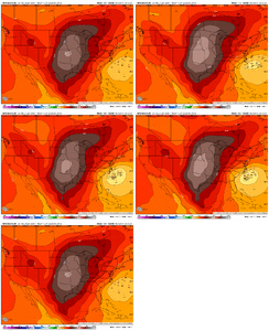
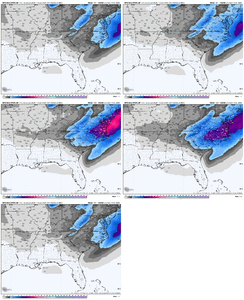
GEFS is gonna be an increase, there are several maulers in there, too bad its the GEFS
if i were a betting man (which i am, just ask fanduel), i would wager the euro capitulates modestly to the rest of the crowd, maybe getting the edge of the coastal snow shield to wilson. if its cohort even simply ticks east, then time to have a hard look in the mirror.Euro will be a super adult here & wiff but hopefully it at least stays the same or ticks back West.
BrickTamland
Member
It's pretty bad they can be so far apart this close.Recognizing there’s a lot that feeds into our models and lots of little things that have downstream implications. But isn’t it wild that we have such divergence in models that one shows 30” of snow and the other none less than 4 days out?
Snowflowxxl
Member
UK was embarrassingly bad at this range with the last event
BrickTamland
Member
UK and Euro are really the only ones that are that far east.I will say, its rather worrying that so many models are taking this OTS as we head into day 4. need trends to come back west before we lose the system, next 24 hours of runs could be the most crucial
Brandon10
Member
If Euro matches UKMET and ICON...I worry.
Trend on the Euro AI and WeatherNext are the most important IMO
Let’s remember the ICON was much improved compared to it 12z and 0z runs. Kinda surprised me that the UKMET did a complete whiff like that after the improvement the ICON madeIf Euro matches UKMET and ICON...I worry.
You are America's best attempt at an ensemble I need you to be in the ballpark at LEAST at this range. Good gracious
- Joined
- Jan 23, 2021
- Messages
- 4,596
- Reaction score
- 15,184
- Location
- Lebanon Township, Durham County NC
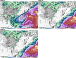
AIGFS has gone from .17 at 0z to .46 at 6z and now .65 IMBY at 12z.
AIEuro went from .5 at 0z to .65 at 6z.
AIEuro went from .5 at 0z to .65 at 6z.
The UKIE was worse. Too far east and it followed the Euro in that direction. At least the ICON stopped its eastward movement with the last run.
- Joined
- Jan 23, 2021
- Messages
- 4,596
- Reaction score
- 15,184
- Location
- Lebanon Township, Durham County NC
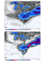
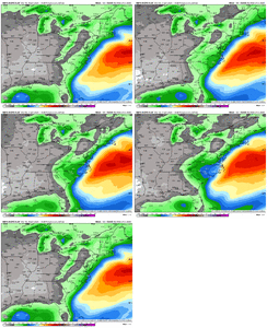
12z GEFS would imply a foot here with the ratios exhibited by the OP.
Webberweather53
Meteorologist
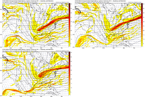
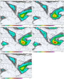
The GEFS is trending in the right direction with the slower wave and earlier tilt, still could afford some continued shifts in tilt.
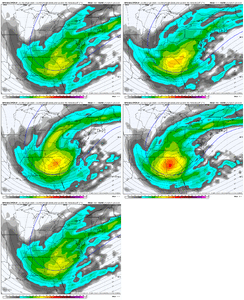
For Central NC, you need this upper wave to go neutrally tilted over roughly the I-65 corridor from about Huntsville to Nashville to maximize your potential out of this. That’s basically what the 12z GFS does
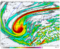
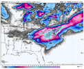
The CMC oth is a really good hit but the neutral tilt is a bit late over I-75 or Atlanta to Knoxville instead. Hence, our storm is a tad east as well.
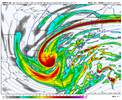
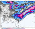

For Central NC, you need this upper wave to go neutrally tilted over roughly the I-65 corridor from about Huntsville to Nashville to maximize your potential out of this. That’s basically what the 12z GFS does


The CMC oth is a really good hit but the neutral tilt is a bit late over I-75 or Atlanta to Knoxville instead. Hence, our storm is a tad east as well.


iGRXY
Member
I really don’t know what to think at this point. Usually I’d say having the GEFS/CMC/GFS on your side isn’t the side you want to be on. Especially when it’s the EURO/EPS/UK. But then I think about how the UK just did a complete 180 in one model run and tbh I have not been impressed at all with it these last 2 storms. The one thing that gives me some optimism is the AI models are squarely in the GFS camp right now. We will wait to see if the AIFS switches but so far it’s been almost lock step on a significant winter storm.
bncho
Member
rburrel2
Member
We’ve got euro AI mean, gfs ai mean, and weathernext on our side, we good. The other stuff is mostly just noiseI really don’t know what to think at this point. Usually I’d say having the GEFS/CMC/GFS on your side isn’t the side you want to be on. Especially when it’s the EURO/EPS/UK. But then I think about how the UK just didn’t a complete 180 in one model run and tbh I have not been impressed at all with it these last 2 storms. The one thing that gives me some optimism is the AI models are squarely in the GFS camp right now. We will wait to see if the AIFS switches but so far it’s been almost lock step on a significant winter storm.
Tokenfreak
Member
Weathernext has been get less and less each run though.We’ve got euro AI mean, gfs ai mean, and weathernext on our side, we good. The other stuff is mostly just noise
rburrel2
Member
A little bit, sure. But it’s still giving a good snow to most and now aligns perfectly with the other ai models.Weathernext has been get less and less each run though.
And don’t expect continued weaker shifts. That’s why it’s the best. It won’t be way off of what it was showing yesterday. If anything I would guess it ticks back to more precip today.
Bigedd09
Member
Interesting. The last couple of storms the gfs has been on the south side of most models. Now this one it’s further north and west. Battle we got going. Definitely would love to see the euro trend more toward the gfs at 12z. But it normally follows the ukie more often than not
Sent from my iPhone using Tapatalk
Sent from my iPhone using Tapatalk
Tokenfreak
Member
Yeah we shall see. I hope you right. Guess we will see soon around the 12z run about 2pm.A little bit, sure. But it’s still giving a good snow to most and now aligns perfectly with the other ai models.
And don’t expect continued weaker shifts. That’s why it’s the best. It won’t be way off of what it was showing yesterday. If smithing is guess it ticks back some today.
The ukmet was the 1st model to trend way NW , along with canadian this past event. It then pivoted 180 back and had to regather and play catchup.Let’s remember the ICON was much improved compared to it 12z and 0z runs. Kinda surprised me that the UKMET did a complete whiff like that after the improvement the ICON made
It (ukmet) will be different at 0z tonight. guranteed.
Stormsfury
Member
Well, here's something quite similar to Dec 2010. If I recall correctly, that storm got lost and I mean completely lost for a day or two. Came back suddenly towards last minute go time. So much energy to resolve. Ukmet definitely took a huge step in the wrong direction. The GFS went nuclear. CMC moderated itself a bit.Euro will be a super adult here & wiff but hopefully it at least stays the same or ticks back West.
rburrel2
Member
Just my two cents, but it looks like any coastal enhancement will be too late except for maybe moyock/outerbanks.
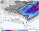
But we’re also coalescing on a nice upper level low snow with a max/jackpot centered around charlotte; with maybe as much as 1/2 inch of liquid there. And decent snows for everyone else in nc/sc too. And even northeast Georgia.
I’ll be shocked if we wind up with something at go time thats much different than that.
Ron Burgundy
Member
Brutal cutoff in NGA. Like being just outside the outer hurricane band
ColdAMO
Member
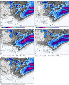
All of these maps are assuming 10:1 ratios? However I think we would be closer to 15:1 So we could add 40-50 percent to these maps?
Last edited:
rburrel2
Member
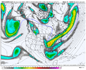
The trough broadening is hurting the coastal enhancement odds imo, but the stronger vort and better tilt is helping the upper low precip. Jives with the ai models.
The UK is very bouncy. It's not the one I'm concerned about. But we have to get WNxt and AIFS ENS back.
iGRXY
Member
Yes, but the UK has not been good this winter from what I’ve seen. And idk how I’d clsssify the euro. Still better than the gfs and cmc but even it isn’t what it used to be. It was entirely too flat with the first storm early in the month, its lack of ability to handle CAD made it one of useless this past weekend. The GFS did a lot better with thermals and p types.UK/Euro combo will be tough to beat--historically right?
The trough broadening is hurting the coastal enhancement odds imo, but the stronger vort and better tilt is helping the upper low precip. Jives with the ai models.
I don't know how much better it can get...it looks really good verbatim and brings snow to many on the board which is about all we can hope for.

