iGRXY
Member
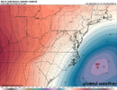
Not to dissimilar from it's 18z ensemblesUK day 5 looks legit on these coarse maps. I can’t keep my eyes open…off to bed
View attachment 189780


And we got Mitch involved. 1 more hair tick sw on the dig and be a lot of happy campers on this boardCarolina special
View attachment 189788
Heck, check out that little rotation on the upstate SC meso low. This is how the whole package should work, but with more intensified precip with the mesoscale models as we get closer in. Of course, it all hinges on getting the teardrop upper wave evolution rightGFS knows ball. looking at MSLP it’s a textbook miller AView attachment 189781

Rooting for a west trend myself here in NE TN but don’t wanna take anyone outView attachment 189790
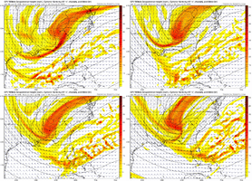
enjoying tracking the little southern portion of this wave and the trend of this outpacing the main trough. it looks like a gif from one run, no, it's a trend gif. i think this feature really helps pull our storm into negative tilt and explode
to me, still ample room to adjust west and get more people (ME) on the board here without sacrificing the coast. if i'm in wilmington, i feel good but i also know how tough it is to get snow at the coast
We’re close man. A December 2010 analog repeat would do us in the foothills wonders and get all the CarolinasAs a member who lives on the western side of the mountains in a bordering county (Sevier TN) this one has piqued my interest. Good luck to all you Carolina peeps! Trends are looking decent tonight

Yeah but would love for them all to keep ticking 40-50 miles like that it brings a whole lot more into the game while bombing CarolinaView attachment 189796
beautiful look
don't know where you're at in the cycle... i wouldn't say "much further", main vort lobe jogged about 40-60 miles NW. still in the "noise" range to me
Read these 3 paragraphs in write up following crusher. Kind of goes with your meso low annalysis above. How to keep the fire going, even though surface is low has passed us and off coast. Maybe the meso low, like an ULL can capture it feedback, prolong inland snow.Heck, check out that little rotation on the upstate SC meso low. This is how the whole package should work, but with more intensified precip with the mesoscale models as we get closer in. Of course, it all hinges on getting the teardrop upper wave evolution right
View attachment 189794

I'd sing it standing in the snow in my boxers and video it for all to see if this happensI would be willing to sing the Canadian National Anthem every night before going to bed if this happened
View attachment 189808
