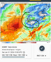
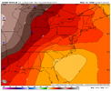
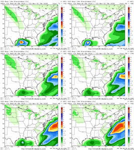
Yeah I recall Polk County/Paulding in areas had 3-5 inches of snow and then BRUTAL cold for several days. The roads were terrible and covered in several inches of melted and frozen Ice and power outages came day after the snow as the snow that melted weighed froze and weighed down lines and trees.This is not a picture of the February 12th 2010 snowstorm. That storm was an I-20 special.
AI Overview
On February 12, 2010,
a rare and historic winter storm brought heavy, wet snow to the Deep South and Southeast United States, contributing to a remarkable event where snow was on the ground in 49 of the 50 states simultaneously. The storm, which occurred during a strong El Niño, caused significant travel disruptions, power outages, and school closures across the region.
Regional Snowfall and Impacts (Feb 12-13, 2010)
Key Details
- South Carolina: Heavily impacted with 4–8 inches of snow, including 8.6 inches in Columbia, which was the city's 6th largest snow event. Over 1,500 auto accidents were reported, and 37,000 homes lost power.
- Georgia: A large swath of 3–6 inches fell across Central Georgia. Savannah recorded nearly an inch of snow.
- Alabama & Florida Panhandle: A "rare" heavy snow event occurred, with up to 7 inches in interior southwest Alabama and accumulating snow down to the Gulf Coast.
- Louisiana & Texas: Snow fell for over 12 hours in central Louisiana, with 1–4 inches of accumulation. In Texas, a record 12.6 inches fell in Dallas, and up to 20 inches in areas near the upper coast.
- Mid-Atlantic: This event was part of a series of storms in Feb 2010, often referred to as "Snowmageddon," which dropped 20+ inches in areas like Virginia and Maryland just days before this event.
- Timing: The heaviest snow fell from Friday evening, February 12, into Saturday morning, February 13.
- Conditions: The snow was described as very heavy and wet, causing widespread power outages from falling branches and tree limbs.
- Temperature: The storm was powered by cold arctic air, allowing for snow in southern regions that rarely see significant accumulation.
-
Hello, please take a minute to check out our awesome content, contributed by the wonderful members of our community. We hope you'll add your own thoughts and opinions by making a free account!
You are using an out of date browser. It may not display this or other websites correctly.
You should upgrade or use an alternative browser.
You should upgrade or use an alternative browser.
Wintry Machine Learning Mauler 1/30-2/1
- Thread starter SD
- Start date
rburrel2
Member
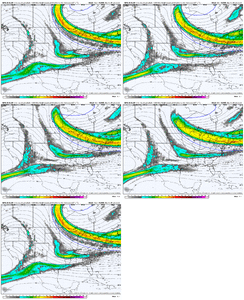
There’s gonna be one heck of a Lee-side trough Saturday morning. That’s a big reason we’re see the precip breaking out so well over the upstate. It’s like your typical Lee-side trough low level convergence except this time it also has upper level support from the vort max…. I’m honestly pretty high on this producing and possibly surprising some folks. My biggest concern is I think it will be very band-centric and feature winners and losers.
I also like that the progged convergence zone is more towards northeastern Georgia instead of the typical gsp/charlotte region. Thats why models get precip back in to Georgia before pivoting
I also like that the progged convergence zone is more towards northeastern Georgia instead of the typical gsp/charlotte region. Thats why models get precip back in to Georgia before pivoting
Last edited:
NCWeatherhound
Member
It's been a lonnnng time since I've seen an ensemble mean of 5+ inches for Fayetteville.
iGRXY
Member
Trying to forecast an ULL is very tough but it always comes with great rewards for areas that get under or just north of it. I think the upstate is sitting pretty as we stand right now. The ULL alone could drop easily 2-8"+ of snow west to east. Anything we could get from a coastal development is just money. I'd like to trend the ULL a bit more west (not much honestly) it would shift your area into the 2-6" range and my area in the 5-8"+ probabilities. right now that's sitting more along I77.There’s gonna be one heck of a Lee-side trough Saturday morning. That’s a big reason we’re see the precip breaking out so well over the upstate. It’s like your typical Lee-side trough low level convergence except this time it also has upper level support from the vort max…. I’m honestly pretty high on this producing and possibly surprising some folks. My biggest concern is I think it will be very band-centric and feature winners and losers.
Not another Baja LowI see some type of interacting with Baja low
Am I correct?
rburrel2
Member
rburrel2
Member
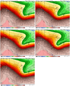
Even if this 5h trough doesn’t go negative and pinch off in time… I think you’re gonna see a nice swath of snow from northeastern Georgia and then swinging through South Carolina and all of North Carolina before exiting the coast…. You’ve got that lee-side enhancement and 850 low spinning, it will cook… and role east across the state, even without the bombogenesis miller A outcome.
iGRXY
Member
ICON similar to the 12z EURO. Less separation early from the 50/50
If I am looking at this correctly, N/S is further wesr this run. I don't see any interaction with the Baja low anymore (shocker when you need ). I am I seeing this right.
Does that mean the system gets started earlier??
iGRXY
Member
ULL is further north so it's a northeastern NC and VA hit
BrickTamland
Member
BrickTamland
Member
wow
Member
Icon was more east, less amped. NE weenies will not like.
Bigedd09
Member
Clear southeast trend today. Don’t think we’re gonna get a massive northwest trend with this one
Sent from my iPhone using Tapatalk
Sent from my iPhone using Tapatalk
The contrast in ocean temps just offshore and the contrast in air temps with the polar air mass coming in makes me really hope we can get things started south and early, even if it misses me east. We could really see some fireworks. The powder keg is loaded.
Did the southern wave suppressed or sheared off?
Too early to say IMHO!Clear southeast trend today. Don’t think we’re gonna get a massive northwest trend with this one
Sent from my iPhone using Tapatalk
CNCsnwfan1210
Member

Sent from my iPhone using Tapatalk
WEATHERBOYROY
Member
Was not the end result a north trend on the ICON?Clear southeast trend today. Don’t think we’re gonna get a massive northwest trend with this one
Sent from my iPhone using Tapatalk
jeremy.ashley79
Member
- Joined
- Jan 5, 2017
- Messages
- 8
- Reaction score
- 12
Is it 8pm when the next WeatherNext 2 run comes out?
Brandon10
Member
Definitely warmer air to about 95 on this run in NC. Showed rain to start before a transition east.
Tokenfreak
Member
Is it 8pm when the next WeatherNext 2 run comes out?
WeatherNext schedule (roughly)
12z becomes available around 2pm ET
18z becomes available around 8pm ET
00z becomes available around 2am ET
06z becomes available around 8am ET
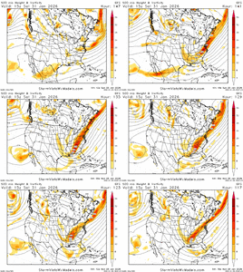
Brother I'll give you a dollar & a boiled hotdog if you include South Carolina towns in this.My current thoughts on this setup:
View attachment 189659
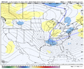
Here is a view of the potential Upstate SC Mesolow in this setup (kink in the isobars connecting to the surface low off the coast):
View attachment 189660
NBAcentel
Member
wow
Member
StormSurf
Member
Ill throw in some chips for a Roanoke.Brother I'll give you a dollar & a boiled hotdog if you include South Carolina towns in this.
Sorry about the banter
rburrel2
Member
rburrel2
Member
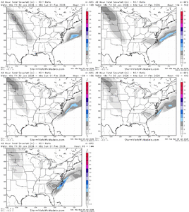
I’d cash out right now if I could! That’s 3-5 inches of dry powder for most of sc/nc.
jeremy.ashley79
Member
- Joined
- Jan 5, 2017
- Messages
- 8
- Reaction score
- 12
Thank you!WeatherNext schedule (roughly)
12z becomes available around 2pm ET
18z becomes available around 8pm ET
00z becomes available around 2am ET
06z becomes available around 8am ET
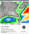
That's 3 days after the calendar start of spring lolConfidence is increasing in a winter storm this weekend according to KRDU although we may have to wait quite a while, 56 days to be exact.View attachment 189666
BrickTamland
Member
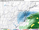
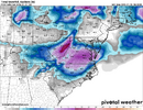
GFS looks like it is later than the ICON bringing the precip. Finally gets going at 123 when the ICON was going at 108.
Yep, shifting further south with our energy compared to 12Z
iGRXY
Member
BrickTamland
Member
GFS has snow moving up from GA, SC and NC coasts at 126.

