iwantsouthernsnow123
Member
Depends on where in Georgia, East and Northeast GA has a better shot at it.This was never going to be our storm in AL/GA....H5 is all wrong.
Depends on where in Georgia, East and Northeast GA has a better shot at it.This was never going to be our storm in AL/GA....H5 is all wrong.
They almost always do from what I've seen in these type events. Just north of where ULL comes thru gets a thump if I recall.Don’t sleep on the ULL/TPV extension for areas further west, esp WNC/upstate of SC. It could do some work here, Tropopause heights look ridiculously low this weekend under that as well
Euro AI ensemble and weathernext2 are pretty close as far as snowfall footprint imo.
Sent from my iPhone using Tapatalk
History and climo.I know we keep saying "Oh it'll trend NW" but by what mechanism exactly? Western ridge will soften or scoot to the west? N/S won't be as dominant?
I know we keep saying "Oh it'll trend NW" but by what mechanism exactly? Western ridge will soften or scoot to the west? N/S won't be as dominant?
It already has been trending N/NW.
The models are typically too far SE due to a bias. So, we’re betting the streak. How much more will they trend NW? Well, nobody knows as it depends on how much the models are still off from reality.
We've seen suppression evaporate snow chances in this range as well. All the times we saw a snowmap paint over central NC and the coastal plain only to have it completely offshore. Weathernext2 is not trending NW.
February 12th, 2010 has no precedent before this if anyone is interested. I remember researching that before doing prognostic discussion back then. Such an anomalously strong +AO push kept the players quite far south but also had a much earlier development. Low took shape in the Western Central Gulf, deepened a bit faster than models progged. This airmass is colder and considering what kind of snowpack we have after the past weekend storm, don't really think there will be major shifts, but minor adjustments as we progress.Cherry picking some of the CIPs analogs...these seem to do well for some of us in the past
View attachment 189625View attachment 189626
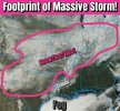
Brad P starting to notice.
February 12th, 2010 has no precedent before this if anyone is interested. I remember researching that before doing prognostic discussion back then. Such an anomalously strong +AO push kept the players quite far south but also had a much earlier development. Low took shape in the Western Central Gulf, deepened a bit faster than models progged. This airmass is colder and considering what kind of snowpack we have after the past weekend storm, don't really think there will be major shifts, but minor adjustments as we progress.
View attachment 189628
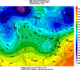
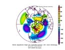
2/6/2010 was one of the two famous Mid-Atlantic "snowmageddon" storms of the 2010 season. The Triad actually got 2-4" from it before it changed over to rain. This was one of the most memorable storms to observe, even from afar.Dang...good catch. Yeah, huge blizzard for the mid-atlantic on 2/6. This potential looks close to 2/12/10...it was showing up on the analogs
View attachment 189633View attachment 189634
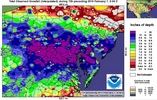
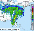
Any hints at a NW trend for us in Alabama?That EPS posted above is still all over the place. I am mainly speaking for those of us back to the west but there are whiffs, light events, and still a few big hitters. I think it is foolish to write it all off right now.
a long duration one at that. Atlanta would even do well....at least 3 or 4.And don’t forget that’s 10:1 ratios…. Whew. Crush job for SC/NC
I know Alabama isnt in the prime location to be but you shouldn't lump ga in with it. Every model but the ukmet gives ga accumulating snow.This was never going to be our storm in AL/GA....H5 is all wrong.
wow, that is a pretty big adjustment with ULL-forced snow and a decent move overall with the 4" probs, no?WeatherNext snowfall probabilities:
View attachment 189638View attachment 189639View attachment 189640
Are these probabilities calculated by taking the percentage of the ensemble members that dropped these snowfall totals at each location on the map?WeatherNext snowfall probabilities:
View attachment 189638View attachment 189639View attachment 189640
YesAre these probabilities calculated by taking the percentage of the ensemble members that dropped these snowfall totals at each location on the map?

James Spann's favortite model. Maybe he will mention it in his afternoon update.NBM Snowfall
View attachment 189632

Yup that looks right..me and burrel blanked...perfect


We’re in a good spot for this one I think; wide goal posts for a solid event. We can score 1-3 inches from the vort max pass without relying on bombing out/occlusion stuff.Yup that looks right..me and burrel blanked...perfect
If it stays locked in this far out id be shocked. Hopefully changes come and include some more folks on here

This is not a picture of the February 12th 2010 snowstorm. That storm was an I-20 special.February 12th, 2010 has no precedent before this if anyone is interested. I remember researching that before doing prognostic discussion back then. Such an anomalously strong +AO push kept the players quite far south but also had a much earlier development. Low took shape in the Western Central Gulf, deepened a bit faster than models progged. This airmass is colder and considering what kind of snowpack we have after the past weekend storm, don't really think there will be major shifts, but minor adjustments as we progress.
View attachment 189628
Good for folks to the west, correct?
I think stormfury's attached pic was the aftermath of the winter storm we had over the weekend, not 2.12.10This is not a picture of the February 12th 2010 snowstorm. That storm was an I-20 special.
AI Overview
On February 12, 2010,
a rare and historic winter storm brought heavy, wet snow to the Deep South and Southeast United States, contributing to a remarkable event where snow was on the ground in 49 of the 50 states simultaneously. The storm, which occurred during a strong El Niño, caused significant travel disruptions, power outages, and school closures across the region.
Regional Snowfall and Impacts (Feb 12-13, 2010)
Key Details
- South Carolina: Heavily impacted with 4–8 inches of snow, including 8.6 inches in Columbia, which was the city's 6th largest snow event. Over 1,500 auto accidents were reported, and 37,000 homes lost power.
- Georgia: A large swath of 3–6 inches fell across Central Georgia. Savannah recorded nearly an inch of snow.
- Alabama & Florida Panhandle: A "rare" heavy snow event occurred, with up to 7 inches in interior southwest Alabama and accumulating snow down to the Gulf Coast.
- Louisiana & Texas: Snow fell for over 12 hours in central Louisiana, with 1–4 inches of accumulation. In Texas, a record 12.6 inches fell in Dallas, and up to 20 inches in areas near the upper coast.
- Mid-Atlantic: This event was part of a series of storms in Feb 2010, often referred to as "Snowmageddon," which dropped 20+ inches in areas like Virginia and Maryland just days before this event.
- Timing: The heaviest snow fell from Friday evening, February 12, into Saturday morning, February 13.
- Conditions: The snow was described as very heavy and wet, causing widespread power outages from falling branches and tree limbs.
- Temperature: The storm was powered by cold arctic air, allowing for snow in southern regions that rarely see significant accumulation.
YesGood for folks to the west, correct?
