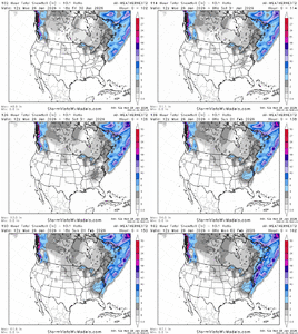
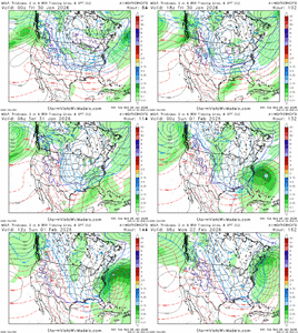
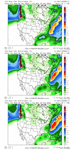
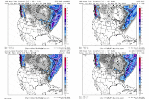
Still some misses in there but I count 30/50 members with at least 1’’ or more for MBY. Also it looks as if the misses are south and east.
-
Hello, please take a minute to check out our awesome content, contributed by the wonderful members of our community. We hope you'll add your own thoughts and opinions by making a free account!
You are using an out of date browser. It may not display this or other websites correctly.
You should upgrade or use an alternative browser.
You should upgrade or use an alternative browser.
Wintry Machine Learning Mauler 1/30-2/1
- Thread starter SD
- Start date
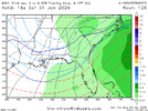
We’re already seeing gulf origins at a decent lead so I’m a bit more optimistic about the setup. Same caveats apply. There’s something we’re not seeing yet. Last system went from a long fetch overrunning look at this lead to early NW kicker wave interaction w SS wave leading to a big tilted mess. Same players on the field here. Fool me once shame on me. Fool me twice..wellEPS surface...day 4 gulf low. By tomorrow we will looking at that spot being only 60 hours out.
I could see this becoming a coastal hugger right over Carolina Beach to Morehead City
View attachment 189587
Yeah I’m quite certain that 40:1 ratios like I got with that storm is something I’ll never see here again. However looking at these soundings, I would say 15-20:1 would definitely be possibleI dont think we'll see 1/23/03 ratios but i think they'll be real nice if this scenario plays out.
Nice footprint spread of outcomes there. Should keep this interesting for several more cycles
Ron Burgundy
Member
wow
Member
Pretty high ceiling for precip amounts and rates dealing with bombogenesis this far south, especially if it can kick it up in the GOM. Then that tongue of snow will start further SW into GA/AL.
LukeBarrette
im north of 90% of people on here so yeah
Meteorology Student
Member
2024 Supporter
2017-2023 Supporter
Yeah it’s going to be a bit before we get this locked in.
Charleston also addressing the setup.
KEY MESSAGE 2: Very cold temperatures and the possibility of winter
weather could impact the region this weekend.
Beginning Friday, there is good model agreement (deterministic and
ensemble) that a sharp trough and developing closed low will dive
southwards out of the Great Lakes region. This upper low is expected
to steadily deepen as it pushes to the south, settling somewhere
across the Carolinas Saturday night into Sunday. At the surface,
arctic high pressure is expected to drop southward out of central
Canada and across the central CONUS. As this occurs, the
aforementioned upper low should drive surface low development
somewhere along or just off the Southeast coast Saturday and
Saturday night. The proximity of this developing low to the coast
would then have significant implications for the inland extent of
any precipitation development, as well as the potential for any
winter weather across southeast GA and southeast SC.
To be clear, this setup looks completely different compared to the
winter weather event across the region this past weekend. The upper
low and arctic surface front look to usher in an anomalously and
deeply cold airmass. In fact, the 26/00z NAEFS suggests the
potential for temperatures through the column on the order of 3 to 4
standard deviations below normal. There remains significant
uncertainty surrounding the surface low including the timing of its
development and proximity to the Southeast coast, all of which will
have crucial implications regarding the potential for winter weather
and its extent across the forecast area. However, there is enough
model support and consistency to warrant the inclusion of
precipitation chances across the entire forecast areas as well as
the mention of snow this weekend.
While the above forecast items remain low confidence, there is
relatively high confidence in a period of very cold temperatures
this weekend. Highs only in the 30s look increasingly likely
Saturday and Sunday, with Saturday night/Sunday morning lows dipping
well into the teens. Such values would be on the order of 20-25
degrees below normal for late January and early February. See the
Climate section below for a list of record low temperatures and
record low max temperatures.
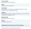
Also even down in KJAX, where they have small chances of wintry through much of N FL including chance of snow showers and ZR at JAX:
SATURDAY
MOSTLY CLOUDY IN THE MORNING, THEN BECOMING PARTLY
SUNNY. A CHANCE OF RAIN SHOWERS. A CHANCE OF SNOW SHOWERS IN THE
AFTERNOON. COOLER WITH HIGHS IN THE MID 40S. CHANCE OF
PRECIPITATION 40 PERCENT.
SATURDAY NIGHT
PARTLY CLOUDY IN THE EVENING, THEN CLEARING. A
SLIGHT CHANCE OF SNOW SHOWERS. A SLIGHT CHANCE OF RAIN SHOWERS IN
THE EVENING, THEN A SLIGHT CHANCE OF FREEZING RAIN AFTER
MIDNIGHT. COLDER WITH LOWS IN THE LOWER 20S. CHANCE OF
PRECIPITATION 20 PERCENT.
—————
PREDOMINANTLY COLD WEATHER CONDITIONS WILL CONTINUE THROUGH THE END
OF THE WEEK AND INTO THE WEEKEND WITH CHANCES FOR PRECIPITATION
FORECASTED TO INCREASE ON FRIDAY AND SATURDAY AS THE INFLUENCE OF
HIGH PRESSURE OVER THE REGION DIMINISHES AHEAD OF AN APPROACHING
COLD FRONT PRESSING IN FROM OUT OF THE NORTH.
This kind of has the mid Jan 1977 feel to it in FL, but that’s a very high bar that hasn’t been matched since.
55% with an inch or more. Not too shabby.6z WeatherNext2 meteogram for Kennesaw Georgia (KRYY). Just got this function working
View attachment 189606
Can you do the ATL airport sir? Thank you.6z WeatherNext2 meteogram for Kennesaw Georgia (KRYY). Just got this function working
View attachment 189606
That EPS posted above is still all over the place. I am mainly speaking for those of us back to the west but there are whiffs, light events, and still a few big hitters. I think it is foolish to write it all off right now.
Bhm discussion
Towards the end of the week, latest guidance suggests another Arctic
trough will rotate southeast across the Great Lakes region and phase
with a southern stream shortwave which will track along the northern
Gulf or Gulf Coast region. This evolution will need to be watched
for more winter mischief to our east/northeast across the Mid-
Atlantic region, but for now, our forecast features a low chance of
rain across southern portions of the area Friday night, followed by
another reinforcing shot of cold, dry air for the weekend.
RollTide18
Member
Mobile is watching
As we head through the rest of the week dry air will continue to
prevail with a cold airmass staying in place. Highs each day
remain in the upper 40`s to lower 50`s before taking another
nosedive this coming weekend into the 30`s and lower 40`s.
Overnight lows stay in the 20`s and 30`s each night, once again
potentially dipping into the teens over the interior this weekend.
The forecast remains dry late this week into this weekend for the
most part. There is a system that is being monitored on
deterministic and ensemble guidance that will largely hinge on
when and where the interaction of the northern stream and
subtropical jet shortwaves occurs. For now, guidance remains
suppressed and out of phase, shoving the southern stream system
well into the Gulf keeping most of the precipitation well away
from us. Something to monitor as we head throughout the rest of
this week. MM/25
SegTindoProWx
Member
Mobile is watching
There’s some hope…
Sent from my iPhone using Tapatalk
NCHighCountryWX
Member
- Joined
- Dec 28, 2016
- Messages
- 697
- Reaction score
- 1,914
We knew it LOL
Watch qpf maps/trends. Assuming we set synoptically at h5. If you can net.45-.5, qpf, your looking at seriously getting a double digit snowfall. As of right now subject to change but at 15:1 - 18:1 that should net you 10 inches of fluff.
Ceiling is getting closer to the .75 + qpf and having these ratios. Oh boy!
Ceiling is getting closer to the .75 + qpf and having these ratios. Oh boy!
rburrel2
Member
And don’t forget that’s 10:1 ratios…. Whew. Crush job for SC/NC
Won't this tend to drive the waa further inland?EPS surface...day 4 gulf low. By tomorrow we will looking at that spot being only 60 hours out.
I could see this becoming a coastal hugger right over Carolina Beach to Morehead City
View attachment 189587
rburrel2
Member
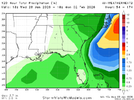
This is the way for the upstate.This run got a little drier on the coastal plain but more evident ULL action:
View attachment 189613
Looks like I'm around 35/50 depending on how much you squint at the panelsStill some misses in there but I count 30/50 members with at least 1’’ or more for MBY. Also it looks as if the misses are south and east.
Makeitsnow
Member
wow...that's a 36 hour snow over the interior.
Last edited:
Not the mama
Member
What are the odds this thing ticks NW?
blueheronNC
Member
Weathernext2 is pretty far offshore and has the main snow hit east of I-95. I wonder if we’re back to having to worry about suppression especially with the faster timing.
What are the odds this thing ticks NW?
I'm kind of sure the NW trend is done. Probably gonna see this hold steady or worse trend east.
Brad P starting to notice.
iwantsouthernsnow123
Member
By chance are you able to get this for the Toccoa GA Airport?6z WeatherNext2 meteogram for Kennesaw Georgia (KRYY). Just got this function working
View attachment 189606
It bumped (@jackendrickwxWeathernext2 is pretty far offshore and has the main snow hit east of I-95. I wonder if we’re back to having to worry about suppression especially with the faster timing.
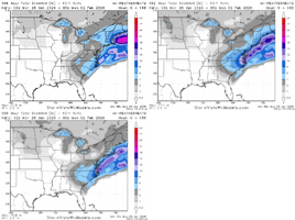
CNCsnwfan1210
Member
Euro AI ensemble and weathernext2 are pretty close as far as snowfall footprint imo.
Sent from my iPhone using Tapatalk
It's losing the GOM low to the south. I'm not a fan of that trend for Alabama and Georgia.
NBAcentel
Member
Don’t sleep on the ULL/TPV extension for areas further west, esp WNC/upstate of SC. It could do some work here, Tropopause heights look ridiculously low this weekend under that as well
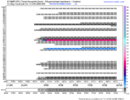 Half of the members with accumulating snowfall. Ain’t no way I can sleep on this. This is the best look I’ve see from the eps all winter for our area. I would obviously love the home run but give me a 1-2 inch event with these temps and I’ll be happy. I’d imagine a lot of these lighter members aren’t far off from more. We live to fight another day!
Long ways to go...It's losing the GOM low to the south. I'm not a fan of that trend for Alabama and Georgia.
Mahomeless
Member
This was never going to be our storm in AL/GA....H5 is all wrong.It's losing the GOM low to the south. I'm not a fan of that trend for Alabama and Georgia.

