-
Hello, please take a minute to check out our awesome content, contributed by the wonderful members of our community. We hope you'll add your own thoughts and opinions by making a free account!
You are using an out of date browser. It may not display this or other websites correctly.
You should upgrade or use an alternative browser.
You should upgrade or use an alternative browser.
Wintry Machine Learning Mauler 1/30-2/1
- Thread starter SD
- Start date
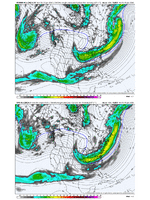
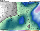
It will but you have to let the run finish or just after. Yeah, super annoying...and the 48hr, 120hr snow maps don't work.StormVista does this weird thing where it doesn't allow you to put the most recent weathernext QPF frame in a trend loop, so here is 0z for comparison:
View attachment 189432
rburrel2
Member
This is quickly looking like a lock for at least minor/moderate snow in the upstate. We should get something even with the less-amped solutions thanks to the Lee-side convergence zone as the vort passes overhead.
And the more-amped solutions are even better than that for us.
And the more-amped solutions are even better than that for us.
MichaelJ
Member
What models are not able to hone in at this point are things like Thermal profiles, placement of low and high pressure, track and timing. Looking at this synoptically, it seems this will come back some NW as we get closer to go time but how much is unknown. This will be determined by the movement of the high pressure to our North and the area where the cyclogenesus gets wound up. Even if it stays offshore (not too far) the precipitation field will expand further North and West than the models will show, happens every time.
Brandon10
Member
WeatherNext almost seems like a mix between the less amped GFS and the more amped EURO. Almost closer to the CMC.
Makeitsnow
Member
I would imagine those totals are underestimated over the Carolinas because ratios will be quite a bit higher than 10 to 1. Same goes for the ensembles
rburrel2
Member
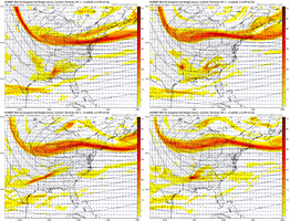
Biggest fail mode here is if the vort pass starts trending farther to the north. That’s bad for everybody except maybe the northeast.
Would be concerned if we see weathernext trend this way the next few cycles but so far so good. Insane we are 108-120hrs out and not 240+.Biggest fail mode here is if the vort pass starts trending farther to the north. That’s bad for everybody except maybe the northeast.
rburrel2
Member
I haven’t looked at the 5h maps, but this feels like it could be like the 2004 storm. Where you got a weak gulf low that gives 2-5 inches to Alabama/georgia, then a transfer to a coastal bomb that gives charlotte 2 feet… meanwhile my house gets a feather dusting.
Let’s hope it’s not that.
Edit: 5h pattern not all that similar
Let’s hope it’s not that.
Edit: 5h pattern not all that similar
packfan98
Moderator
Yeah, the two ways to fail is if the low sweeps out to sea quickly or if the northern stream is too far north and east and the storm doesn't get started far enough south. It would be a mid-Atlantic, Northeast deal.Biggest fail mode here is if the vort pass starts trending farther to the north. That’s bad for everybody except maybe the northeast.
Y’all are gonna wishcast this to rain here. But given the recent northerly trends with past storms, that was probably a given anyway.
Chattownsnow
Member
- Joined
- Jan 2, 2017
- Messages
- 1,566
- Reaction score
- 4,279
Man thats a big increase for the upstate!
iGRXY
Member
Yeah we are trending the vort into a better position out west, but it doesn’t need to go too far west either
- Joined
- Jan 2, 2017
- Messages
- 1,566
- Reaction score
- 4,279
Oh hell you had to mention that disaster. At first glance yesterday that's all I could think of..was actually scared to look this morning. But now I think we are o k for a light event at leastI haven’t looked at the 5h maps, but this feels like it could be like the 2004 storm. Where you got a weak gulf low that gives 2-5 inches to Alabama/georgia, then a transfer to a coastal bomb that gives charlotte 2 feet… meanwhile my house gets a feather dusting.
Let’s hope it’s not that.
Edit: 5h pattern not all that similar
JHS
Member
Oh yeah, that one was nasty for Oconee and Pickens counties. Little to nothing there, while I get 1 foot here and other parts of my county get 18+. I don't see it happening, but what this board needs is a Jan 1988 repeat. 95% of the board would be hit if that happened again. All the way from OK and TX to the Carolinas and VA.I haven’t looked at the 5h maps, but this feels like it could be like the 2004 storm. Where you got a weak gulf low that gives 2-5 inches to Alabama/georgia, then a transfer to a coastal bomb that gives charlotte 2 feet… meanwhile my house gets a feather dusting.
Let’s hope it’s not that.
Edit: 5h pattern not all that similar
Bigedd09
Member
Yall the weathernext model is pretty much locked in and that’s saying something as it was locked in on this weekends storm at this range. I think this will be a decent storm for many on this forum.
Sent from my iPhone using Tapatalk
Sent from my iPhone using Tapatalk
Chattownsnow
Member
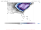
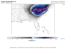
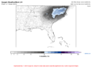
That is an amazing look for you guys west of here. I dream of heavy powder falling at 15 degrees6z WeatherNext snowfall probability thresholds.
WeatherNext is clearly a little under dispersed, but considering the run-to-run consistency and the track record, this is very high confidence from the model.
View attachment 189439View attachment 189440View attachment 189441
While this might not be an Alabama “Storm”, looks like we might get a bit of snow Northeast of I59-I20. Worth watching.
I encourage you to read closely the maps @bouncycorn just posted literally 3 posts before yours, 20 mins ago, and see if you can answer your own question. If you’re not sure where Atlanta is without labels, can pull up a county map on Google. Really helpful when reading weather maps to find your own county.Does this have any chance near atl at this point or mostly coastal?
LovingGulfLows
Member
- Joined
- Jan 5, 2017
- Messages
- 1,499
- Reaction score
- 4,100
Does this have any chance near atl at this point or mostly coastal?
There's definitely a chance for some snow in ATL-Athens corridor if there's earlier cyclogenesis in the gulf. WeatherNext kind of hints at this. You would need the northern stream to dig futher west and south.
blueheronNC
Member
Let’s be careful. It isn’t locked in until the precip and height fields stop bouncing around so much from run to run. It’s almost there but for the last storm it was only locked at 120 hours. I’d wait at least a day.Yall the weathernext model is pretty much locked in and that’s saying something as it was locked in on this weekends storm at this range. I think this will be a decent storm for many on this forum.
Sent from my iPhone using Tapatalk
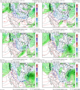
I mean precip is cranking in the gulf by hr 96, wow.The latest 06z WeatherNext Ens run was without a doubt the best one I've seen for the eastern / northeastern areas of the forum. The EPS and WNext are quite similar with the storm right now.....but where do we trend??
06z WeatherNext run…
View attachment 189446
View attachment 189447
Just just eyeballing the 6z Euro AI and trying to estimate what that looks like for GA specifically I-20 and then to East the most of this falls under very cold temps would be all snow and slightly better ratios. It's a 1-3 inch event for western counties and grows moving toward the Carolinas upward in totals

Cary_Snow95
Member
Grit, question--the orientation of this coastal NE->SW on its snow print looks kind of odd to me for storms that tend to form and move up the coast. What do you think is going on there?The latest 06z WeatherNext Ens run was without a doubt the best one I've seen for the eastern / northeastern areas of the forum. The EPS and WNext are quite similar with the storm right now.....but where do we trend??
06z WeatherNext run…
View attachment 189446
View attachment 189447
would you mind adding the aifs ens to this with similar parameters? curious what that story tells and if it's similar to weathernextGEFS v/s EPS v/s Google at day 5 out from yesterdays deal. I saw some questions on just how good was it for this past weekend...
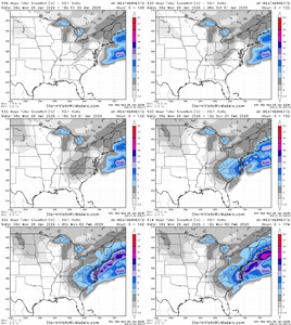
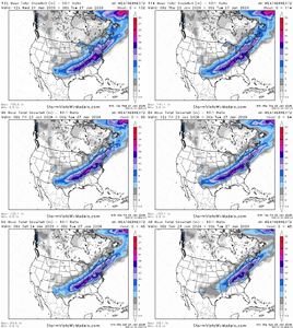
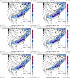
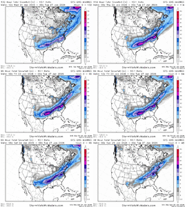
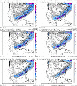
View attachment 189451View attachment 189452View attachment 189455
GEFS v/s EPS v/s Google at day 5 out from yesterdays deal. I saw some questions on just how good was it for this past weekend...
View attachment 189451View attachment 189452View attachment 189455
Will be a another good test, but this is much trickier IMO.
WolfpackHomer91
Member
No, IK it isn’t Set, but unless I see something other than a Bombing Coastal I’m not overly excited for Western Carolina’s. We need a traditional Gulf LP

Granted I’m speaking for I-77 an West / NW in SC / NC
Track A - Heavier Totals (Ride the Line of RN/SN in Miller A)
Track B - Moderate Totals (Far enough NW No Rain in Miller A)
Track C - Imo Too Far NW I’ve scraped a 1-3” out out of this but primarily a East of 77 event
Sent from my iPhone using Tapatalk
something must be done about AIFS snow mapsGEFS v/s EPS v/s Google at day 5 out from yesterdays deal. I saw some questions on just how good was it for this past weekend...
View attachment 189451View attachment 189452View attachment 189455
Just added to the original postwould you mind adding the aifs ens to this with similar parameters? curious what that story tells and if it's similar to weathernext
I am near ATL and I think this is a great look at this range. Though it is an even better look for the CarolinasDoes this have any chance near atl at this point or mostly coastal?
Yeah, for sure, we shouldn’t refer to them as snow maps. Really just frozen probability maps.something must be done about AIFS snow maps
Notice he went with the most northerly map looks. Who knows, he's maybe more right than wrong.What a relief...not sure who is better...BAM or Google.
Cary_Snow95
Member
Not necessarily. He moreso just used later frames of the runs which focus more on the northern areasNotice he went with the most northerly map looks. Who knows, he's maybe more right than wrong.

