• Hello, please take a minute to check out our awesome content, contributed by the wonderful members of our community. We hope you'll add your own thoughts and opinions by making a free account!

Wintry Jan 23-27 Winter Storm Obs

So is it safe to say “so far” (still awaiting kidney beans) this has been a meteorology anomaly and no model knew bow to handle it because the strength of the wedge was an exception to every single law of winter weather physics in the book?
Amen. A few years ago we had 3 mini-events on 3 consecutive weekends in CLT. Each was sleet-y and similar to the others. I would never expect to see today's event re-occur in my lifetime.
 
Is it gonna stay freezing as the line moves though east of atl?
Sure is looking like it. I fully expected to be warming ahead of this front. Instead, the temperature has been slowly falling over the past couple of hours and now is at the lowest reading during the ZR early this AM 27.9
 
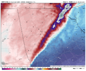
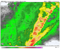
This is going to be fascinating to watch how it interacts with the wedge. wondering if a huge sleet bomb could happen like the 3km nam. One thing is for sure it would appear temps here at my local are going to be no better than 26 or 27. I'm assuming it warms a degree or two over the next hour or two but i'm starting to wonder. regardless the 3km nam is showing some localized cooling aloft at 925mb and even at 850mb...and 700 and 800mb though not as extreme..but it makes you wonder what could do under strongest areas of lift/dynamical cooling. Going to be cool to see what happens.

3km.png1km2.png
 
This is going to be fascinating to watch how it interacts with the wedge. wondering if a huge sleet bomb could happen like the 3km nam. One thing is for sure it would appear temps here at my local are going to be no better than 26 or 27. I'm assuming it warms a degree or two over the next hour or two but i'm starting to wonder. regardless the 3km nam is showing some localized cooling aloft at 925mb and even at 850mb...and 700 and 800mb though not as extreme..but it makes you wonder what could do under strongest areas of lift/dynamical cooling. Going to be cool to see what happens.

View attachment 189069View attachment 189070

I think there’s a real chance if you get under of of the more robust cells.


Sent from my iPhone using Tapatalk
 
This is going to be fascinating to watch how it interacts with the wedge. wondering if a huge sleet bomb could happen like the 3km nam. One thing is for sure it would appear temps here at my local are going to be no better than 26 or 27. I'm assuming it warms a degree or two over the next hour or two but i'm starting to wonder. regardless the 3km nam is showing some localized cooling aloft at 925mb and even at 850mb...and 700 and 800mb though not as extreme..but it makes you wonder what could do under strongest areas of lift/dynamical cooling. Going to be cool to see what happens.

View attachment 189069View attachment 189070
I've been at this hobby since 1963. This is unprecedented in my experience.
What's 700MB look like? Are we looking at short-term dynamic cooling with the squall line? Wow, just wow.
 
Just got back from a Short drive..

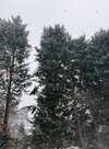
NICE Glazing of Ice on Pine Trees, about a couple hundreds? of a inch enough too start bending (smaller) branches..

Watching WHITE RAIN with heaver Precip & returns..

NWS & Models had a VERY Hard time under-estimating the strength of CAD & the cold..
Currently..

Mist/White Rain

33F

humidity 90%
dew point30.7ºh
rainfall 0.12"
 
I've been at this hobby since 1963. This is unprecedented in my experience.
What's 700MB look like? Are we looking at short-term dynamic cooling with the squall line? Wow, just wow.

I’m so intrigued. I have got out of the 20s, but have been firmly planted at 30.4 for a while now. Still have freezing drizzle falling.


Sent from my iPhone using Tapatalk
 
I've been at this hobby since 1963. This is unprecedented in my experience.
What's 700MB look like? Are we looking at short-term dynamic cooling with the squall line? Wow, just wow.
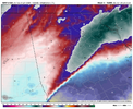
It's not as pronounced as below but who knows what would happen inside the heaviest cells. Heavy sleet certainly appears likely in the heaviest cells.

700.png
12nam.png
 
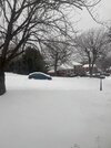
These heavy sleet showers are pretty cool. It pours sleet then quickly slows down, then a repeat.
 

Attachments

  • IMG_8911.jpeg
    IMG_8911.jpeg
    3.9 MB · Views: 28
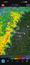
Can see the wind barbs change direction in west ATL metro as the squall line pushes through bringing some obs stations >32, but RT mesoscale analysis and ground observations show most of E/NE ATL still below freezing. Going to be wacky to watch as the front pushes in. And it’s moving quick. I honestly don’t think it’ll erode the CAD wedge enough…
 
514bc0957712e70379c551e45f7ebc99.jpg

Slightly nervous lol. 30.4 still and that line isn’t far away. Something’s gotta give.


Sent from my iPhone using Tapatalk
 
Still really struggling to rise above freezing as of 1 PM, but it does appear that I am about to lose my CAD influence.

That lengthy walk I took...good LORD was that miserable. I'm pretty sure I was colder than I was with 1/21/25. That goes to show you what cold+wet can do as the mist was enough to where I'd have had to use windshield wipers if I drove.
 
We might get a 25 degree bust on highs in CHS today. Inland areas barely above 32, downtown at 40 when highs were supposed to be around 60 late evening
 

Attachments

  • Screenshot_20260125_130220_Wunderground.jpg
    Screenshot_20260125_130220_Wunderground.jpg
    919.3 KB · Views: 13
  • Screenshot_20260125_130233_Wunderground.jpg
    Screenshot_20260125_130233_Wunderground.jpg
    892.2 KB · Views: 12
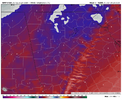
It's not as pronounced as below but who knows what would happen inside the heaviest cells. Heavy sleet certainly appears likely in the heaviest cells.

View attachment 189079
View attachment 189081
This is MBY sounding during the passage, HRRR is running 2 degrees too warm at this hour at the surface fwiw. Some dynamic cooling occurs as the Big Nose Kate cools some. It'll be interesting to watch regardless.soundings-[33.75,-83.84]-hrrr-ref1km_ptype-us_se-2026012512-8.pngsoundings-[33.75,-83.84]-hrrr-ref1km_ptype-us_se-2026012512-8.png
 
Back
Top