NEGaweather
Member
Heavy sleet and flakes mixed in. Nothing in trees as of yet
Sent from my iPhone using Tapatalk
Sent from my iPhone using Tapatalk
The 1+" of ice hype!What hype?

The 1+" of ice hype!
Generally speaking, those types of amounts were forecast by GSP as the high end (10% chance).The 1+" of ice hype!
Just waking up. Has that line verified back west yet?the thing is, everybody is going to think they’re out of it til that line of kidney beans comes through in a little while and tries to wipe out the grid.
You need to find more reliable sources of information. Warning people to be prepared for a major storm and power outages is not hype.The 1+" of ice hype!
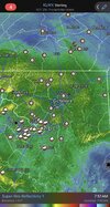
For the Triad, future radar looks like this steady precipitation will continue through around noon. Hopefully we can keep it mostly sleet. Then I imagine freezing drizzle before the heavy squall line comes through around 5:00. The NWS Raleigh mentions that most of its area can rise above freezing for a few hours. Long way to go to get there.
Not trolling just speaking facts. They can easily get people prepared withouy spreading all the panicYou need to find more reliable sources of information. Warning people to be prepared for a major storm and power outages is not hype.
PS - dial back your trolling and rhetoric. Maybe take a break from posting.
For whatever reason the ZR just didn’t add up. We got plenty of precip and temps got as low as 29.7
I'll do this one more time and then we are done with this discussion. Who is "they" and what's your evidence of "spreading the panic"?Not trolling just speaking facts. They can easily get people prepared withouy spreading all the panic
It was cold prior to Jan 10th last year, like in the mid 20s the night before and 30s the day before.Yeah it's super bizarre. Imma be real. This ice isn't even as bad as the ice my backyard got last year during the Jan 10th snow event. I didn't really get any sleet either so that can't be an explanation here.
Yes, it is currently forming and working its way through western TN and Mississippi, I'm watching power outage numbers shoot up as that line is moving through over thereJust waking up. Has that line verified back west yet?
Their job is to get peoples attention, what you do and how you interpret the information they present is entirely up to youNot trolling just speaking facts. They can easily get people prepared withouy spreading all the panic
Not trolling just speaking facts. They can easily get people prepared withouy spreading all the panic
A lot of the local Mets were hyping 1"+ of ice accrual. And I know it's not over But most can pretty much know no one is gonna see those kinds of totals. Will probably be on the very low end maybe .25" and yes that's still a lot of ice but not Crippling like they kept sayingI'll do this one more time and then we are done with this discussion. Who is "they" and what's your evidence of "spreading the panic"?
We are going to have to agree to disagree on this one. Your definition of hype is different than mine. It was a valid warning of the potential. You've been here seeing the models as have I. I didn't see anything from reputable outlets that I would consider hype.A lot of the local Mets were hyping 1"+ of ice accrual. And I know it's not over But most can pretty much know no one is gonna see those kinds of totals. Will probably be on the very low end maybe .25" and yes that's still a lot of ice but not Crippling like they kept saying
It was cold prior to Jan 10th last year, like in the mid 20s the night before and 30s the day before.
It was 45+ just yesterday.
And another thing - I was measuring the droplets with an IR thermometer today. They were around 35F, so they weren't subfreezing like classic freezing rain. Perhaps due to the very warm warm nose.


Sleeted all night in the upstate i-85 corridorCrazy. 23.5 in lexington, sc. Mostly sleet.
have you not been following the flow of discussion with this storm in here? Man it was clearly stated that sleet had a strong possibility to limit the higher end ice storm stuff. Mise well be grateful!A lot of the local Mets were hyping 1"+ of ice accrual. And I know it's not over But most can pretty much know no one is gonna see those kinds of totals. Will probably be on the very low end maybe .25" and yes that's still a lot of ice but not Crippling like they kept saying