SegTindo
Member
And so begins the trend towards BHAM…
/j
Sent from my iPhone using Tapatalk
Nice jump in AIFS ENS snow mean.View attachment 188582View attachment 188583
That snow mean includes this weekend. Correct? What’s it look like just focused on next week?Nice jump in AIFS ENS snow mean.View attachment 188582View attachment 188583
Nice jump in AIFS ENS snow mean.View attachment 188582View attachment 188583
It’s not that great of a signal imo.This is about to be make or break for some people just matters now who gets it…
Sent from my iPhone using Tapatalk
We push all the chips into the middle . Its a good look 6-7 days out .View attachment 188595
Big dog skews this a little but I sure like seeing the boom potential
Here's the Weathernext runAnyone got the latest weathernext? Coming up on the timeframe where it locked into the current storm


Am I reading it right that that shows a board-wide snow storm?Here's the Weathernext run
View attachment 188596
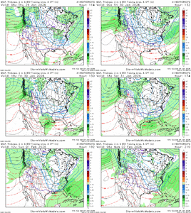
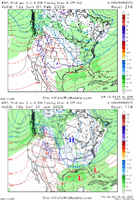
Here's a comparison of today's 12z run vs. yesterday's 12z run. I added a little flavor with the High and Low pressure (nice sketch tool on SV). The timestamps are different because the speed of the system on the mean changed a bit, but I tried to line them up when they were moving along at the same point with low pressure straddling FL.
Anyway, it's improved some with the trough backed more to the west / colder / high pressure up top. Don't have 500mb to view on SV
View attachment 188601
light snow but its a good trendAm I reading it right that that shows a board-wide snow storm?
It's an ensemble mean. Not the finished product we want to see, but it's shown improvementAm I reading it right that that shows a board-wide snow storm?
Hard to tell totals from thatlight snow but its a good trend
How often do they come in board wide? You and me and Gainesville/Chattanooga too? Ever? 1880's?
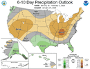
Yes sir, they have even moistened us up some on the precip outlook. We comin.The Mitch West / Stormfury storm showing up on the CPC Day 6 to 10 analogs (2/12/2010)
View attachment 188610
View attachment 188613

Amazing consistency shown at the end of today's ensemble runs (Day 15)
View attachment 188616
After Day 15, here is today's Euro Weeklies for Feb 8-24
View attachment 188617
Dang that is some huge anomalies over Greenland for a 360hr mean...
So for the south, we usually want a -NAO which is what is depicted on this map. That means there is higher than normal pressure over Greenland and the labrador sea. In a perfect world, that is right where we want it. You can also see eastern based NAOs which arent as fruitful over our area. This is a well written article that explains it pretty well.Can you explain what’s happening sorry i don’t understand all that yet I’m learning but I’d love to know what it means!
Sent from my iPhone using Tapatalk
Here's the Weathernext run
View attachment 188596
Here's a comparison of today's 12z run vs. yesterday's 12z run. I added a little flavor with the High and Low pressure (nice sketch tool on SV). The timestamps are different because the speed of the system on the mean changed a bit, but I tried to line them up when they were moving along at the same point with low pressure straddling FL.
Anyway, it's improved some with the trough backed more to the west / colder / high pressure up top. Don't have 500mb to view on SV
View attachment 188601
Remember that comment of wall to wall cold after the 8th on for the country? I think it’s very possible looking at that retrograde pattern.Amazing consistency shown at the end of today's ensemble runs (Day 15)
View attachment 188616
After Day 15, here is today's Euro Weeklies for Feb 8-24
View attachment 188617
Yeah it’s just a pattern with lots of energy flying around. Yeah there is definitely potential in there but I honestly think we’re gonna need to get through the current storm before modeling starts to zero inIt's picking up on the next wave instead
I like that a lot
Thanks, Larry. So once in roughly 10 years. Maybe this when we get decimated. See what I did there, lol.For a hit in GA from coast to NW GA (say 0.5”+ at both and/or sig ZR), I know of these:
-Jan 1893
-Feb 1895
-Feb 1899
-Feb 1914
-Jan 1918
-Jan 1921
-Jan 1922
-Feb 1934
-Feb 1968
-Jan 1977
-Jan 1988
-Feb 1989
-Feb 2010
-Jan 2014
-Jan 2025
Yeah we used to love this look. But now not so much.
