• Hello, please take a minute to check out our awesome content, contributed by the wonderful members of our community. We hope you'll add your own thoughts and opinions by making a free account!

Wintry January 23rd-27th 2026

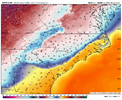
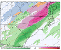
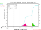
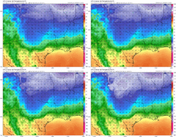
3km a block of ice for Greensboro…3” of sleet and the a solid coating of freezing rain. That would be nuts. 🤯

IMG_5463.png
 
Wild…RGEM with freezing rain in Raleigh and 30-40 miles away it’s almost 70F. How is that even possible…🤯


View attachment 188329View attachment 188330
I've seen this before in the Carolinas. Happened in Jan 1994. Same day the Northridge, Los Angeles, California happened. I started 29 degrees that morning, strong warm front punched north, hit up to 68 degrees, tornado watch, had strong thunderstorms. Cold front back thru, teens the next morning. North of the warm front, it was commonplace 30 degrees or more colder, very tight gradient.

I work sunday afternoon. I legit could have to be bundled up, by closing time, could be in shorts.
 
3km a block of ice for Greensboro…3” of sleet and the a solid coating of freezing rain. That would be nuts.

View attachment 188332

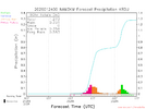
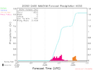
I’m actually extremely nervous in Greensboro. I’ve never seen so many passionate knowledgeable snow lovers so concerned over a storm around here before


Sent from my iPhone using Tapatalk
 
I'm still at 47. Why is it so much colder where you are?
Because the cold front approaching from the northwest is oozing through the northwest part of GA. It won't make it to the east side of Atlanta. You will have to wait for the CAD front in order to get a supply of cold, dry air. Fortunately it won't have enough time to drop your temps much below freezing and your ice threat should be minimal. That air has to move all the way from the mid-Atlantic states!
 
Because the cold front approaching from the northwest is oozing through the northwest part of GA. It won't make it to the east side of Atlanta. You will have to wait for the CAD front in order to get a supply of cold, dry air. Fortunately it won't have enough time to drop your temps much below freezing and your ice threat should be minimal. That air has to move all the way from the mid-Atlantic states!

I still think I should get .25-.5 inch accretion...I'm in a favorable part for the wedge in the metro. It honestly won't matter what the antecedent temperature is before the wedge arrives. This is an well above average strength CAD.
 
I'm still at 47. Why is it so much colder where you are?
Just like @weatherfide said, the actual arctic front has sagged south through the northwest part of the state. Our winds are supposed to shift to ENE overnight, which should briefly warm us back up as we get put back in the same air mass as you. We will see though because we are already colder than forecast and it’s funny watching these hourly forecasts trying to adjust. At some point taking us back up to the low 40s from the mid 30s just isnt going to happen. Already 35.8/28.6
 
Wild…RGEM with freezing rain in Raleigh and 30-40 miles away it’s almost 70F. How is that even possible…🤯


View attachment 188329View attachment 188330

I mean Lumberton is 42F, Whiteville is 68F. Wow. Possible some SE NC counties could go from freezing rain to feeling like a June night in a few hours. The dynamics of this storm are unprecedented
 
HUGE FAVOR… I sincerely ask that when posting maps that you place what time .. say EST. Despite hanging around from the early boards, Eastern, American. I simply can’t wrap my head around the Z times. Perhaps I’m a bit of a dum dum LOL. It’s really just something I can’t decipher. I suspect several others would benefit as well. Thank you, Mods.
 
HUGE FAVOR… I sincerely ask that when posting maps that you place what time .. say EST. Despite hanging around from the early boards, Eastern, American. I simply can’t wrap my head around the Z times. Perhaps I’m a bit of a dum dum LOL. It’s really just something I can’t decipher. I suspect several others would benefit as well. Thank you, Mods.
I'm going to save you the angst with this.
Print this out and put it on a piece of paper to refer to next to your computer. If you need a calculator, put that next to it. This is how you convert. Do it before you lose power so you can still print. When you see Z time it is UTC time.

UTC - 5 hours = EST
UTC - 4 hours = EDT

The only tricky part is that you need to know when you are in Standard Time vs. Daylight Savings Time.
When you 'fall back' in the fall, you move to Standard Time, EST.
When you 'spring forward in the spring, you move to Daylight Savings Time, EDT.
It's that simple. Print out that piece of paper or copy it by pen and you are set for life.
 
Back
Top