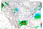
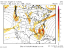
I'm not really paying attention to next weekend's storm yet, but the deep snow pack that will be laid this weekend over the vast majority of the Midwest and Northeast will certainly help to keep the storm track on more of a southerly route than what we are experiencing with the current storm.
-
Hello, please take a minute to check out our awesome content, contributed by the wonderful members of our community. We hope you'll add your own thoughts and opinions by making a free account!
You are using an out of date browser. It may not display this or other websites correctly.
You should upgrade or use an alternative browser.
You should upgrade or use an alternative browser.
Pattern January Joke
- Thread starter SD
- Start date
smast16
Member
8 days out, Congrats Louisville, Again...
smast16
Member
With the upcoming cold following our mess this weekend, that snow to our north isn't going anywhere before next weekends system comes through.I'm not really paying attention to next weekend's storm yet, but the deep snow pack that will be laid this weekend over the vast majority of the Midwest and Northeast will certainly help to keep the storm track on more of a southerly route than what we are experiencing with the current storm.
lusting4Adusting
Member

Sent from my iPhone using Tapatalk
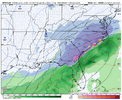
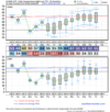
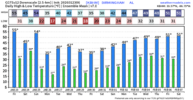
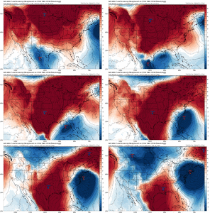
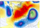
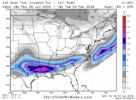
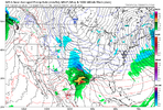
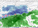
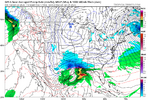
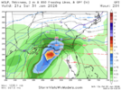
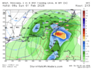
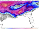
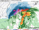
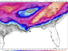
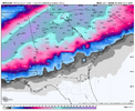
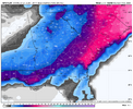
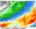
This insane 6Z GFS would triple the modern day record (back to 1870s) of biggest snowfall in this area and would be the biggest since a similar one on March 3, 1837. Suffice it to say, the odds of this 10.3” day 8-9 snow (on ~1.1” qpf) coming even close to verifying are infinitesimally low. Only 8-9 days of NW trend to deal with lol.
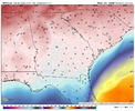
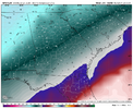
For the record/entertainment:
Snowfall:
Qpf:
2m temps 1PM on 1/31:
850 temps 1PM on 1/31:
Last edited:
If it is suppressed at this time I'm good with that. Just tend to believe the gfs is on acid with it's hallucinogenic print outs at range sometimesThe Euro has honked a little bit (and may have had one run that was just plain crazy, idk for sure), but as of today, it's suppressed.
Which would normally be okay, but we remember what occurred with late January last year...
You referring to the stalled (off the coast) cold front kind of deal where a wave forms and moves along with less hair-loss predictability.for what it's worth i'm completely over "long" storms. i think it's an internal rule of mine now.
what i mean by that is i am over storms that show up in long range models as long, zonal stretches of precip from texas to north carolina
this weekend is the most egregious example, but that shape never pans out. it happened last year too. a kink in the line forms somewhere and if it's too far out west, it raises heights to the east and the jig is up. no more.
shooting this preamble off to say, refreshing to see a clipper and a coastal out here. known entities.
been too long since we've referred to precip as blossomingYou referring to the stalled (off the coast) cold front kind of deal where a wave forms and moves along with less hair-loss predictability.
broken025
Member
Funny how it will actually be too far south this time lol. And yes I’m speaking in absolutes cause I know our luck.
rburrel2
Member
It’s gonna be a repeat of last year it’s gonn get so cold it pushes it down to Florida and they get a blizzard and get more snow than all of us combined the past 10 yearsGood lord...not again...it's already too far north. It needs to be showing snow in Cuba.
What does BAM think? Probably coming north...
View attachment 188027
BHS1975
Member
Great spot at this range.
Cary_Snow95
Member
Ground temps won’t be a concern so we have that going for us
Nah, it would be that type of air mass like last yearIt’s gonna be a repeat of last year it’s gonn get so cold it pushes it down to Florida and they get a blizzard and get more snow than all of us combined the past 10 years
Cary_Snow95
Member
broken025
Member
ForsythSnow
Moderator
It surges North the next frames for snow. Low tracking along the panhandle. This is a true bomb this run
Makeitsnow
Member
well it's far enough south that we might still stand a chance with the north trend. But man that is pretty.
btw, if you look at the winds...there would be blizzard conditions.
btw, if you look at the winds...there would be blizzard conditions.
broken025
Member
ForsythSnow
Moderator
The kucera totals are dumping. 1.5 ft streak from S AL into N GA
ForsythSnow
Moderator
How is this real. 2 ft in Atlanta. Weenie run of the century
whatalife
Moderator
Well we know how this ends being in the bull’s-eye nine days away.
Rain snow line is already to close for comfort: passBack-to-back years in New Orleans? Wouldn't that be something!
View attachment 188041
lexxnchloe
Member
Looks nice for the deep south
lexxnchloe
Member
Needs to be 75 miles further east.
BKWRN29
Member
Lawd.. gonna be another longggg week.Lmao 2 feet in south Alabama. Still going here. Should be epic totals through Carolinas. Long live the GFS lol.
View attachment 188040
broken025
Member
lexxnchloe
Member
Historic snow for ATL with NC turning to rain.
Makeitsnow
Member

