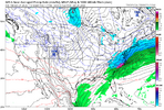
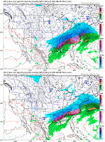
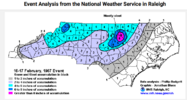
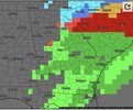
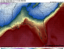
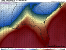
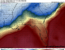
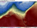
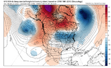
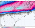
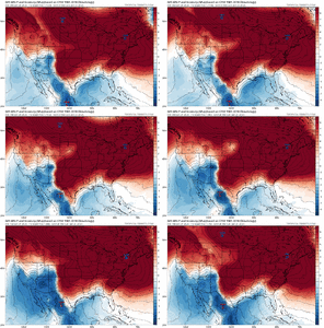
Half a foot+ of sleet would be a positively absurd thing to see manifest
-
Hello, please take a minute to check out our awesome content, contributed by the wonderful members of our community. We hope you'll add your own thoughts and opinions by making a free account!
You are using an out of date browser. It may not display this or other websites correctly.
You should upgrade or use an alternative browser.
You should upgrade or use an alternative browser.
Wintry January 23rd-27th 2026
- Thread starter SD
- Start date
Oh yeah for sure. Less than .1” ZR in Raleigh I’d sign up for that. Get to keep my power and sled around campus all day and have some cold beersThat it is, but it’s several inches of it. We could be talking 3-6” of sleet alone which would be insane and shut things down for a long time. Topped with ice. Preceded by a little snow, perhaps? That’s a hell of a storm.
iGRXY
Member
trend is pretty clear in the upstate. Potential front end snow thump is there, but heavy sleet and then as the 2nd wave gets going we switch to ZR. 3-5” of sleet and 0.5-0.75” of ZR. Maybe 1-2” of backside snow on top.
Btownheel
Member
I think some of you all have unrealistic expectations with this which is leading to some of the meltdowns and bittercasting. Yes, it’s true that it’s nigh impossible for this to become a 12-18” snowstorm for those of us in NC/SC/GA but the table is still set for a sizable front end thump if the cards are aligned right and then a transition to tons of ice pellets and freezing rain (I understand feelings are mixed on this P-type, and for good reason). The GFS is still showing this for some. A lot of major winter storms are like this in our area - snow to ice pellets to freezing rain.
Honestly, a front thump of 4-6 followed by a raging 3 inches of pingers with a .15 zr glaze to turbocharge sledding, make it pretty but leave power and trees alone sounds awesome. Better than anything we’ve seen in years and my daughter would have a ball.
Sent from my iPhone using Tapatalk
sledding down the court of carolina would be pretty freaking cool. Sleet bombs can be dopeHonestly, a front thump of 4-6 followed by a raging 3 inches of pingers with a .15 zr glaze to turbocharge sledding, make it pretty but leave power and trees alone sounds awesome. Better than anything we’ve seen in years and my daughter would have a ball.
Sent from my iPhone using Tapatalk
TigerSnow
Member
When is all of this going to be fully sampled. With a system this complex I’m curious when all the energy will be on the models and sampled. I’m not saying it will change anything but maybe we get more clarity.
Cary_Snow95
Member
Plus the backside now would be great. I see lower QPF in the lee side so you know its right. LOLMan that would be an epic time of sledding if played out like the 18Z GFS just showed. 3 inches of snow, then 2 inches of sleet, then 4 more inches of snow.
CraggyRider
Member
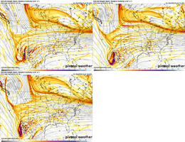
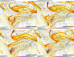
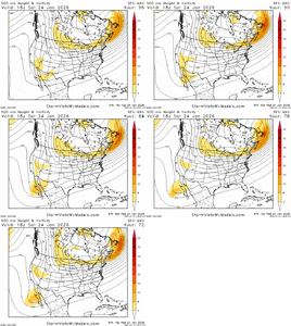
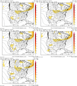
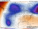
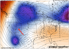
UKMET continues with 12z element of Northern Energy and Baja low separating a decent amount you can see the nose retrograde here some that will continue to help flatten the initially elements.... now if the Energy would then just slide east a little sooner you would have a better SE overrunning window for deep south
12Z
18Z
12Z

18Z

ridge also slightly weakerUKMET continues with 12z element of Northern Energy and Baja low separating a decent amount you can see the nose retrograde here some that will continue to help flatten the initially elements.... now if the Energy would then just slide east a little sooner you would have a better SE overrunning window for deep south
12Z
View attachment 187139
18Z
View attachment 187140
“The hazardous conditions could impact the Monday morning commute” is maybe the biggest understatement ever by GSP
Makeitsnow
Member
uk also has a faster cold press across the east at 66 hours vs prior runs. In general this has been the theme today....as part of this is the models are "seeing" the wedging more as we get closer.UKMET continues with 12z element of Northern Energy and Baja low separating a decent amount you can see the nose retrograde here some that will continue to help flatten the initially elements.... now if the Energy would then just slide east a little sooner you would have a better SE overrunning window for deep south
12Z
View attachment 187139
18Z
View attachment 187140
It does pan out. I’ve seen it many times over the 5 decades I’ve lived IN NC. Storms this big, complex and with such a long duration always flip flop back and forth and very often there is snow on back end. Screw the models.Just a word of caution about backside snow…it often doesn’t pan out since extremely dry air is advected in and CAA is highly favorable for subsidence
Storm5
Member
Interested in what the gefs shows Saturday into su day for western areas
MichaelJ
Member
Biggest question for me is, when does the GFS fold now or tomorrow?
The February 2014 backside snow comes to mind. The ULL gave areas of the foothills 6-12” on the backside of the snow to ice storm,It does pan out. I’ve seen it many times over the 5 decades I’ve lived IN NC. Storms this big, complex and with such a long duration always flip flop back and forth and very often there is snow on back end. Screw the models.
Mahomeless
Member
Great backside change by the GFS!! Let’s see if it holds on other globals.
CONGRATS NC!!!
CONGRATS NC!!!
National map really starting to light up with watches and warnings. Continue to believe we have not seen the last of model swings, and often times at this range corrections can be overdone, to dial back some inside 48hrs. Small changes N/S interaction with the Baja wave, orientation of the PV lobe, just a lot of small details to work out still. I'd certainly be preparing for a ZR storm if I was south of the VA boarder, hoping that a good portion of QPF verifies as IP. Normally the core ZR zone is narrow as others have stated, the NAM usually handles it well inside 48hrs, it's highly uncommon to see a region wide ZR event so right now I'm inclined to think the freezing rain zone tightens up, and many will end up with a raging sleet storm. 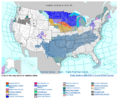

Chris Justus said south shift is more than possible. NW trend is over
ULLs are a beautiful thing and over perform in most cases. Speaking from pure experience here.The February 2014 backside snow comes to mind. The ULL gave areas of the foothills 6-12” on the backside of the snow to ice storm,
rburrel2
Member
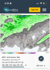
This is the model to follow for surface temps. Good news for Atlanta, the rgem is pretty warm there. Bad news for NC/SC, it’s super cold there.
Temps are still dropping across the region on this last panel. She was going at least a few degrees lower than this.
Already damaging ice developing in places.

Temps are still dropping across the region on this last panel. She was going at least a few degrees lower than this.
Already damaging ice developing in places.


WSNC
Member
Elevation hurts in this setup. WB sent a reporter to Sky Valley back in the 2000 ice storm and it was raining while it was icing all over Atlanta.I don't think I've ever seen a model output where Statesboro is at 27 and Hiawassee is 34 and raining lol
Chattownsnow
Member
Both are trending much weaker. If I were that model I would be embarrassedGFS is trending weaker and retreating with the high like the Euro…so they have that in common. But I guess we shouldn’t discuss that….only positive vibes
View attachment 187136
It depends on the setup. You need a trailing wave / vort max dropping in on the backside of the storm (Dec 2010, Feb 2014). GFS has a small one, but it's on an island with that (well, with a lot of things)It does pan out. I’ve seen it many times over the 5 decades I’ve lived IN NC. Storms this big, complex and with such a long duration always flip flop back and forth and very often there is snow on back end. Screw the models.
That’s a jump N on NAM, correct???Y'all didn't think we'd all not get NAMd at some point? Potent wedge deep into the Ga. CAD region, precip looks like it would be much lighter than say the ICON that goes nuclear with 3+ inches.
View attachment 187085View attachment 187086
It has me snowing! The first model to show the precip shield that far N!!
Might be banter and sorry if it is, I in some recent discussion from some people here, they stated that the HP could weaken as we get closer. Not has strong as modeled. I am not shocked by this at all.Both are trending much weaker. If I were that model I would be embarrassed
Not going too, the euro has been off due to the triple phasing and will correct SBiggest question for me is, when does the GFS fold now or tomorrow?
I’ve never seen anything like this. Nothing close. I’ve seen it on 300hr maps. But that’s it. It’s not snow but if this happens the way they say it’s going to happen, it’s a storm you will never forget. The landscape once this is over with won’t let you.For those who have been doing this for a while, how rare is this entire scenario, with how powerful the storm is and seemingly confused the models are.
rburrel2
Member

