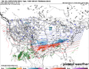
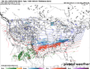
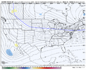
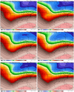
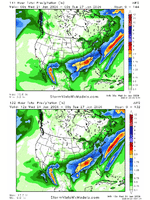
So random. Wonder why the models are adjusting the BAJA SW then.
-
Hello, please take a minute to check out our awesome content, contributed by the wonderful members of our community. We hope you'll add your own thoughts and opinions by making a free account!
You are using an out of date browser. It may not display this or other websites correctly.
You should upgrade or use an alternative browser.
You should upgrade or use an alternative browser.
Wintry January 23rd-27th 2026
- Thread starter SD
- Start date
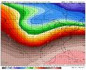
06z Euro valid 12z Sunday. Not quite the same, but heights in the Carolinas are very similar valuesLet's keep trending that SER down please.
View attachment 185187
Here's the blueprint for disaster, H5 analysis from 12z 12/05/2002:
View attachment 185188
SnowDoomer21
Member
didn't the 1993 or 1996 superstorm have that crazy derecho in S Florida?you know our big winter weather events tend to have severe wx in florida. not even kidding here
the 12z ECMWF and AIFS suite is delayed indefinitely
Yep. More separation west w/Baja and the ns. Quite a bit actually (Vort max shifted from Edmonton to almost the SK border). Cold press slightly further southWhat should I be looking at here. That there seems to be more separation out west or the cold press in the east?
SnowNiner
Member
This is coming back to the point Webberweather made before. Baja lows are generally stubborn on wanting to get ejected out once they establish. IF we continue to see these even small slower, SW or W ticks, this flattens the flow downstream (US) and negates some of the ridge pumping
So much so that it feels like climatology. It makes so much more sense that it doesn't come out, and things end up more progressive like they have SO many times in the past. So there's that. The trends this morning keep my glimmer of sleet hope alive. Euro run will crush them, or keep them alive.
This makes so much more sense synoptically than the Canadian. But as we know, the Canadian doesn't care about meteorology.
It would also favor more sleet than freezing rain for many.
Perhaps that's another thing to look out for, an earlier transfer Miller A/B hybrid rather than the straight Miller B.
ChattaVOL
Member
North Georgia Winter Storm Watch:
WINTER STORM WATCH IN EFFECT FROM LATE FRIDAY NIGHT THROUGH MONDAY
MORNING...
* WHAT...Heavy mixed precipitation possible. Total snow and sleet accumulations up to 4 inches and ice accumulations greater than one quarter inch possible.
* WHERE...Portions of north central, northeast, and northwest Georgia.
* WHEN...From late Friday night through Monday morning.
* IMPACTS...Expect power outages and tree damage due to the ice. Travel could be impossible. The hazardous conditions could impact the Monday morning commute.
PRECAUTIONARY/PREPAREDNESS ACTIONS...
Monitor the latest forecasts for updates on this situation.
Persons should consider delaying all travelSaturday and Sunday. If travel is absolutely necessary, drive with extreme caution. Consider taking a winter storm kit along with you, including such items as booster cables, flashlight, shovel, blankets and extra clothing. Also take water, a first aid kit, and anything else that would help you survive in case you become stranded.
Sent from my iPhone using Tapatalk
Down here (and tbh up to DC/Balt) miller B transfers straight up blow. It brings that WAA way too far north. For miller B's you need to sometimes be north or east of New Haven, CTSo much so that it feels like climatology. It makes so much more sense that it doesn't come out, and things end up more progressive like they have SO many times in the past. So there's that. The trends this morning keep my glimmer of sleet hope alive. Euro run will crush them, or keep them alive.
Perhaps that's another thing to look out for, an earlier transfer Miller A/B hybrid rather than the straight Miller B.
PvilleWeather
Member
I agree. Over the years, the CAD has made it here to Prattville with much weaker high pressure. We’ll have to wait and see as it’s always hard to forecast these. May not know here in Central Alabama until go time.It’s gonna be there due to the surface low track . Still have doubts it’s that strong with the massive CAD funneling down . Just have to wait and see
Makeitsnow
Member
Jesus lol can’t even get it down into Atlanta. I’m sure they will add to this as we go but sucks when it would’ve been a lock 24 hours ago
that's probably based on start time more than expected overall impacts..relax.
No data queued indicates that this could take a while.
NCHighCountryWX
Member
- Joined
- Dec 28, 2016
- Messages
- 699
- Reaction score
- 1,918
Yes the GFS started receiving data from recon planes last night and now the Canadian. I’m interested to see when the EURO might have access to itWell that's a interesting post...if accurate he's basically inducing that GFS/GEM particularly have some early data ingestion that others may not have... It's interesting that RGEM/CMC both moved the Baja further SW in initial runs with new data if so move toward GFS is slightly. I do not know if there's accuracy here though because wasn't under impression yesterday run was collecting full data and more tracking
ducketta27
Member
This is the town I live in... Those in the upstate need to watch this video on repeat... and sleep on the first floor of your homes come storm time. I cannot overstate how terrifying it was hearing branches snap and feeling the "boom" two seconds later. No power 10 days.
This isn’t true, the recon isn’t going to be added into the GFS until the 0ZYes the GFS started receiving data from recon planes last night and now the Canadian. I’m interested to see when the EURO might have access to it
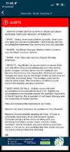
NWS GSP has issued a winter storm watch for the entire CWA
1237 PM EST Wed Jan 21 2026
...WINTER STORM WATCH IN EFFECT FROM SATURDAY MORNING THROUGH MONDAY
AFTERNOON...
* WHAT...Heavy mixed precipitation possible. Total snow and sleet
accumulations between 1 and 6 inches and ice accumulations between
four tenths and one inch possible.
* WHERE...Northeast Georgia, Western North Carolina, and the South
Carolina Upstate.
* WHEN...From Saturday morning through Monday afternoon.
* IMPACTS...Significant ice accumulation on power lines and tree
limbs may cause widespread and long-lasting power outages. Ice and
snow covered roadways will become treacherous and impassable.
Widespread power outages are likely due to the weight of the ice
and snow on tree limbs and power lines. The outages could last for
days in some areas. The hazardous conditions could impact the
Monday morning commute.
* ADDITIONAL DETAILS...Highest snow and sleet accumulations are
possible north of I-40. Highest ice accumulations are possible
across the southern mountains of North Carolina, the mountains of
northeast Georgia, and the mountains of South Carolina.
Not sure how long before we see model output but apparently data flowing again
Webberweather53
Meteorologist
Definitely getting worried about the growing ice storm threat in the carolinas from this storm.
The hardest part about these sorts of events is predicting how much of our precip will be sleet or freezing rain.
I can’t say I’ve seen too many winter storms historically like this that had a +10C warm nose aloft and surface temps were in the low to mid 20s like a lot of the models are showing atm
The hardest part about these sorts of events is predicting how much of our precip will be sleet or freezing rain.
I can’t say I’ve seen too many winter storms historically like this that had a +10C warm nose aloft and surface temps were in the low to mid 20s like a lot of the models are showing atm
finally gettings aifs on pivotal
blueheronNC
Member
Definitely getting worried about the growing ice storm threat in the carolinas from this storm.
The hardest part about these sorts of events is predicting how much of our precip will be sleet or freezing rain.
I can’t say I’ve seen too many winter storms historically like this that had a +10C warm nose aloft and surface temps were in the low to mid 20s like a lot of the models are showing atm
What would it take to keep the precip as IP instead of ZR? The depth and intensity of the cold pool underneath the warm nose, the thickness of the warm nose or max temp. of it, or a combination of all those?
Looks a tick better out west, baja more SW, better press out frontfinally gettings aifs on pivotal
a_gilmore88
Member
Definitely getting worried about the growing ice storm threat in the carolinas from this storm.
The hardest part about these sorts of events is predicting how much of our precip will be sleet or freezing rain.
I can’t say I’ve seen too many winter storms historically like this that had a +10C warm nose aloft and surface temps were in the low to mid 20s like a lot of the models are showing atm
This is why I was asking earlier about an analog storm for this event. From what I can gather, the 2002 storm’s temperatures were in the mid-20s for the duration in the Carolinas Piedmont. The modeling is suggesting mid-TEENS for this one. Has this ever happened?
Still an ice event primarily, but good to see it not run further off the rails
Or not.... and with that I'm done projecting and pbp lolLooks a tick better out west, baja more SW, better press out front
iGRXY
Member
My guess is we trend to a bit flatter out east. That’s been the theme of our winters the last couple of years. We have had major issues with more positively tilted and flatter solutions out east. I don’t see why that would stop here honestly
Rah NWS has issued a winter storm watch, holy smokes these are some early watches going up.
Last year's pattern was SOOOOO progressive and almost every storm trended south, going against conventional wisdomMy guess is we trend to a bit flatter out east. That’s been the theme of our winters the last couple of years. We have had major issues with more positively tilted and flatter solutions out east. I don’t see why that would stop here honestly
Webberweather53
Meteorologist
What would it take to keep the precip as IP instead of ZR? The depth and intensity of the cold pool underneath the warm nose, the thickness of the warm nose or max temp. of it, or a combination of all those?
All of the above and then some like precipitation rates, etc. Even the most subtle things like the types of cloud condensation nuclei we have aloft can impact it because water that condenses around black carbon aerosols vs say sea salt or pollen freezes at slightly different temperatures!
I mean despite the changes, an inch of ice is no joke. Correct me if I’m wrong, but wasn’t the 2002 ice storm in general .75 to 1.25 ice?
The major 2000 ice storm, was about .75.
The last ice storm I remember was in 2016, and that had about .5.
The Augusta 2014 ice storm was about an inch
And those storms were intense.
This seems worse
The major 2000 ice storm, was about .75.
The last ice storm I remember was in 2016, and that had about .5.
The Augusta 2014 ice storm was about an inch
And those storms were intense.
This seems worse
I wondered in class why we talked about cloud microphysics so much. Well, I guess I'm finding out why right nowAll of the above and then some like precipitation rates, etc. Even the most subtle things like the types of cloud condensation nuclei we have aloft can impact it because water that condenses around black carbon aerosols vs say sea salt or pollen freezes at slightly different temperatures!
Changes for the 12z Euro look similar to the 12z AIFS @hr57 with slight lowered heights east and slightly less sharp northern feature in MT
Downeastnc
Member
HurricaneSolomon
Member
- Joined
- Dec 6, 2021
- Messages
- 154
- Reaction score
- 276
Rah NWS has issued a winter storm watch, holy smokes these are some early watches going up.
Yeah, you hardly see them go out in more than the 48 hour period. This is basically a 72 hour notification on the Watch
Sent from my iPad using Tapatalk


