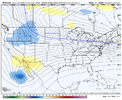
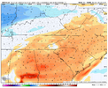
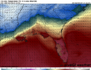
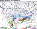
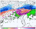
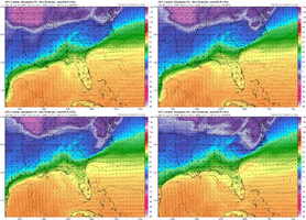
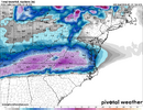
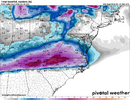
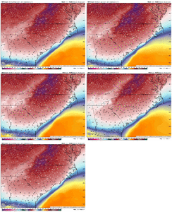
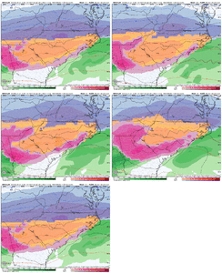
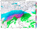
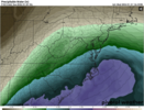
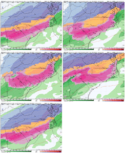
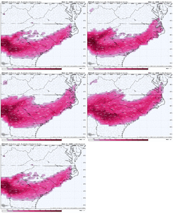
54 hours out on the gfs and that baja low has taken a moderate jog westward compared to 6z
-
Hello, please take a minute to check out our awesome content, contributed by the wonderful members of our community. We hope you'll add your own thoughts and opinions by making a free account!
You are using an out of date browser. It may not display this or other websites correctly.
You should upgrade or use an alternative browser.
You should upgrade or use an alternative browser.
Wintry January 23rd-27th 2026
- Thread starter SD
- Start date
Sorry for the questions but what downstream effects could this have ?54 hours out on the gfs and that baja low has taken a moderate jog westward compared to 6z
CADs are notoriously modelled incorrectly, esp in terms of precip. I realize models are updated, etc, but in the past with such a strong CAD and a HP of 1050 a CAD will push much further south putting many more people in the winter zone. I still firmly believe there will be a big thump of snow at the onset in central NC atleast....
you're a mod never say sorry to me! i should be saying sorry to YOU for the banter i put in here sometimes. but the quicker ejection baja low is one of the catalysts that's helping dig the trough out west and raise heights across our neck of the woodsSorry for the questions but what downstream effects could this have ?
WEATHERBOYROY
Member
I'm very glad to see in the north Alabama area the freezing rain gone from the models now. However, I'm a little concerned the surface temps might be a little over done with the steady north and north east winds depicted. If the cold air source is as cold as it's being depicted it might filter in a little bit colder dew points at the surface. I would like a little more ESE winds to fill comfortable.
Also, I know it's not being forecast by the models now, but I would love to see the LP to the south come in farther SE and wrap up full blown pulling in the 850s and enhancing the precip to the west and changing it to an area of heavy snow. The more amped it gets it seems like a little more reasonable?
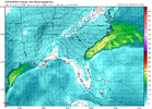
Also, I know it's not being forecast by the models now, but I would love to see the LP to the south come in farther SE and wrap up full blown pulling in the 850s and enhancing the precip to the west and changing it to an area of heavy snow. The more amped it gets it seems like a little more reasonable?

2 things from the ICON fwiw: 1) it used to have a bias to warmer BL temps, so seeing these insane cold temps is interesting and 2) it would literally be about 6" of sleet for a lot of NC. Not gonna lie, that would be amazing lol
Downeastnc
Member
GFS looks better to me so far, baja hanging back a bit SW....I am fine with baby steps back in the right direction at this point...
packfan98
Moderator
Fine, I'll say it. The GFS is still looking good. Some positive things of note with setup.
Mr Baja Vort doesn't look like he really wants to come out and play at that much on the GFS
Precip onset is going to be slower with the 12z GFS compared to 06z. Don’t think this is going the way of the Euro, although we’ll see if it ticks northwards some.
Sleetpocalypse continues on the GFS, and she still wants NC to snow
RTRwx
Member
I can't recall, does anyone know which GFS run will be the first with the Baja low recon data included?
Stormsfury
Member
Looks like its going to entrench the wedge strongly before precipitation arrival based on what I'm seeing now. I think another banger of a runPrecip onset is going to be slower with the 12z GFS compared to 06z. Don’t think this is going the way of the Euro, although we’ll see if it ticks northwards some.
CNCsnwfan1210
Member
I can't recall, does anyone know which GFS run will be the first with the Baja low recon data included?
It started with the 00z run last night, 300 HDOBS
Sent from my iPhone using Tapatalk
The SW flow above our heads is so prevalent though with this system. I have a hard time believing in snow for central NC even at onset. Maybe a thump of sleet for sure. I could see sleet sticking around longer but this WAA means business above our headsCADs are notoriously modelled incorrectly, esp in terms of precip. I realize models are updated, etc, but in the past with such a strong CAD and a HP of 1050 a CAD will push much further south putting many more people in the winter zone. I still firmly believe there will be a big thump of snow at the onset in central NC atleast....
packfan98
Moderator
0Z but it could be later. That's around 10:30pm est!I can't recall, does anyone know which GFS run will be the first with the Baja low recon data included?
Makeitsnow
Member
gfs has a lot more precip back over the plains at 96 and 102 hours so an even longer event on this run.
Tokenfreak
Member
Dang, the GFS is showing freezing rain for my area again. Hopefully the Euro is right as I rather have sleet or just rain not freezing ran.
Downeastnc
Member
Common theme accross modeling over the last 12+ hours is there is no escape hatch. Even with the heaviest axis running much more NW now, the CAD is stronger View attachment 186929
hell of a banana high anchored to the north....cant see any way around the cold being in place, just need to not cross the streams....
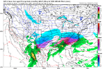
Yeah, there will be a definite SW flow, but my thinking it won't get cranking until later Saturday into Sunday. I guess it really depend on the onset of the precip...earlier the better for snow, for sure. The CAD is deeper than most, too, so that will be a positive for snow. Obviously, we won't know for several more days!The SW flow above our heads is so prevalent though with this system. I have a hard time believing in snow for central NC even at onset. Maybe a thump of sleet for sure. I could see sleet sticking around longer but this WAA means business above our heads
There is an escape hatch still & that's the system amping up so much that the system ends up having significantly less moisture for areas to the South. There is already a strong cut off. We need to bring the moisture shield back South.Common theme accross modeling over the last 12+ hours is there is no escape hatch. Even with the heaviest axis running much more NW now, the CAD is stronger View attachment 186929
The GFS is a heavy thump of snow leading to ice for central NC. Reminds me of February 2014 in a way (except more Precip) - ya know, the big meme storm! Would be an amazing storm. That’s the scenario I tend to favor, with a period of heavy snow transitioning to mostly IP then ending as potentially major ZR. Hope I’m right and this isn’t all icing. I do think IP will be the major P-type for many. The sledding might be insane!
WolfpackHomer91
Member
Soundings > Model Precip Charts
Sent from my iPhone using Tapatalk
JP152
Member
Makeitsnow
Member
well the 12z is a disaster for ga/sc. a longer event than prior runs with a lot less sleet and more freezing rain.
Yep a couple of more cycles and we won't be able to get the snow back even with a few ticks back south (if that happens at all this time).

